the wandering chick
...Monument Valley
Movies have been made here. People from all the world have visited here. Nowhere in America symbolizes the southwest U.S. more than this piece of land owned by the Navajo Indian Tribe. Ironicallly, it's not a U.S. national park, but is as equally recognizeable as any in the country.
Numerous John Wayne movies were filmed here, as well as such favoites as "Back to the Future," "Forrest Gump" and "The Eiger Sanction." For several years it was movie director John Ford's playground, making such movies as "She Wore A Yellow Ribbon," and "Stagecoach, "The Wild, Wild West" and "How the West Was Won." Even the Marlboro Man made it to Monument Valley.
But aside from the movies and the TV commercials, it's a land of breath-taking landscape, absolutely deserving of the attention it gets.
Close by and another scenic drive worth taking is through the Valley of the Gods, situated off Highway 163 . Pictures are below.
the epitome of the American southwest
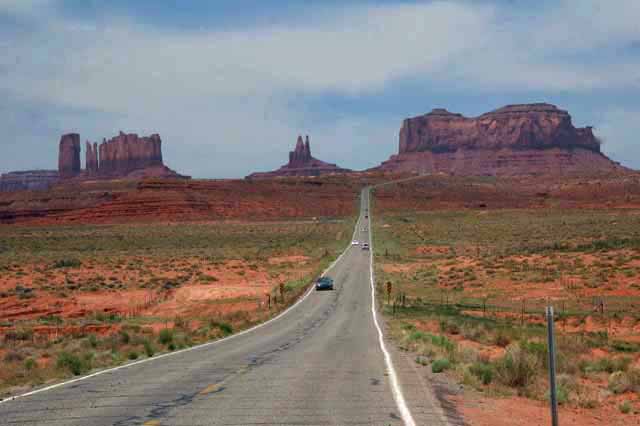
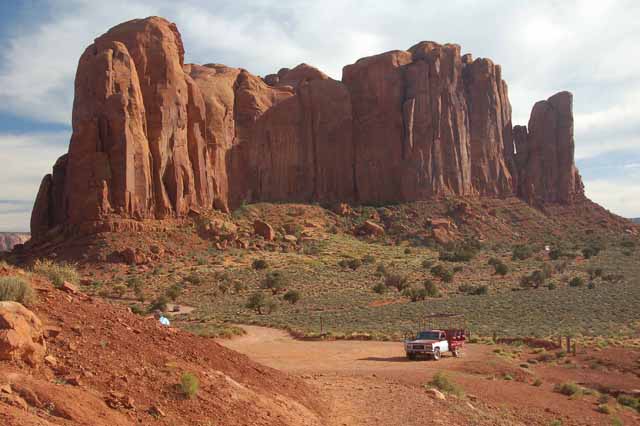
Entering Monument Valley from Utah on Highway 163. It's the well-recognized view of the park. This road is called "The Forrest Gump" road by the locals, as in the movie, it's the one Forrest was walking on when he decided to turn around and go home.
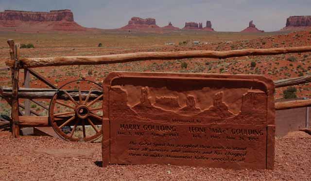
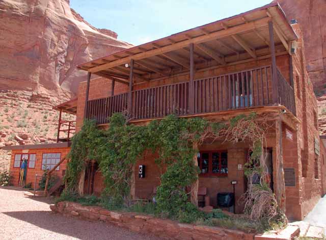
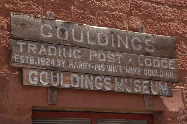
It was Harry Goulding who instigated the making of movies in Monument Valley. He and his wife Leona, known as 'Mike," opened a trading post as a way of helping the Navajo people. He succeeded in bringing revenue and attention to the park and helping the Navajo adjust to the 20th century.
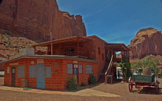
Today there stands a lodge, a campground, restaurant and their home, which has been made into a museum (left and below). Their memorial (above) sits in an appropriate spot, overlooking the more familiar monuments that make up the park.
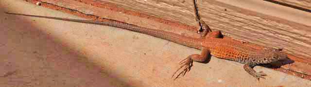
A "whiptail" lizard, so named for its extra-long tail
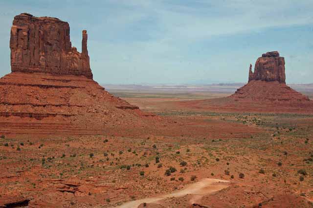
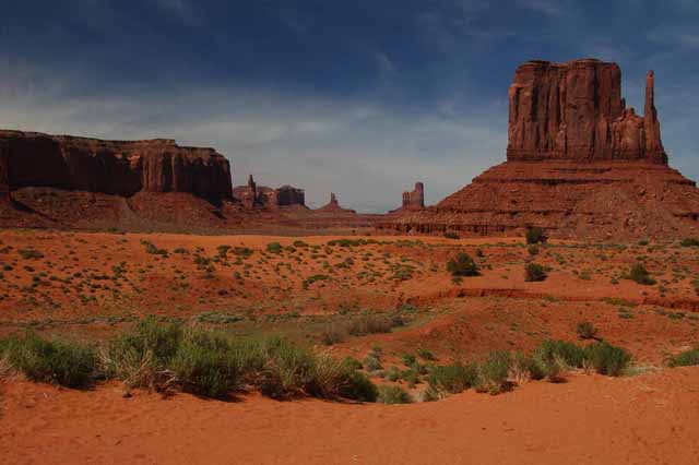
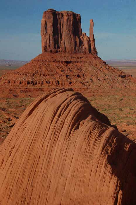
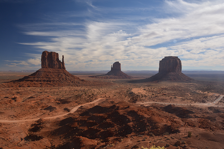
The Left Mitten and the Right Mitten
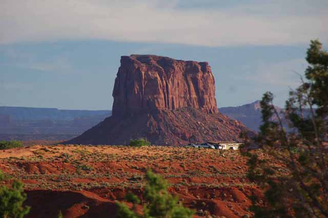
Above: The monument known as "The Hub," named for its likeness to a stagecoach wheel.
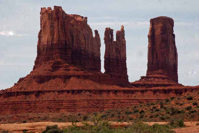
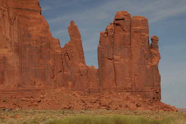
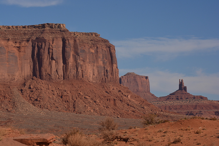
Left, above: The Mittens and Merrick Butte
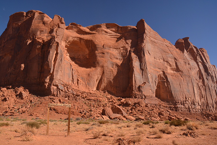
Left, below: Rain God Mesa
Below: a closeup of Rain God Mesa
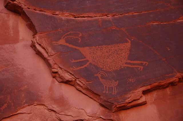
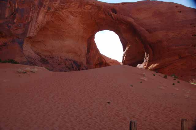
Above and to the right are pictures of what the Navajo have named "The Sun's Eye." Below are petroglyphs that were found along the lower portion of the left flank of the rock.
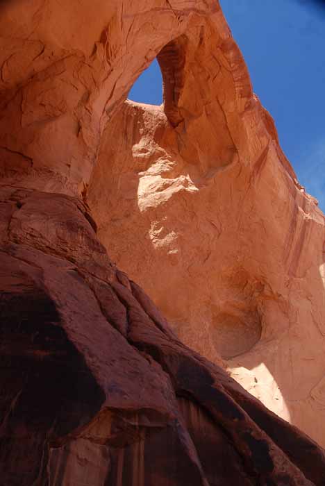
The name for this rock is "Ear of the Wind."
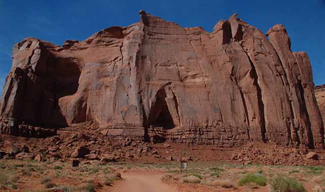
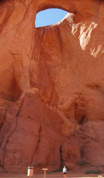
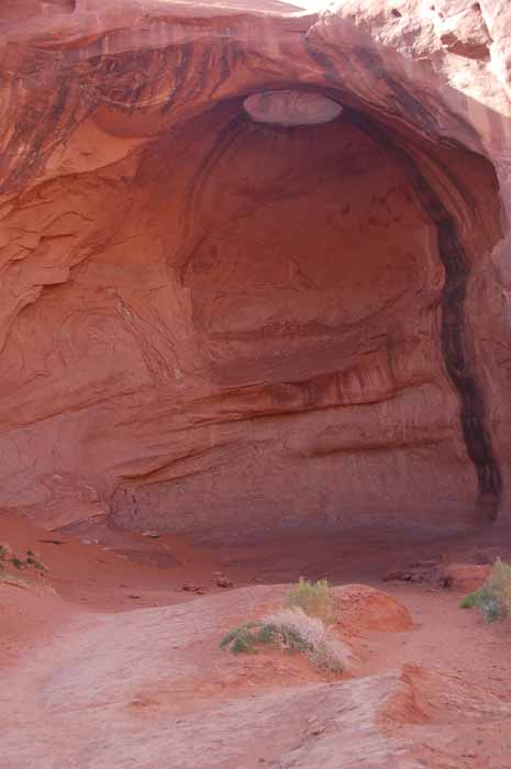
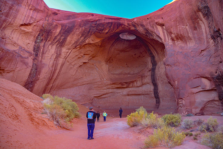
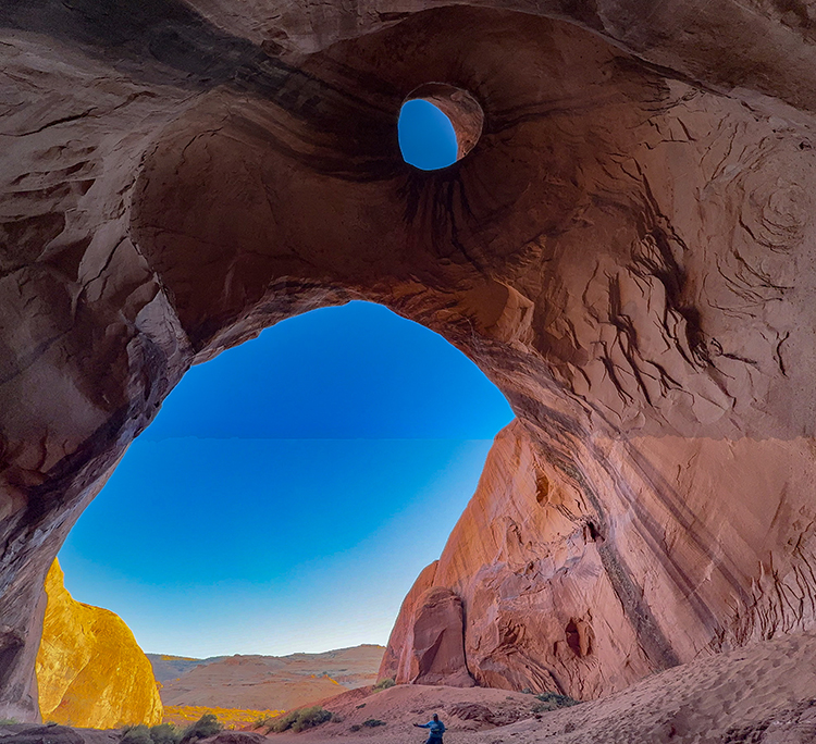
The Navajo have named this rock formation The Big Hogan. A hogan is a traditional type of dwelling and is considered sacred to the Dine (Navajo) people. Today, even though they may live in a more modern-styled home, many still include a hogan for religious ceremonies and events. An interesting photo of the Big Hogan is below.
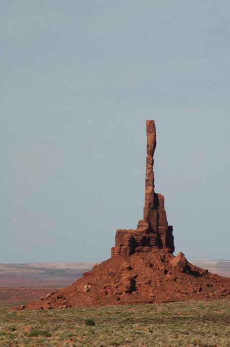
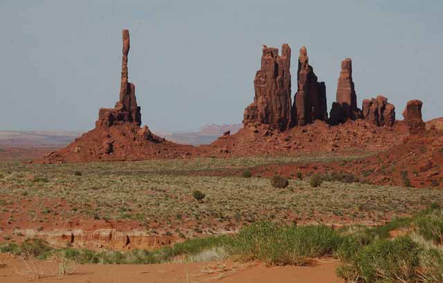
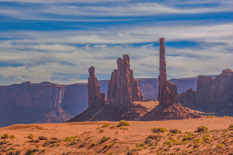
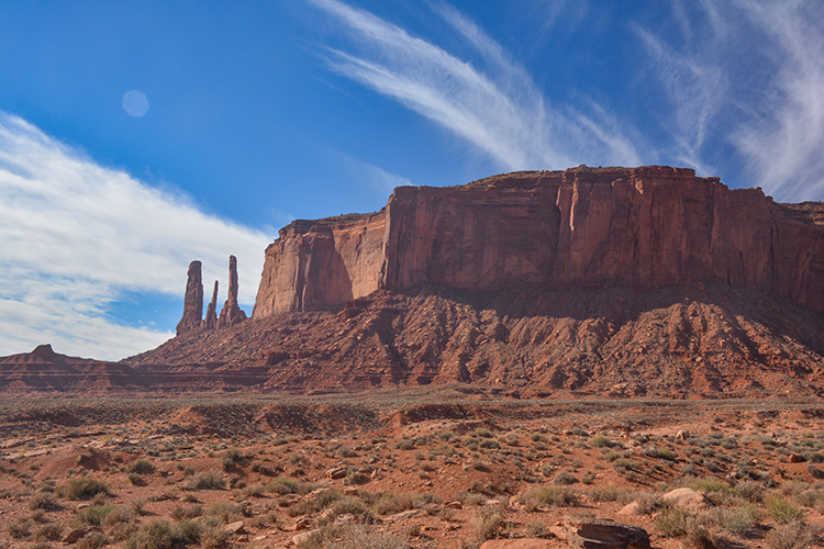
Called The Totem Pole, or fondly by the Navajo "ET's finger." This rock formation was used by Clint Eastwood, who stood atop it along with others, during the making of "The Eiger Sanction." It's also been featured in various TV ads and commercials. Another photo of it is below.
South of the Totem Pole is a formation translated meaning "the Navajo Fire Dancers." One of the various spellings is "Yei Bi Chei." A photo from another angle is below.
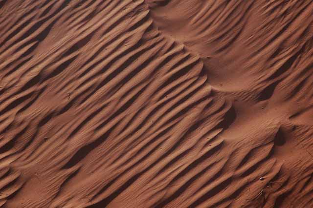
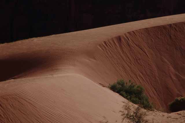
Sand dunes are constantly being formed and reshaped on this desert floor.
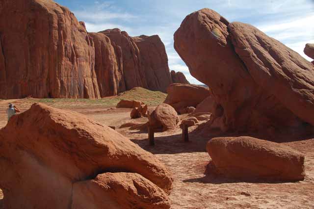
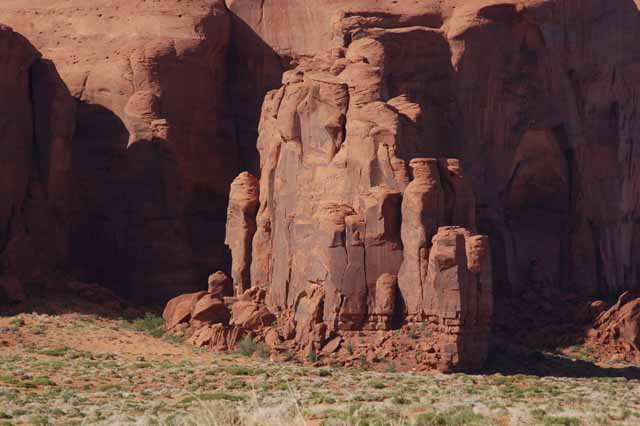
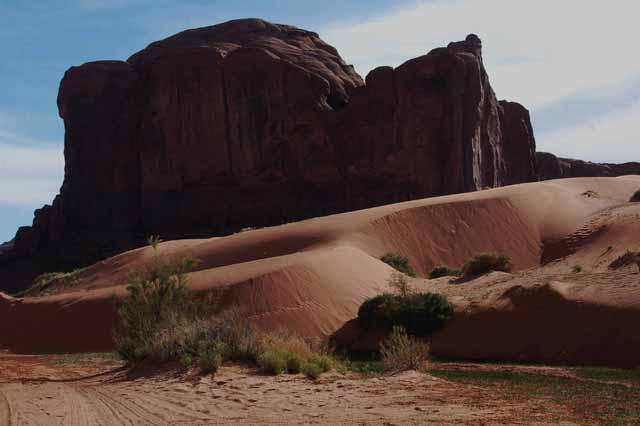
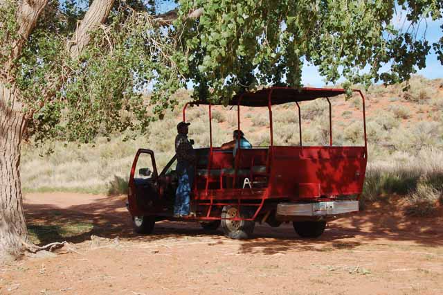
"Back country" tours offer views of the monuments that cannot be seen on the 15-mile free scenic route. The tours usually run a couple of hours, and the cost is reasonable, considering you see wonderful formations that would otherwise be missed.
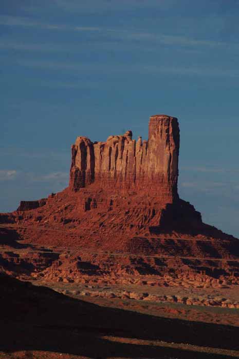
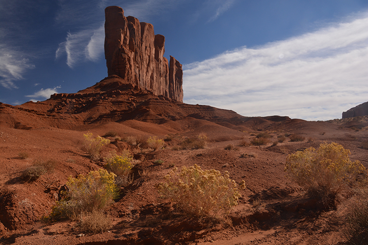
Another view of The Thumb
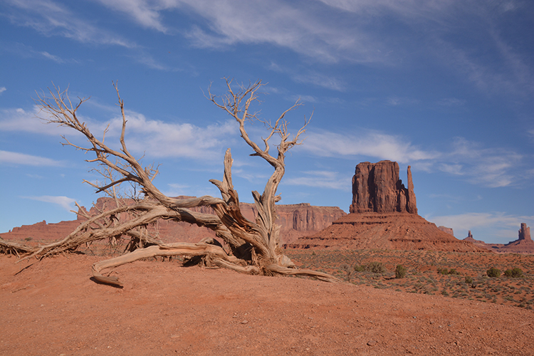
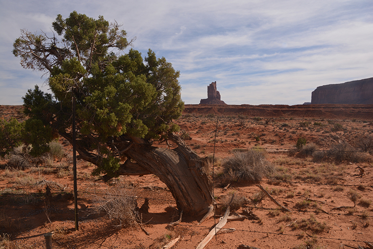
An interesting tree trunk stands in front of the rock formation called The Thumb.
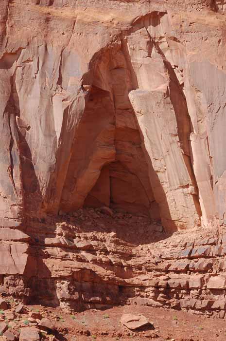
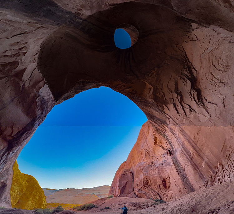
Here is another picture of entering the Big Hogan. In the photos below, the picture was taken from inside the hogan, looking out. Notice the image seen of the eagle's head. The near-perfect circle is the eye of the eagle. He's looking left. The one on the left is unedited; the one on the right I enhanced the image to make the eagle's head easier to see.
A serene view of the West Mitten (also called the Left Mitten), the East Mitten (also called the Right Mitten) and Merrick Butte
This formation, the Rain God Mesa, is the geographical "heart" or middle of the whole Monument Valley land mass.
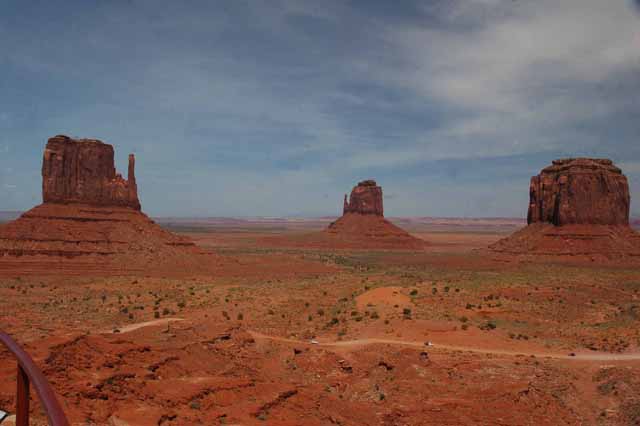
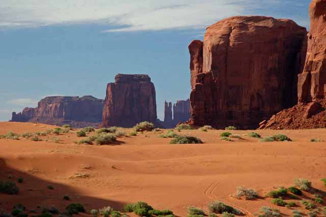
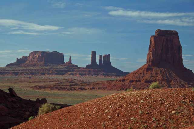
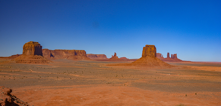
An iconic view taken from Artist's Point that shows some of the more prominent formations in Monument Valley
The tallest of these formations is called the Totem Pole. The spires to the left of the totem pole are referred to in the Navajo language as Yei Bi Chei Dancers. Yei Bi Chei roughly means the leader of holy figures.
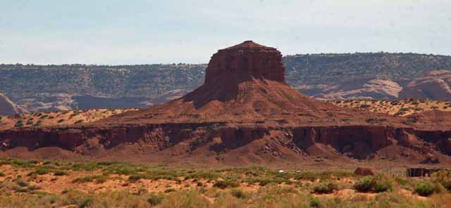
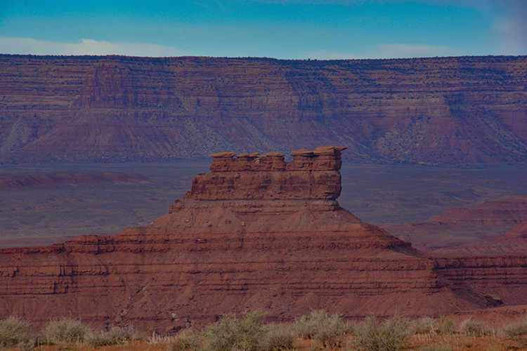
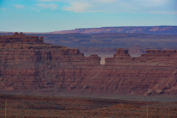
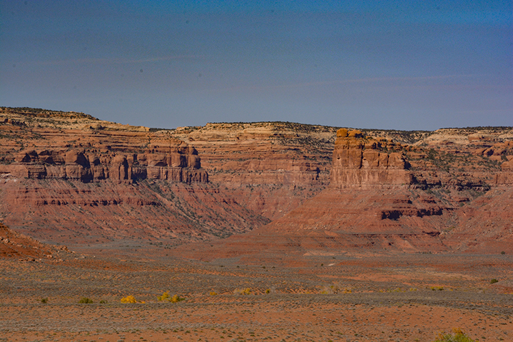
This formation in Valley of the Gods is called "The Seven Sailors Butte."
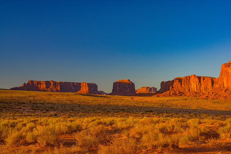
The sun begins to cast its last light of the day on the Navajo's valley of monuments.
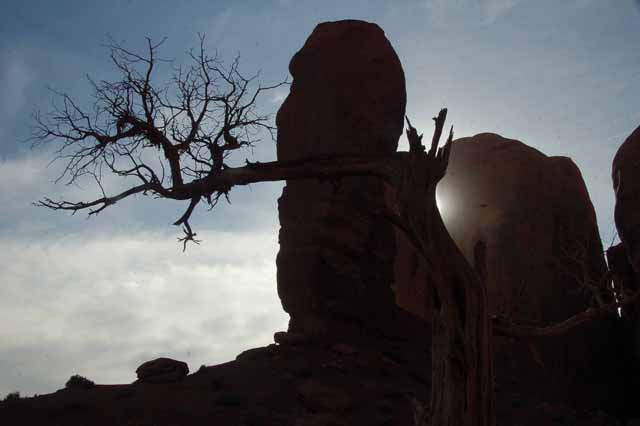
To the left of this massive rock formation are what is called The Three Sisters. A couple of pictures of them follow. Notice in the silhouetted picture on the right how the light plays out the image of the first sister. We can clearly see her standing with rosary in hands.
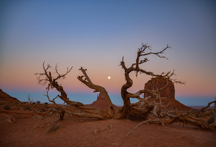
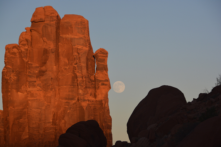
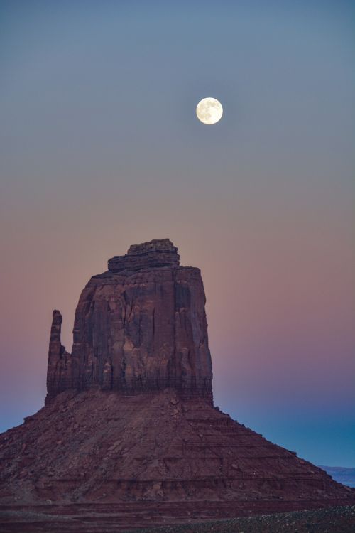
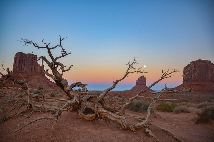
There are areas of the park that can only be seen by tour. The tour we were on was a sunset tour, which got us back to "The Hand" just as the moon was rising. We all gasped when we rounded the corner and saw it, so our tour guide stopped to let us get pictures. We stayed in the area awhile to get other shots of the rock formations with the moon. It was THE highlight of the tour.
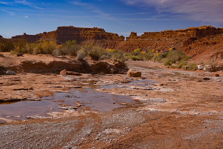
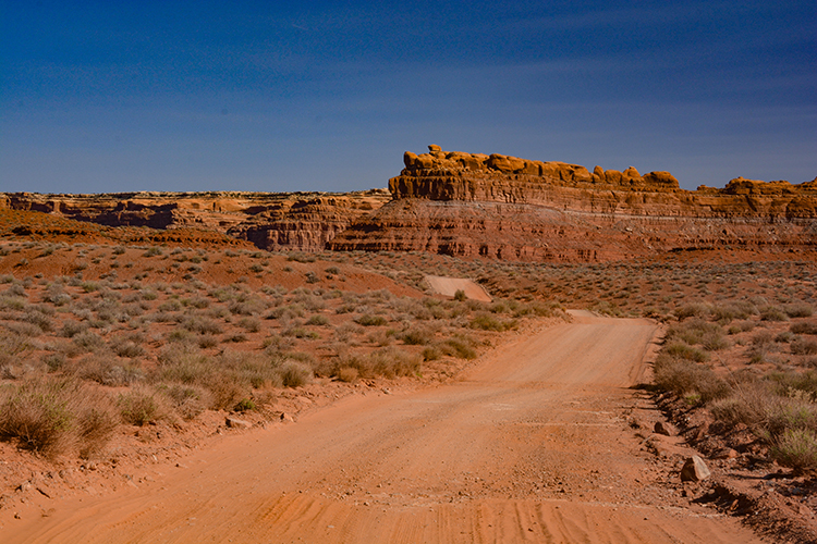
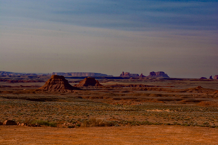
The remaining pictures were taken in the Valley of the Gods just outside the Navajo land and Monument Valley.The rock formations are similar to Monument Valley and many are named. There is a 17-mile packed dirt road that meanders around the formations, fairly easy for high-clearance vehicles. Valley of the Gods is just off Highway 163 northeast of Monument Valley and lies in the southern part of Bears Ears National Monument.
Thank you for visiting these photo pages.
If you're interested in seeing more, please return to the Main Menu at the bottom of my home page and make your selection.
All images within 'The Wandering Chick' Web site are copyright protected. They may not be downloaded or otherwise copied.
Please contact me if you think a particular photo or set of photos can be used in your publication.