the wandering chick
Canyonlands Natl Park
southeast Utah
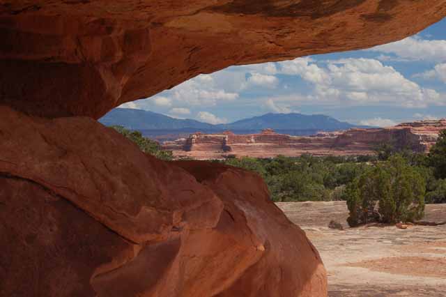
Canyonlands National Park is one of many of Utah's scenic gotta-see national parks. When 'those in the know' speak of Canyonlands they clarify it according to districts. There are three, each very different: Island in the Sky, Needles and the Maze.
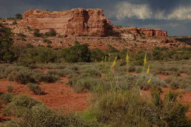
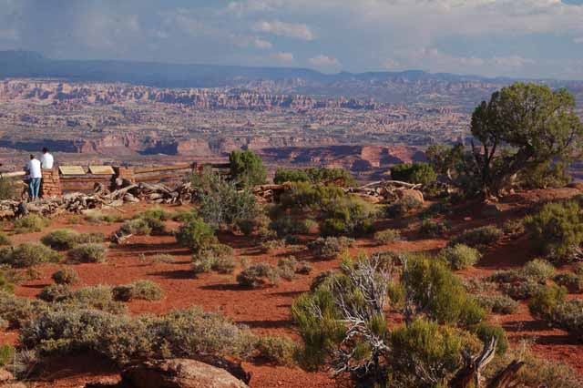
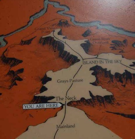
I visited Island in the Sky first, so most of the beginning pictures were taken there. This area is so called because of its geographical layout. Actually, it should be called Peninsula in the Sky, but that doesn't sound as cool. On a map (I provided one below), you'll see a very small passageway, about the size of a two-lane bridge, that separates ISKY from the rest of the park. This is called The Neck. Once you cross over , you're on a vast plateau or mesa surrounded by deep, deep canyons. Hence, Island in the Sky. The only access to ISKY is by way of The Neck.
And even more interesting is that, as in all canyons, the wind and rain are gradually wearing away the sandstone at The Neck, where the canyon on either side makes it so vulnerable. Eventually, but hopefully not in our lifetime, The Neck will be worn away, cutting off access to the stunning beauty we are able to see now.
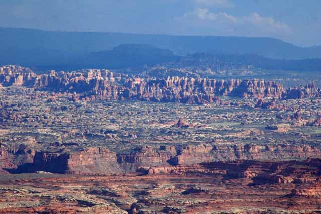
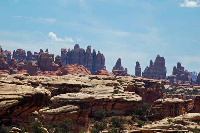
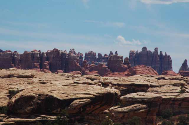
Needles is named for the many cone-like formations that form a perfect skyline.
The Maze is the least accessible part of the park, and a four-wheel drive is needed to explore its vast range.
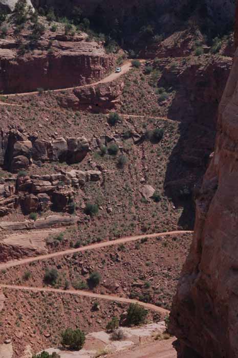
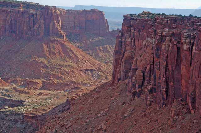
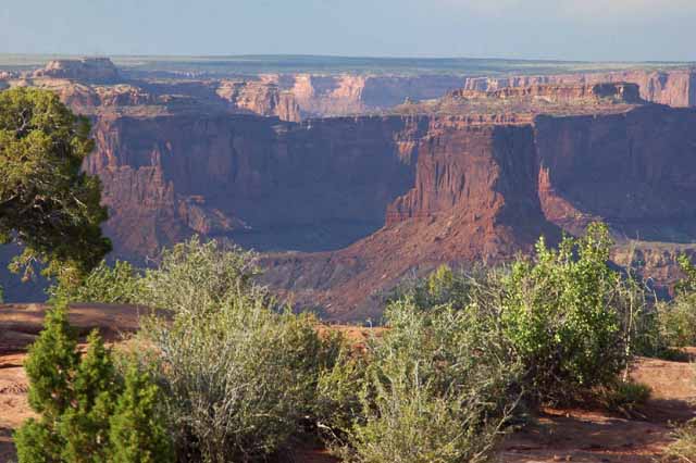
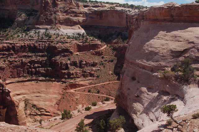
Shafer Canyon surrounds the Neck. Named for a rancher of the 1900s, cattle were driven down the dirt roads in winter to shelter from the storm. The road descends 1400 feet. Today it's accessible by car for those who are so daring.
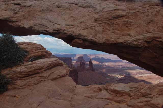
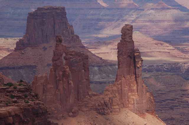
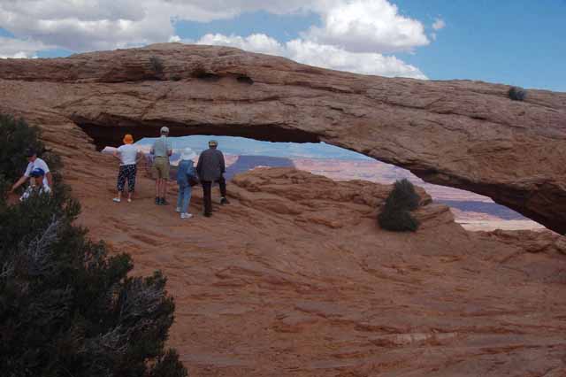
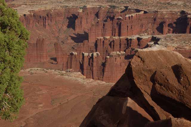
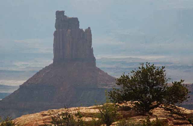
Possibly the biggest attraction on Island in the Sky is Mesa Arch, at least for those who enjoy photography. It's best as the sunrise hits the inside of the arch, but any time of day it's stunning. In the background, framed by the arch, are three rock formations. On the left is Washboard Woman, and to her right is Monster Tower. The large rock behind both of them is called Airport Tower. A close up of the rock formations is at left.
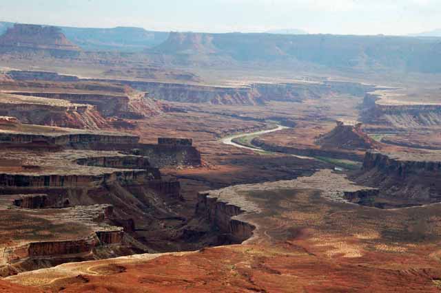
At Green River Overlook you can see the Green River as it meanders through the vast canyon way below the Island in the Sky.
At Buck Canyon
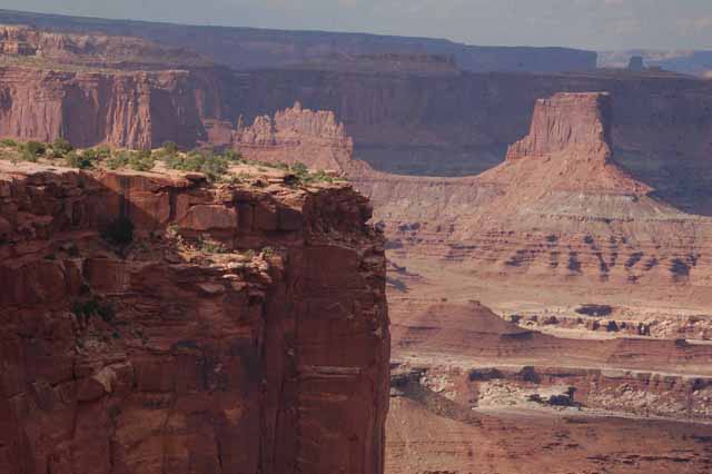
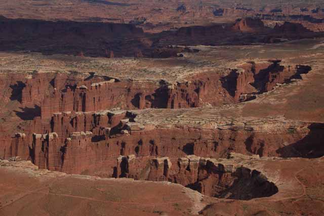
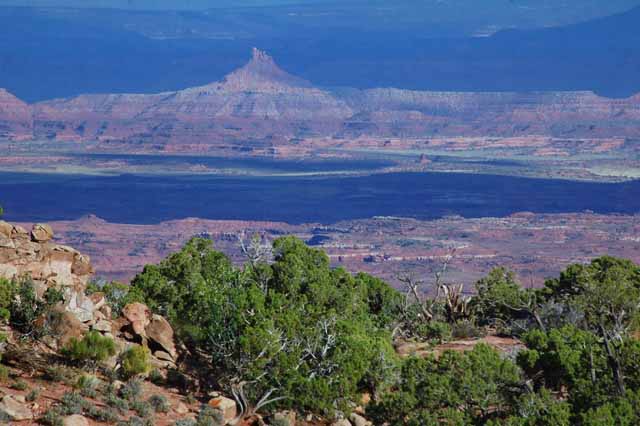
At the very south end of the Island in the Sky is Grand View Point. There is nothing like it. As far as the eye can see, the canyon devours the land, creating endless rock formations and a view that makes the jaw drop. In the far distance, you can see The Needles section of Canyonlands.
The view from White Rim Overlook. A large shadow spills over the canyon.
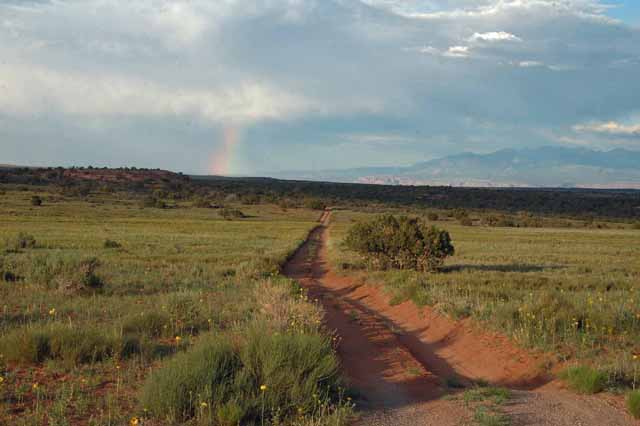
Leaving Canyonlands in the late afternoon, a sliver of a rainbow showed up over the area of Dead Horse Point State Park.
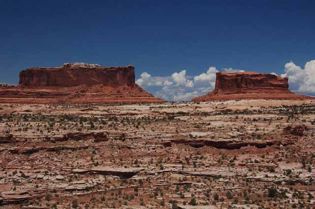
Outside the gates of Canyonlands are the Merrimac (on the left) and the Monitor Buttes, monoliths made up of Entrada stone and rising 600 feet above their bases. The forms were named after two Civil War ships because of the striking resemblance. While the real ironclads are buried at the bottom of the sea, these two will continue to stand erect for years to come.
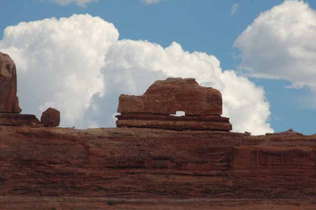
This and the remaining shots were taken in the Needles District of the Canyonlands.
This naturally formed rock is called, appropriately, the Wooden Shoe.
Click
here to visit more areas of Utah, or choose a destination below.
Thank you for visiting these photo pages.
If you're interested in seeing more, please return to the Main Menu at the bottom of my home page and make your selection.
All images within 'The Wandering Chick' Web site are copyright protected. They may not be downloaded or otherwise copied.
Please contact me if you think a particular photo or set of photos can be used in your publication.