the wandering chick
...Galveston and Port Bolivar

Hurricane Ike damage

Sept. 13, 2008

Bayou Shores Apartments across Offatts Bayou from 61st St.
Payco Marina
Payco Marina
Apt complex off 61st St.
Above and right: Payco Marina is located at the Galveston end of the causeway on the right.

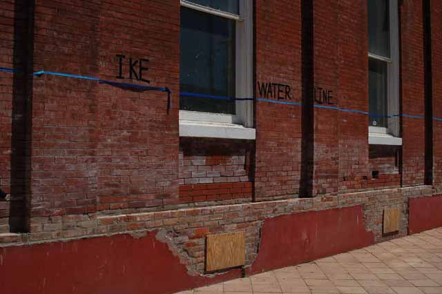
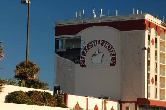
There was the 1900 storm...and there was Ike. The two are constantly being compared down in this part of the country. A big factor in the comparison, of course, is the seawall that stretches along Galveston's most inhabited part of the island. In 1900, there was no seawall; in fact, it was because of that storm, after the deaths of some 6,000 of its 37,000 residents, that the idea and realization of a protective barrier came to be.

And the seawall has done just that from the big ones to hit Galveston: Carla in Sept. 1961 and Alicia in Aug.1983.

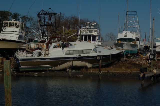
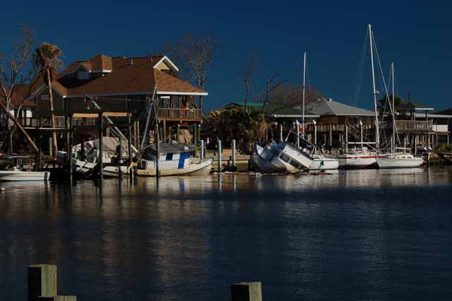
But Ike was larger than the barrier, rising far above it and devastating the island of nearly 60,000 residents. Without the seawall, it would have been much worse, but the bulk of the surge - in both storms - came from the bay side of the island where no protection is offered.

It took 10 days before the 45,000 evacuees could get back onto the island to assess the damage to their homes. Most were shocked, for there has never been devastation to their island of this magnitude in their lifetime.

Payco Marina
Payco Marina
Payco Marina
Bub's old neighborhood
Bub's old pier

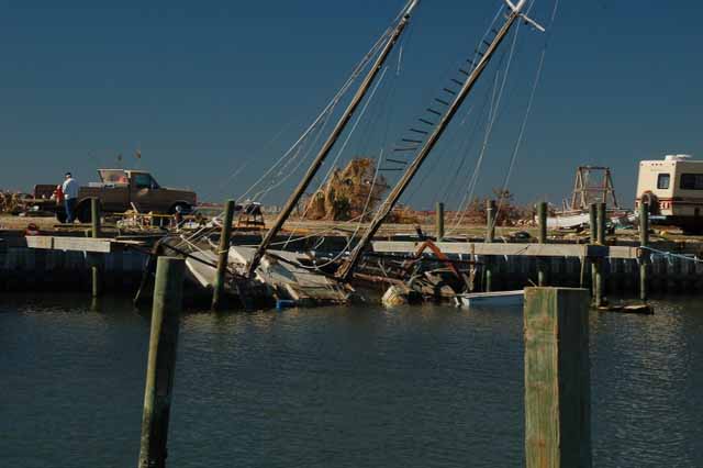
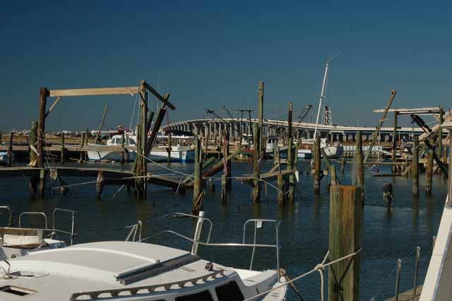
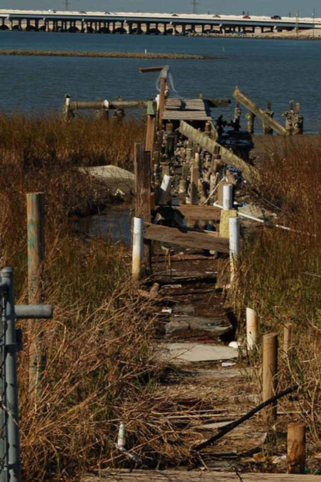
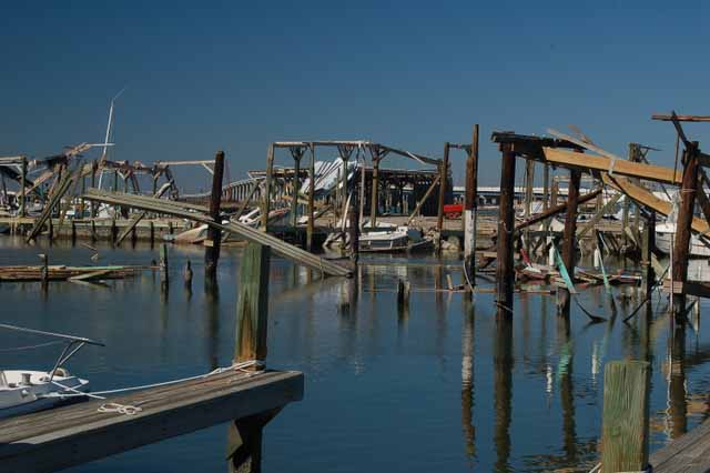
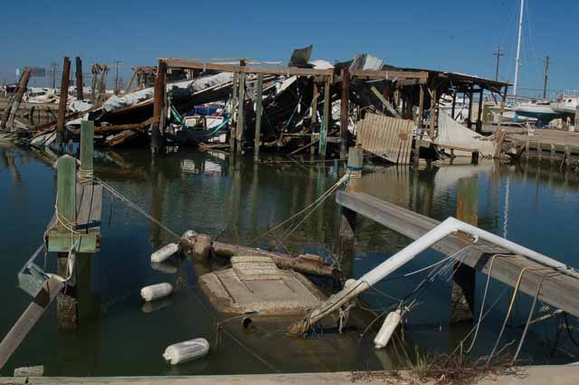
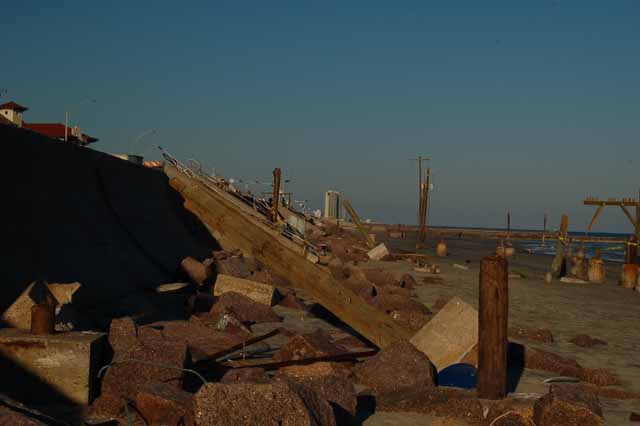
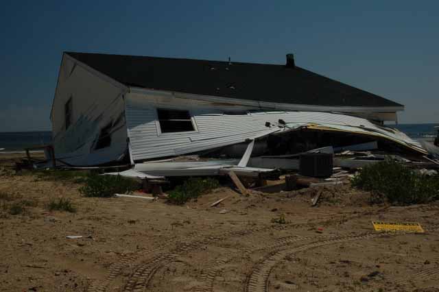
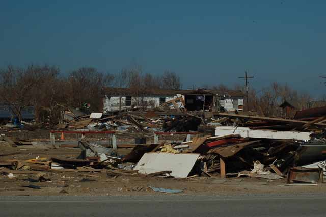
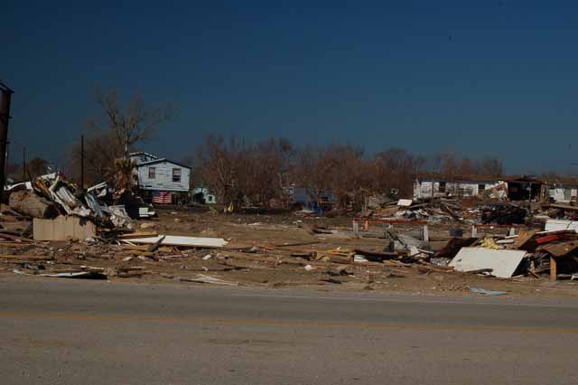
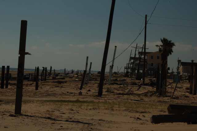
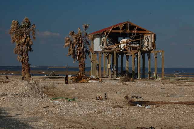
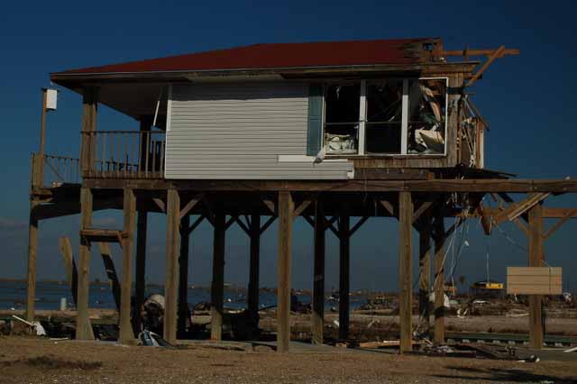
Above: Around 93rd and West Bay Road.

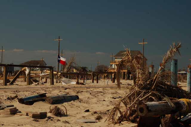
Left: Around 93rd and West Bay Road. The Galveston causeway can be seen in the distance.

Payco Marina
a lagoon off West Bay
A lagoon that leads off of West Bay, behind 90th Street and Lewis Lane
Murdoch's Bath House

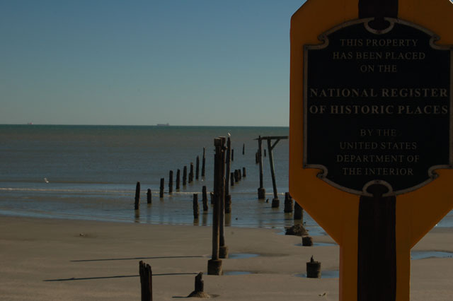
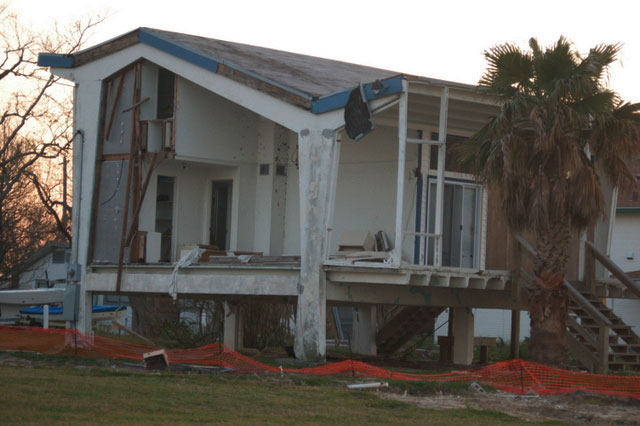
Murdoch's Bathhouse had been around longer than most of Galveston's residents. It was one of the few establishments that was actually built over the water.

It was first built in the late 1800s, destroyed by hurricanes and rebuilt. The current building had been standing since 1910. The owners plan to rebuild it in time for its 100th anniversary next year. It was located on 22nd and Seawall Blvd.

The Balinese Room

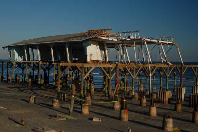
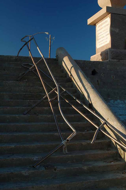
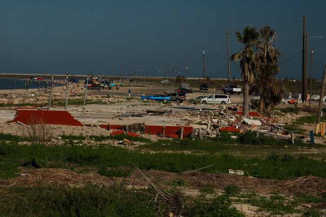
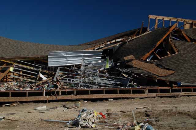
An even more popular Galveston landmark was the Balinese Room on 21st and Seawall. Above is all that is left of it.

The Balinese Room's colorful history dates back to the World War II years, back in its heyday when it was a nightclub up front with a hidden casino far in the back. Back when it was the best illegal gambling joint in the nation. Back when it was larger than Houston. And back when the likes of Frank Sinatra, Sophie Tucker and Guy Lombardo, among others, entertained there.

The Balinese Room
Stair railing from the seawall to the sand
The Flagship
The Flagship was Galveston's only hotel over the water. It suffered major damage, and five months later, there appears to be no attempt to start repair. It's located on the 25th and Seawall Blvd.
Near Jamaica Beach, on Galveston's west end
At Galveston's west end where there is no seawall protection.
Galveston's east end
East end of Galveston
Above and Right: Galveston's east end, where the island gives way to the merging of the Gulf of Mexico and the Galveston Bay. This is a popular fishing spot in Galveston, and the ruins seen were once bait and tackle shops.
San Leon damage
This is a private residence in San Leon, on Galveston Bay.
Port Bolivar

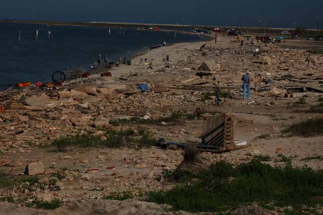
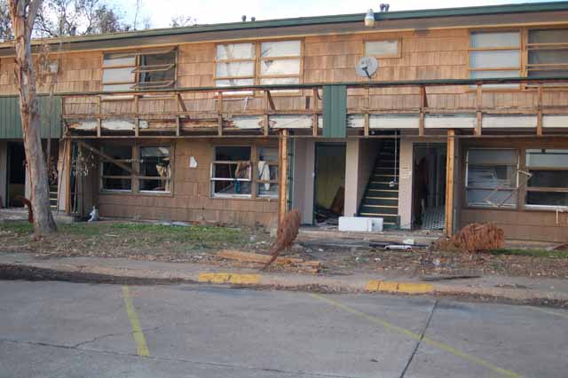
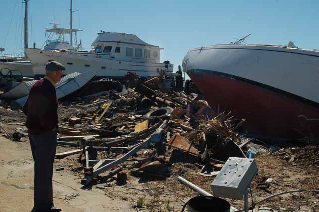
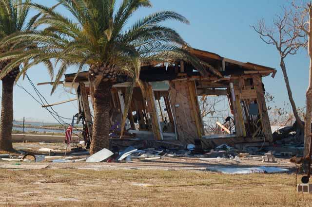
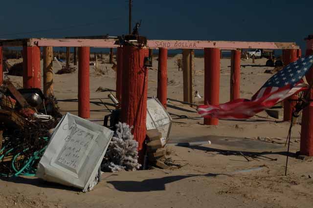
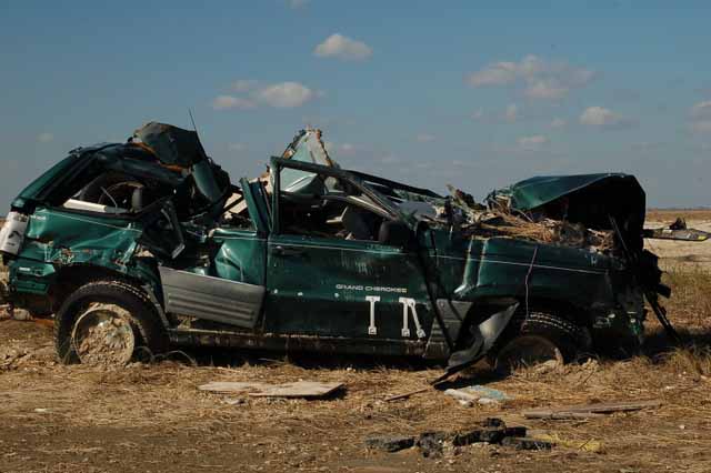
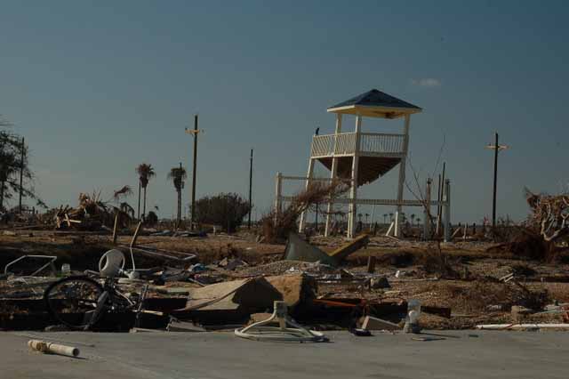
This and the remaining shots were taken on Port Bolivar Peninsula, a 20-minute ferry ride from Galveston's east end. Because Bolivar has no seawall and no elevation, it was pretty much obliterated, miles of rubble and posts sticking out of the ground.

Bolivar consisted mostly of private beach houses. Crystal Beach was a popular gathering spot.

Port Bolivar
Port Bolivar
Port Bolivar
Port Bolivar
Port Bolivar
Port Bolivar
Port Bolivar
Port Bolivar
Port Bolivar

Click the link to another set of Texas pages:

Brazos Bend State Park | the Davis Mountains | Enchanted Rock | Galveston Island | Hill Country | San Antonio Missions | around Texas

Or, choose a destination below.

Please visit some of my other travel locations. Feel free to email me if you have questions or comments.

BY CITY: Boston | Coeur d'Alene, ID | Fort Benton, MT | Galveston, TX | Independence, MO | Juliette, GA | Leadville, CO | New York City | Savannah | Seattle | Sedona, AZ | Tombstone | Tucson | Washington, D.C.

BY STATE: Alaska | Arizona | California | Colorado | Georgia | Idaho | Maine| Michigan | Minnesota |Montana | Nevada | New Mexico | North Carolina | South Dakota | Texas | Utah | Washington | Wyoming

BY REGIONS, LANDMARKS AND NATL PARKS, FORESTS AND MONUMENTS: Antelope Island on the Great Salt Lake | Arches NP | the Badlands | Bighorn Canyon | the Biltmore Estate | the Black Hills | Blue Ridge Parkway | Bridges of Madison County | Bryce Canyon | Canyon de Chelly | Canyonlands NP | Death Valley | Devils Tower| Glacier NP | the Grand Canyon | the Grand Tetons | Gulf Shores, AL | Hoover Dam | Hovenweep NM | Kure Beach | Little Bighorn Battlefield | Mackinac Island | Martha's Vineyard | Medicine Bow NF | Monument Valley | Mount Rainier | Mount Rushmore | Mount St. Helens | Natural Bridges NM | Niagara Falls | OK City (bombing) NM | the Olympic Peninsula |Organ Pipe Cactus NM | the Outer Banks | Pictured Rocks NL | Saguaro NP | Shenandoah Valley | Sleeping Bear Dunes NL | Sunset Crater NM | Texas Hill Country | Tybee Island | White Mountains NF | Yellowstone NP | Zion NP

OUTSIDE THE U.S.: Austria | Budapest, Hungary | Canada | Costa Rica | East Africa | Europe, here and there| France | Germany | Greece | Italy | Morocco | the Netherlands | Portugal | Russia | Scotland | Spain | Switzerland | Tunisia | Turkey

OTHER: HOME | My Favorites | the Andreas family, Moab | Vilseck DoDDS teachers' reunions


All images within 'The Wandering Chick' Web site are copyright protected. They may not be downloaded or otherwise copied.

Ike water line downtown
The water line from Hurricane Ike measures higher than seven feet in this section of downtown's Strand District, the area closest to Galveston Bay. Reports have put the level as high as 12 feet.