the wandering chick
...Galveston Island
and Galveston County
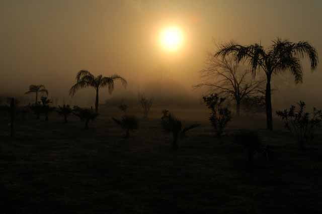
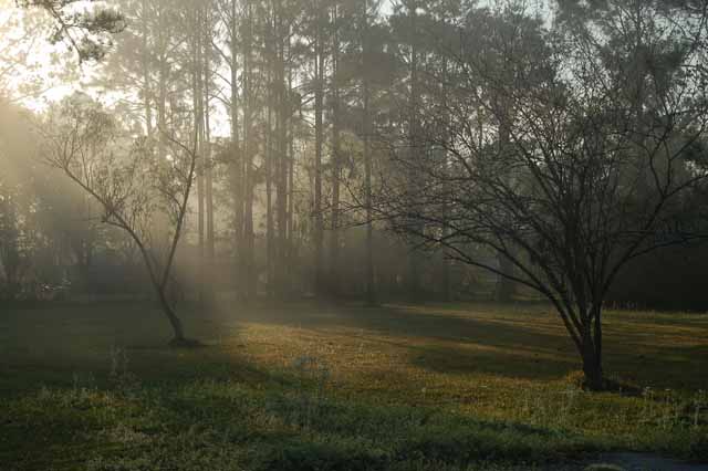
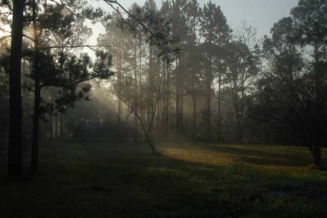
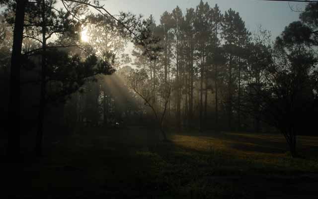
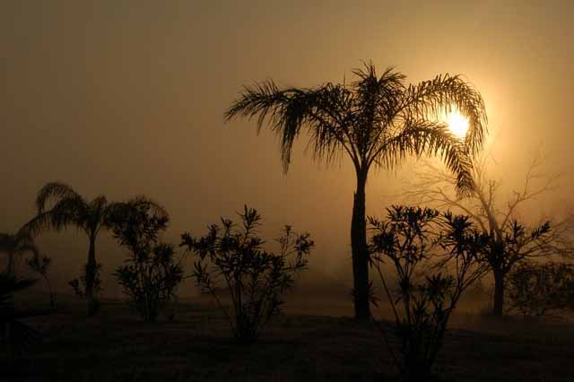
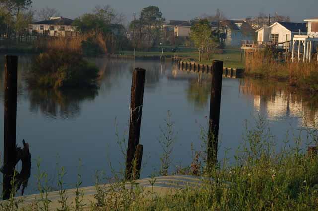
We'd had a few mornings when we were socked in by fog. I got myself up and out early enough to get these few shots. I didn't have to go far from my dad's house in Dickinson, on the mainland, about 20 or miles from Galveston Island. These were shot on Farm Road 517 and on California Avenue, a residential street, in Dickinson.
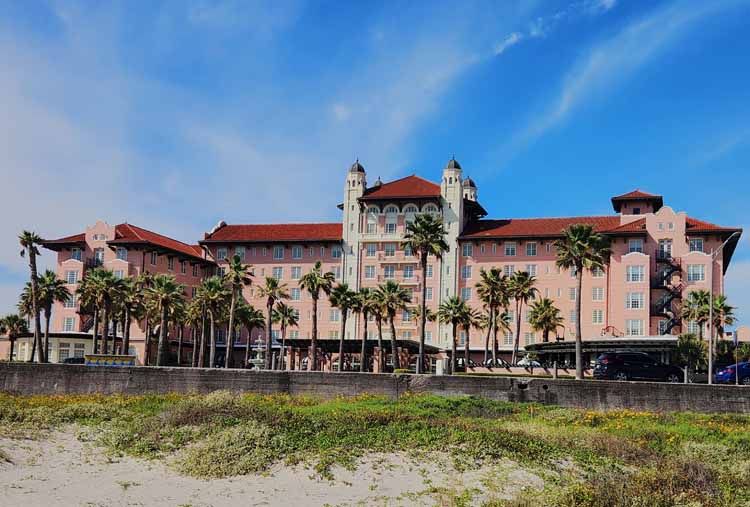
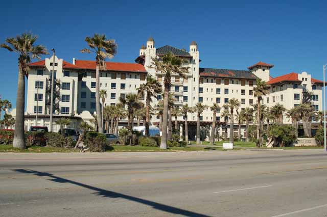
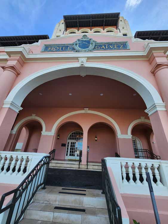
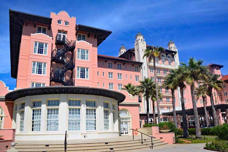
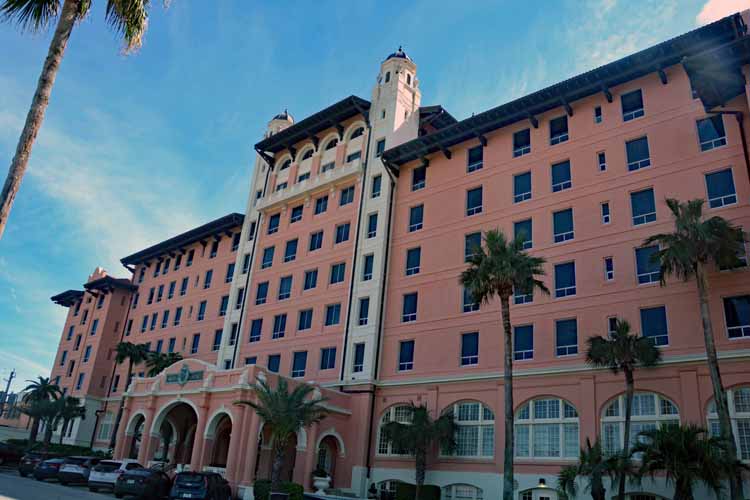
The Galvez Hotel, one of Galveston's oldest, is located on the boulevard, across from the beach. Over the years, the hotel has changed hands numerous times. Its latest change was the restoration of its original exterior color. Pictures are below.
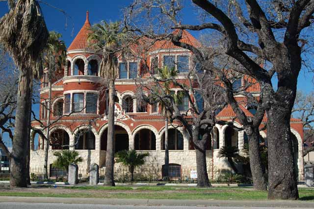
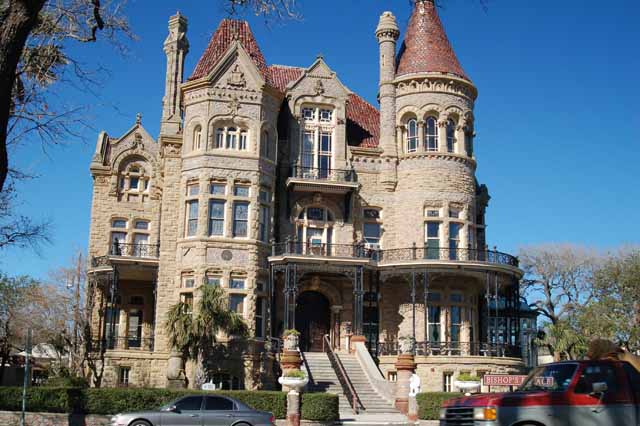
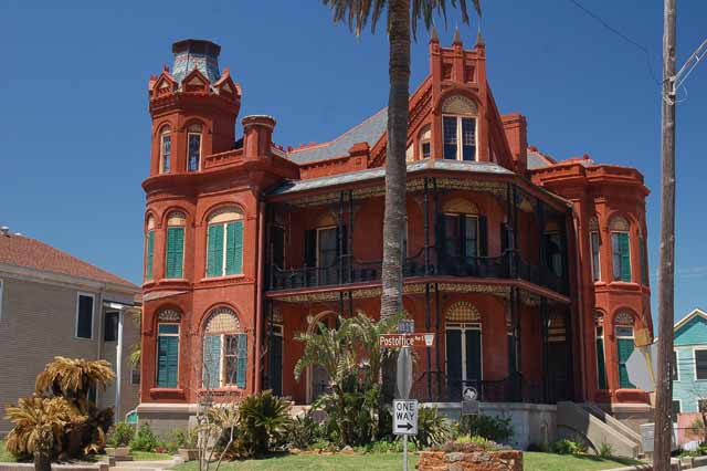
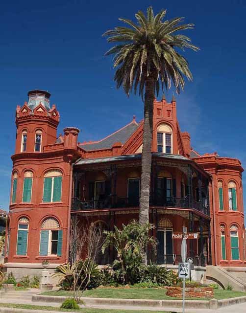
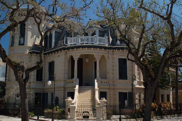
The Bishop's Palace, located on 14th and Broadway, is one of the most well-known and oldest buildings in Galveston and is rated as one of the top Victorian structures in the nation.
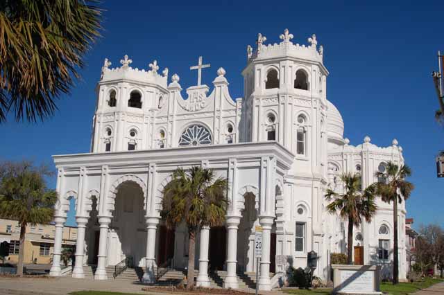
It was built in the late 1880s and used as the bishop's residence to the Sacred Heart Church (right) that is just across the street.
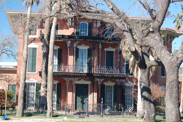
Ashton Villa is another home in Galveston, located on 24th and Broadway. It is not only the first of the 'palaces' built in Galveston (1858), but is also the first brick structure built in Texas.
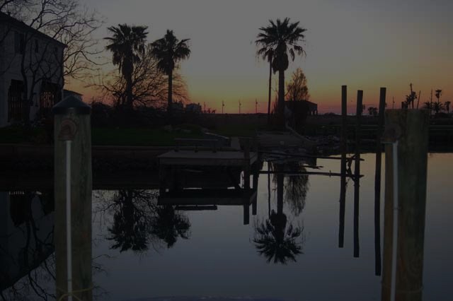
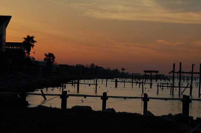
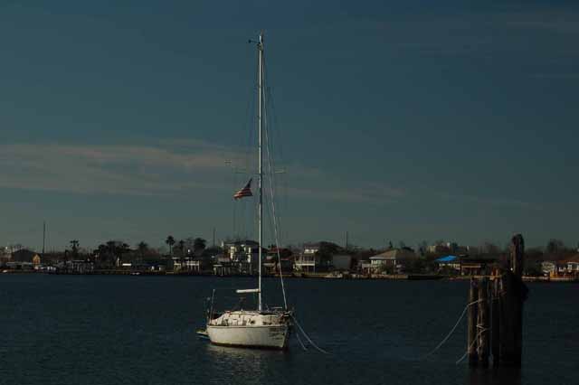
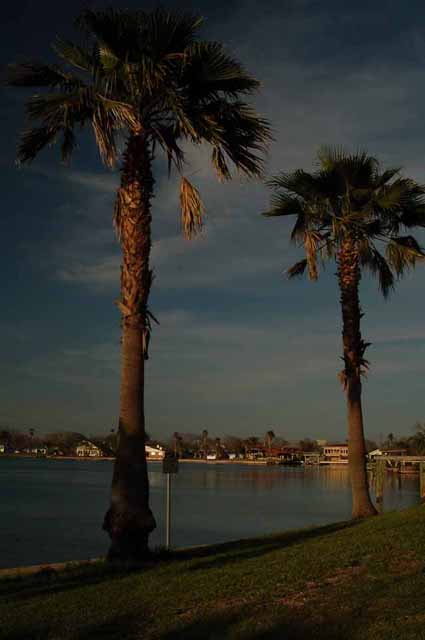
Sunsets at Payco Marina, at the Galveston end of the causeway that leads onto Galveston Island.
There are three entrances to and exits off Galveston Island. The most used is Interstate 45 South from Houston. It is the major artery, being a multi-lane causeway that in recent years has been widened and improved.
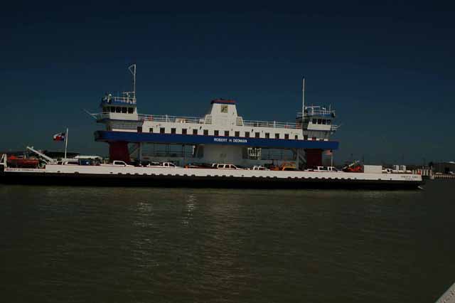
The second route is the ferry to and from Port Bolivar Peninsula, at Galveston's east end and over one of the busiest waterways in the world, leading to the Port of Houston via the Houston Ship Channel.
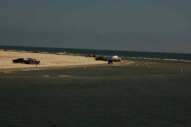
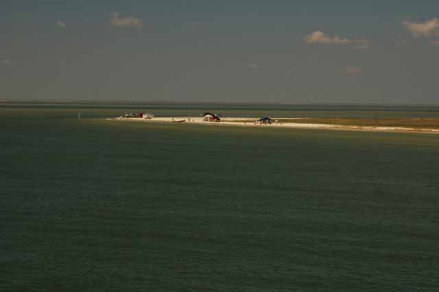
At the southwest end of the island is the smaller San Luis Pass, a toll bridge that connects Galveston to a more southern coastal area of Texas, toward Corpus Christi. This would be where what is called West Bay meets the Gulf of Mexico.
These two pictures (above and above left) were taken from the San Luis Pass bridge at the very tip of Galveston Island.
Gum Bayou, in Dickinson, Galveston County.
San Leon, in Galveston County. San Leon was critically damaged by Hurricane Ike in September, 2008. Many of the pilings seen are what's left of fishing piers and boat slips.
San Leon is a major shrimp and oyster community on Galveston Bay.
If you'd like to see more pictures of Texas destinations, please return to the Texas home page.
Thank you for visiting these photo pages.
If you're interested in seeing more, please return to the Main Menu at the bottom of my home page and make your selection.
All images within 'The Wandering Chick' Web site are copyright protected. They may not be downloaded or otherwise copied.
Please contact me if you think a particular photo or set of photos can be used in your publication.
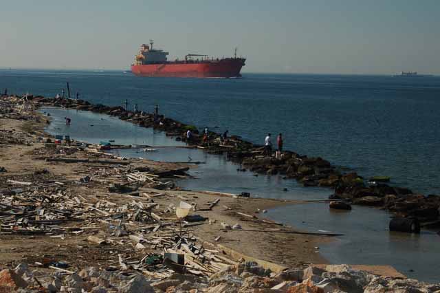
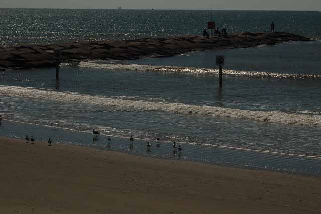
At the very east end of Galveston Island is this jetty, a popular fishing spot. It's here the Gulf of Mexico meets Galveston Bay and where there's a constant stream of freighters making their way to the Houston Ship Channel.
The debris in the foreground washed up from Hurricane Ike in Sept of 2008.
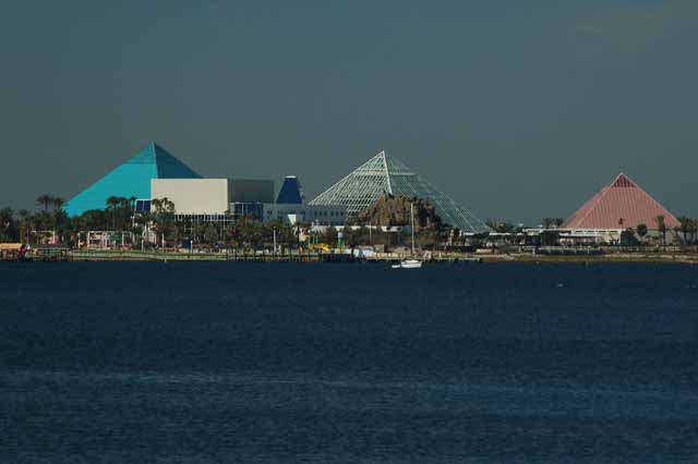
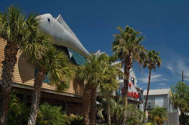
Moody Gardens is one of Galveston's main tourist attractions. Besides the tropical rain forest, it has theaters, aquariums, and other family attractions. It's located on the west end of Galveston Island.
English Bayou and Offatts Bayou straddle 61st Street, a major business area and route to the beach. The bayous are popular fishing and boating areas.
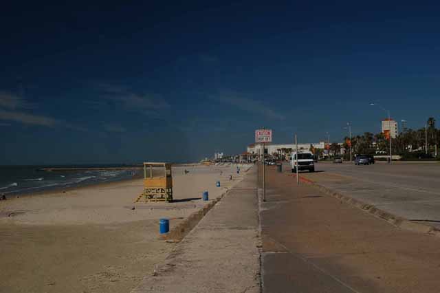
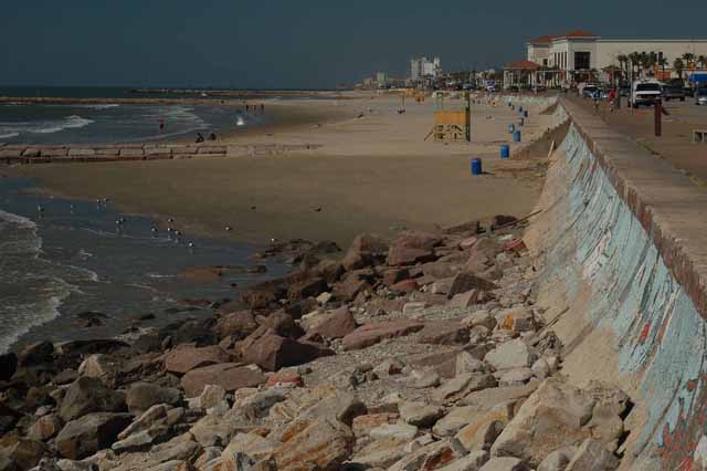
Above: Galveston Beach is, of course, Galveston's major attraction. Seawall Boulevard is the major beach street and is lined with restaurants, hotels and souvenir shops.
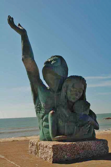
Right: On the Seawall, a bronze statue in memory of those 6,000 Galvestonians who lost their lives in the 1900 storm.
Galveston's beach is 32 miles of the Gulf of Mexico. Rock jetties are placed for fishing. The seawall (right) was built after the 1900 storm as protection against future high waters. It stands 17 feet high and runs approx. 10 miles of Galveston's most populated section.
Beach buggies can be rented for use along the seawall.
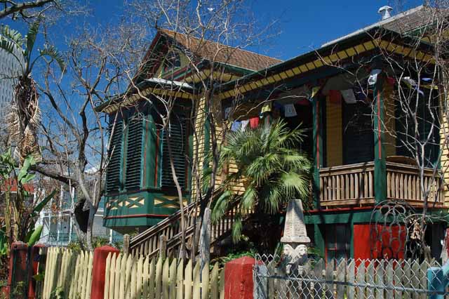
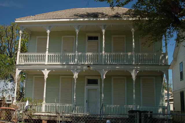
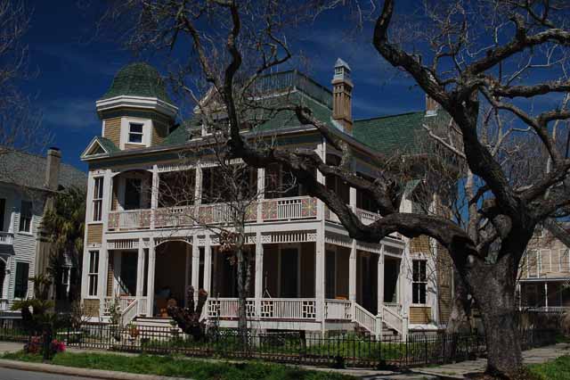
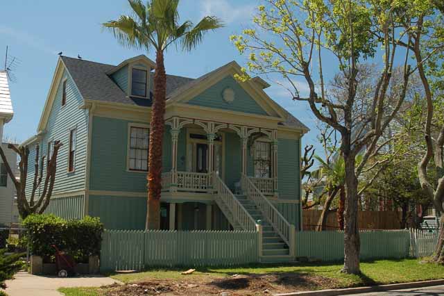
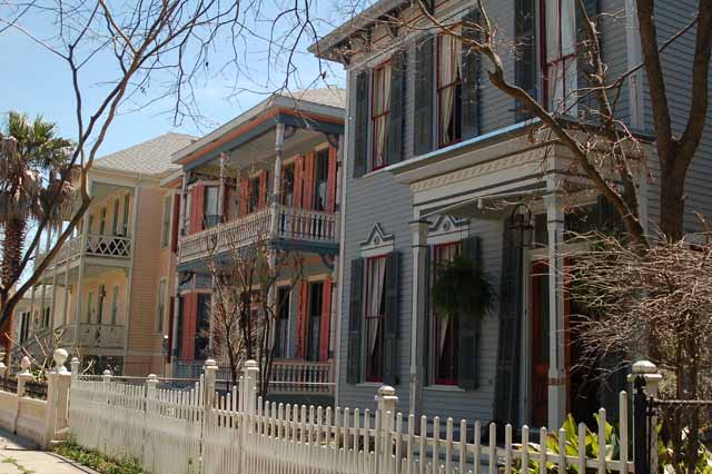
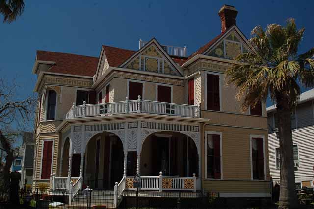
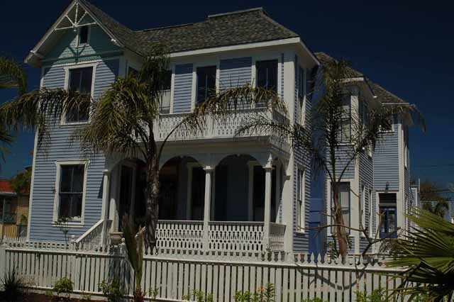
This home above and the ones following are located in the Galveston East End Historic District. Many of the homes were built before the 1900 storm, but over the years have gone through extensive repair. The homes are located on Galveston's east end, between about 10th and 21st streets.
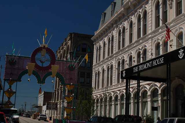
The Tremont House is a grand hotel in Galveston's downtown Strand district. It has a wonderful history, dating back to 1839, due mainly to the prominent guests who have stayed there.
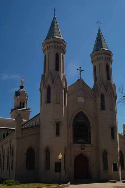
St. Mary's Cathedral on 21st and Church Street
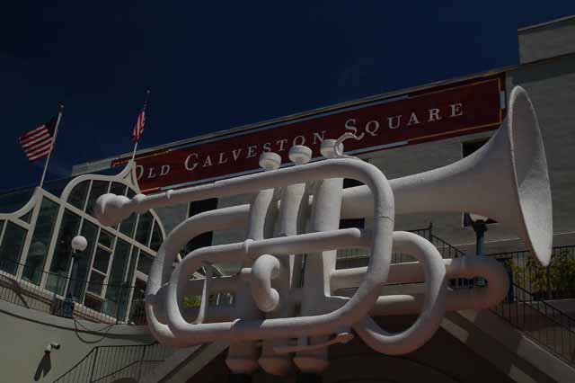
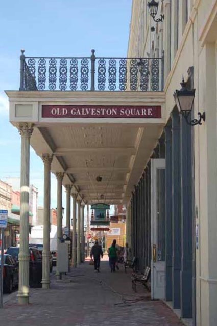
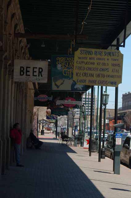
Above and Right: Old Galveston Square is in The Strand District and offers two stories of shopping and eateries. A Mardi-Gras Museum is also located there.
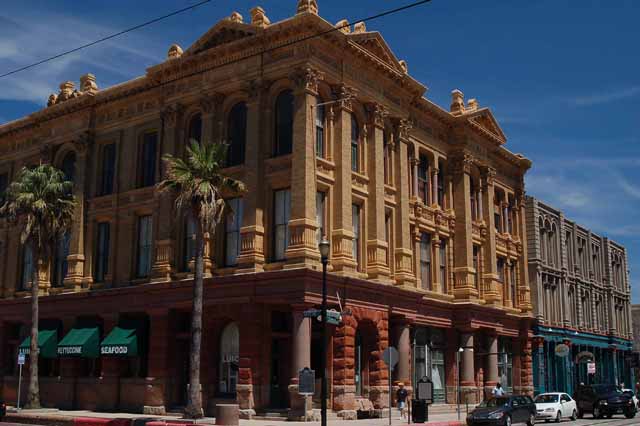
The Hutchings-Sealy Building in Galveston's Strand District. Both prominent names in Galveston's history.
Right: Galveston's effort to rejuvinate the old downtown shopping area has met its own difficulties, the most recent being Hurricane Ike in Sept. 2008.
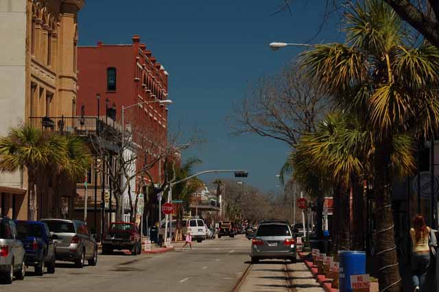
Below: The Strand District is on the bay side of the island and is filled with novelty shops. art galleries and eateries.
Left and Above: Galveston's harbor, on the bay side of the island, is yet another great tourist area. The restaurants offer outside over-the-water tables. It's also the docking area for Galveston's large cruise ships. .
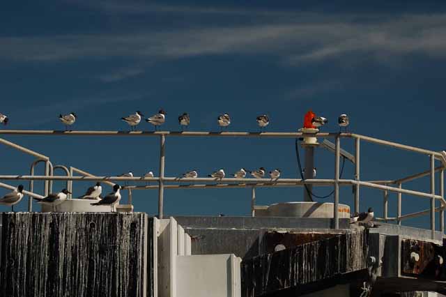
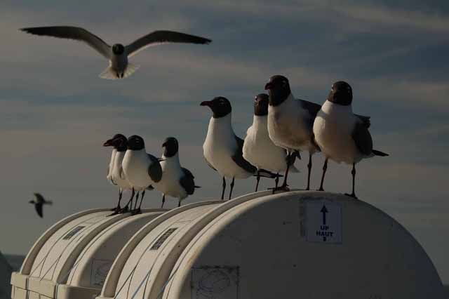
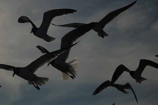
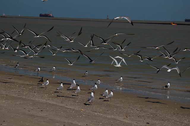
From the east end of Galveston island, the only exit off is by ferry. The ferry system is free and is an 18-minute ride across Galveston Bay to Port Bolivar. Seagulls, and Laughing Gulls like the ones above and below, are numerous, especially when passengers bring their leftover bread for feeding.
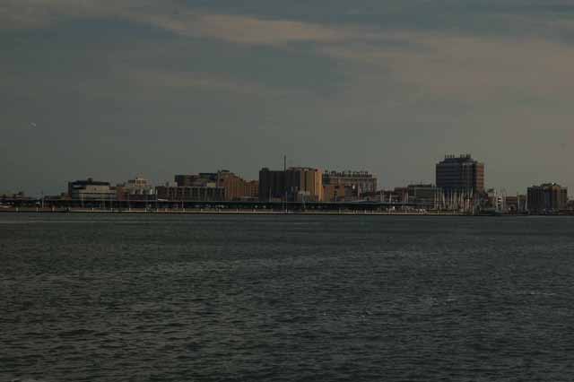
The Galveston skyline - such as it is - from the bay. Most of the buildings seen are of the University of Texas Medical Branch (UTMB).
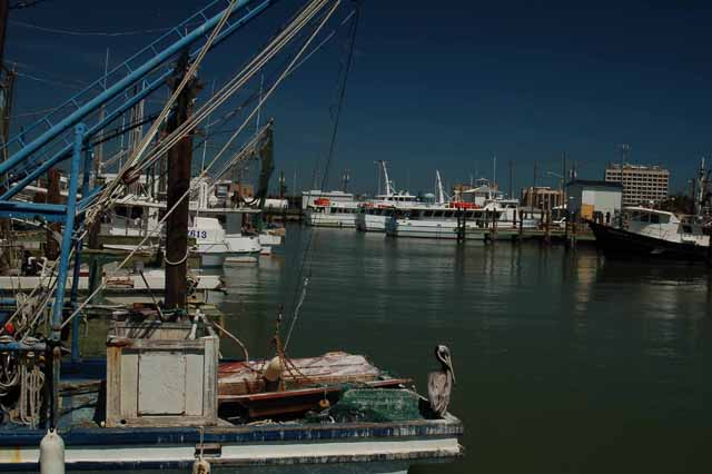
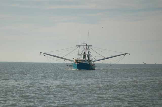
A shrimp boat in Galveston Bay.
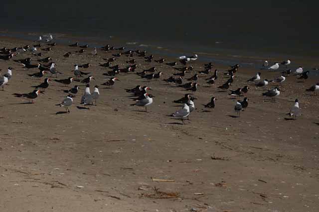
Black skimmers and laughing gulls on the beach on Port Bolivar
Below: Port Bolivar lighthouse
Surrounding shots: Galveston's 61st Street is a main thoroughfare to the beach from I-45. The street bisects Offatts Bayou.
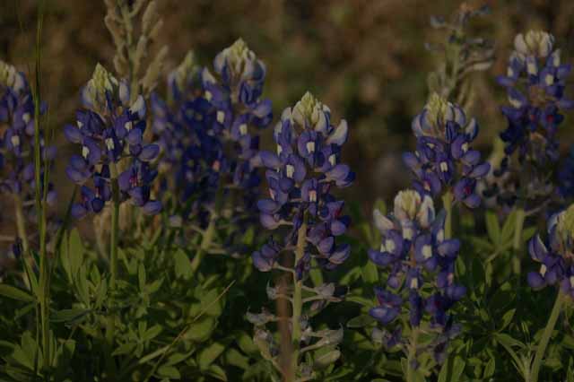
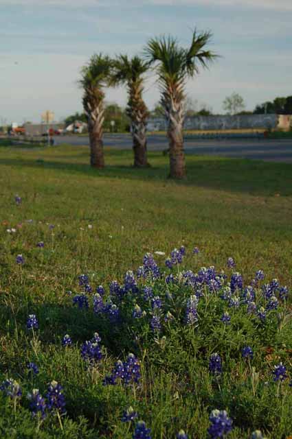
Texas Bluebonnets start springing up in April. These were sighted in LaMarque, Galveston County on Highway 3.
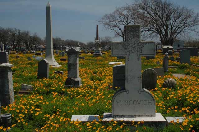
Broadway Cemetery is filled with spring flowers.
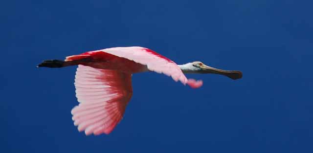
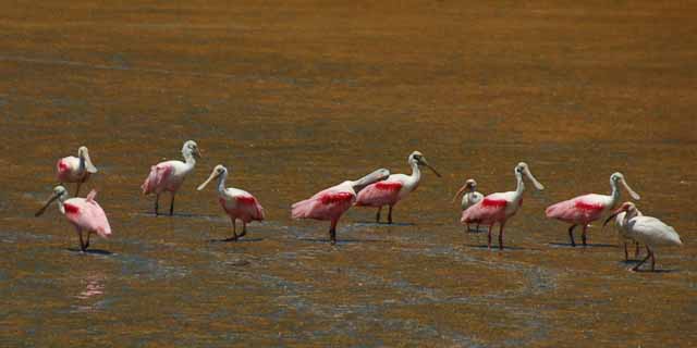
Spoonbills (above and right) have returned to Galveston since Hurricane Ike.
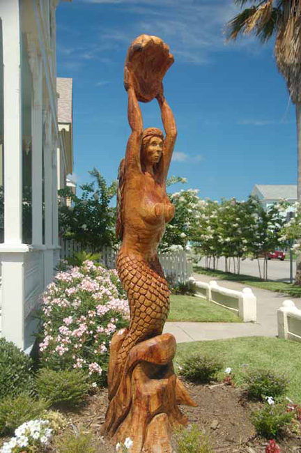
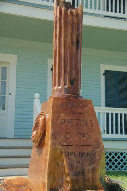
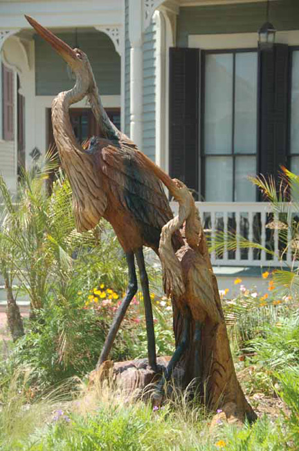
In memory of Galveston's wonderful, old oak trees that once graced the city, but fell victim to Hurricane Ike, artists have turned the stumps into works of art. Several can be found throughout the city's historic district.
The Texas City dike is a five-mile long spit of land that juts out into Galveston Bay. It's,popular to local fishermen and is a wonderful birding area for those who enjoy pelicans, herons and other water-type birds. The dike was completely devasted by Hurricane Ike in September of 2008, but after more than two years of rebulding, it's open and in better condition than ever. As seen in this picture, some of the old pilings that were not downed by Ike have been left in place, and additional ones have been constructed. The next several shots were taken from the dike.
The Halfmoon Shoal Lighthouse near the Texas City Dike
A white pelican
A snowy egret
A great blue heron
Of the several species of pelicans, the brown pelican (above) is the only one that dives head-first into the water to get its food.
The white pelicans, more elusive, stand-offish than the brown, usually are found in numbers. The brown pelicans are more likely to be seen flying solo.
On Texas City's Loop 197 is a residential poind that is teeming with waterfowl. It's where I found this egret, which took off in flight when I got too close, and the flock of white pelicans seen in the next few pictures.
Roseate spoonbills were spotted in the marshy waters near the Texas City dike. A blue heron stands on the shoreline.
San Leon, a coastal town on Galveston Bay, was severely destroyed by Hurricane Ike in 2008. It's making a slow recovery, and evidence of that is Bubba's seafood restaurant. His sign to the left makes a good laugh. Outside the main entrance to the restaurant on a telephone pole is this nest. When I asked, I was told it was a parrot's nest. San Leon is known for having a number of parrots in the wild.
Hooray!! The cairns have made it to Galveston. It was wonderful seeing the whimsical rock formations made by, most likely, tourists. I've seen them throughout my travels and they always make me smile. They'll probably be washed away the next time I visit the island, but hopefully more will be made. These were found against the seawall across from the Academy sports store.
An aging barn in Dickinson, Galveston County
I could sit all day here at my brother's house and watch the water and the sky and the pelicans passing by. In fact, that's 'bout what I've been doing the last week. Here are a few shots I've taken.
The water changes drastically throughout the day, and is typically much calmer in the mornings.
.jpg)
.jpg)
The front of the house faces south and east and overlooks this beautiful lagoon.
.jpg)
.jpg)
A neighbor's house
A brown pelican makes a dive, and there's one less fish in the water.
Some call him Homey, others call him Timmy. He's been hanging out in my brother's neighborhood for several years now, especially since neighbors across the lagoon often throw him fish to eat. He can often be seen hanging out on their patio or, when he's feeling a little bolder - or perhaps hungrier - on the ledge of their upstairs deck. He doesn't seem too bothered by his dangling leg which was injured a couple of years ago.
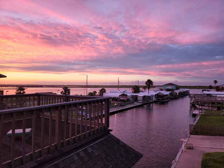
A foggy morning on the lagoon
A great blue heron takes flight in search of a better food source.
The fog rises over Dickinson Bayou at the Paul Hopkins Community Park, Dickinson.
The next few shots were taken on Galveston's west-end beach. As I walking with friends, a group of people on horseback came by.
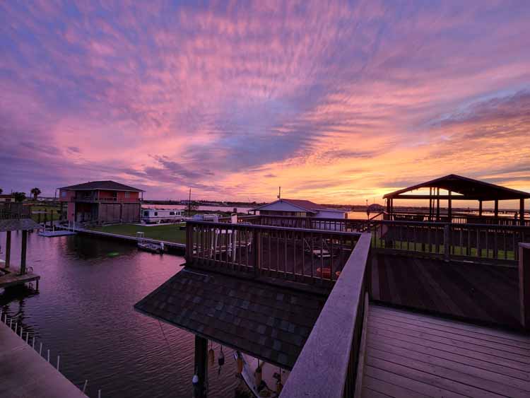
Fishing at sunset in the Lagoon d'Oro
Even when I have better (and more important!) things to do, I find myself trekking from the front to the back of the house capturing the endless flights of birds as they come and go. Above is a brown pelican, and to the right (top and bottom) is a great blue heron.
One may think the two birds (left and right) are completely different species. However, many shore/wading birds can change their appearance simply by curling in their S-shaped necks.
Even though these are both great blue herons, I'm not certain they are the same bird. The one on the left seems to be one-legged, but another of their traits is to often stand on one leg while resting the second.
So, the same question holds: Where the heck do they put it??
On the coldest day of Galveston's 2013-2014 winter, a flock of white pelicans came crashing in on the Laguna d'Oro which faces my brother's house. They stuck around for an hour or more; so did I, watching them.
It's hard to pass up shooting a sunset like this one. At the north end of the Galveston causeway is Tiki Island. This was taken from I-45 next to Tiki's RV park, overlooking Jones Bay.
A more serene sunset is seen over Offatts Bayou in Galveston
Above and Right: From my brother's back terrace, overlooking Galveston Bay and the causeway. A thick mass of clouds surprisingly never dropped any rain.
Taken from my front deck, looking north down the row of beach cottages.
Baby martins squeal for food just a day or so before fledging the nest.
A great blue heron makes a landing in the wetlands across the street from my house.
It's a fact: The beak of a pelican can hold more than its belly can.
A great blue in flight
A crested night heron searches the wetlands for food.
A brown pelican in flight over the waters of Galveston Bay
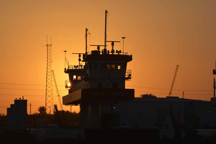
One of many perfect spots for watching a sunset over Galveston Bay is at Teichman Point in Galveston.
A beached whale was found on the very west end of Galveston Island in December of 2015. Officials believed it to be a male sei whale, an endangered species and not normally found in Gulf of Mexico waters. ANY whale on Galveston Island is rare, so news traveled fast that one had beacged. Sadly, the whale did not survive, and the officials believed the 40+- foot sei beached itself because it was sick.
A series of fishing cabins and homes on a canal in Galveston County
Brown pelicans can often be seen in the waters of Payco Marina.
The patience and sharp eyes of egrets generally land them a decent meal.
The Galveston causeway shrouded with fog
Above and Below: Looking into the sunset over Galveston County marshlands off the Gulf Freeway
This series of shots was taken off Galveston's 61st Street looking west over Offatt's Bayou.
Spoonbills, egrets and great blue herons are just some of the waterbirds that can be found in the marshes around Payco Marina at low tide.
Payco Marina, Galveston
Thanks to previous owners, I have Bird of Paradise plants in my own yard. How exquisite they are.
A residential water canal behind Louis' Bait Camp on Highway 6.
An ibis in flight
Spoonbills are typically found in the shallow waters and in wetlands at low tide where their food is easier to find.
A blue-bellied roller strolls the grounds of the Moody Gardens Rainforest.
A waterfall in the Moody Gardens Rainforest
This freighter was plowing through the water of Galveston Bay headed to the Houston Ship Channel .
it was such a clear morning, I couldn't resist taking this shot looking south down my canal.
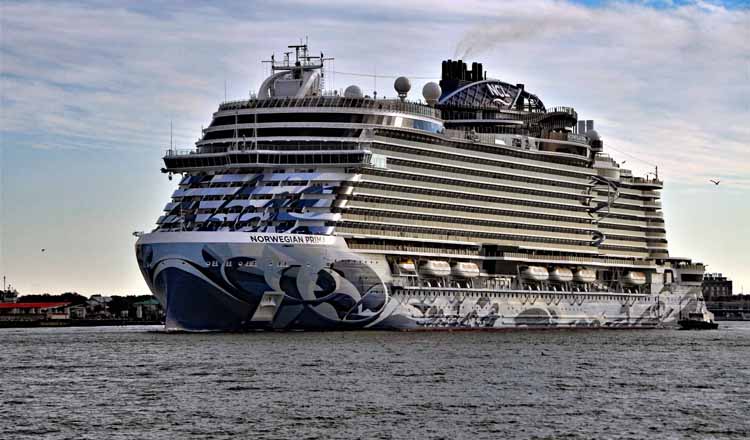
A Carnival cruise ship docks at Galveston harbor awaiting its next voyage.
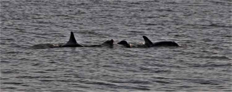
A friend and I took the ferry from Galveston over to Bolivar to hunt to sea glass. The dolphins were so active that we decided to make another round trip. So, we parked the car and went on as foot passengers. This is the best shot I got since, of course, we didn't see that many on our second trip. Isn't that usually the way it is?
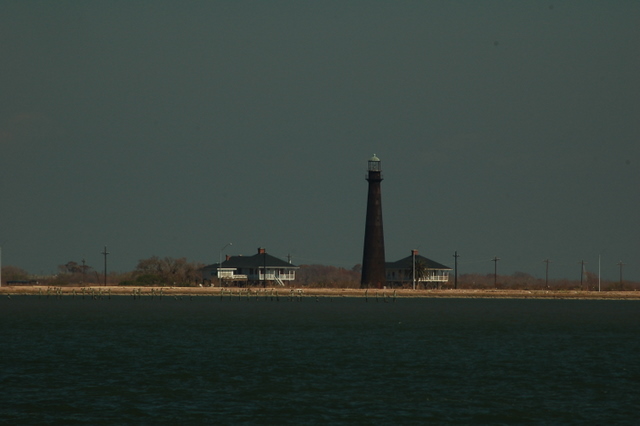
The Port Bolivar lighthouse standing today was built in 1872 and is the second one constructed on the Bolivar peninsula. The original light was built in the mid-1850s, but was taken down during the Civil War to prevent Union warships from using it as a navigational aid.
Shrimp boats are easily identified in the waters of Galveston Bay.
Some pretty snazzy kites were flying on East Beach on this balmy Sunday afternoon.
A really fun bird to watch is the reddish heron. They're known for their crazy "dancing" antics in the water. They hop, skip and jump, spread their wings and charge the water like madmen. But there's a method to their madness, the purpose being to stir the fish in the water for an easier catch.
This gorgeous great blue had just come in for a landing from another spot in the pond.
A roseate spoonbill.
i'm in awe of this beautiful Fred Hartman Bridge that connects LaPorte/Kemah to Baytown on Highway 146. It's most impressive as you drive under its fan-shaped yellow cables, but without creating a national incident, one cannot just stop or pullover to take pictures. More than once I've said I'm going to find someone with a convertible to take me on a slow drive over it. The bridge spans the Houston Ship Channel and its construction was completed in 1995 as a replacement for a tunnel that was demolished when the ship channel was deepened.
I didn't have to wander far to get pictures of this great blue heron eating a pretty good-sized breakfast. I was having my morning coffee on my patio when I spotted him across the canal, seemingly oblivious to everything except his catch.
I love when my travels take me east out of Galveston. It means I get to ride the car ferry over to Port Bolivar, and there's no better start to a day than that.
Freighters lined up in Galveston Bay
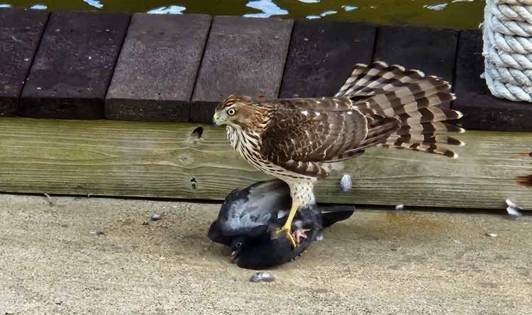
Sometimes animal nature seems cruel, such as when this hawk swooped down for a pigeon dinner.
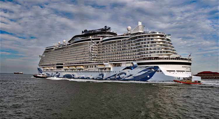
The cruise ship Norwegian Prima leaves Galveston Bay.
Dolphins can often be seen in Galveston Bay.
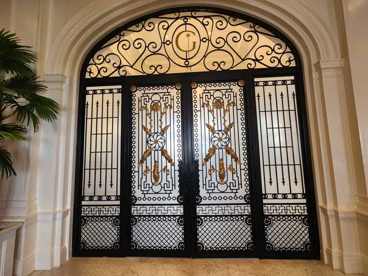
The back entrance to the hotel still holds its original name.
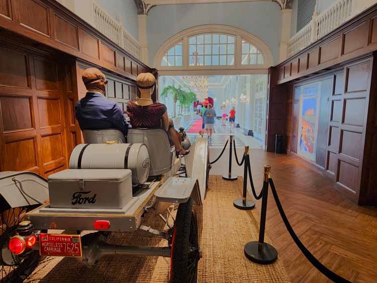
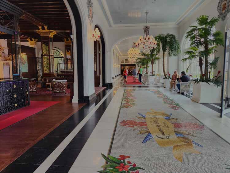
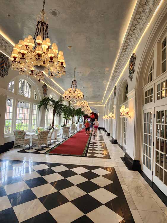
As one enters the main entrance to the hotel, to the right is a long corridor known as Peacock Alley. It leads from the lobby to the ballroom, and was so named for its promenade of guests in their finest clothing, heading to the ballroom.
The hotel's elevators
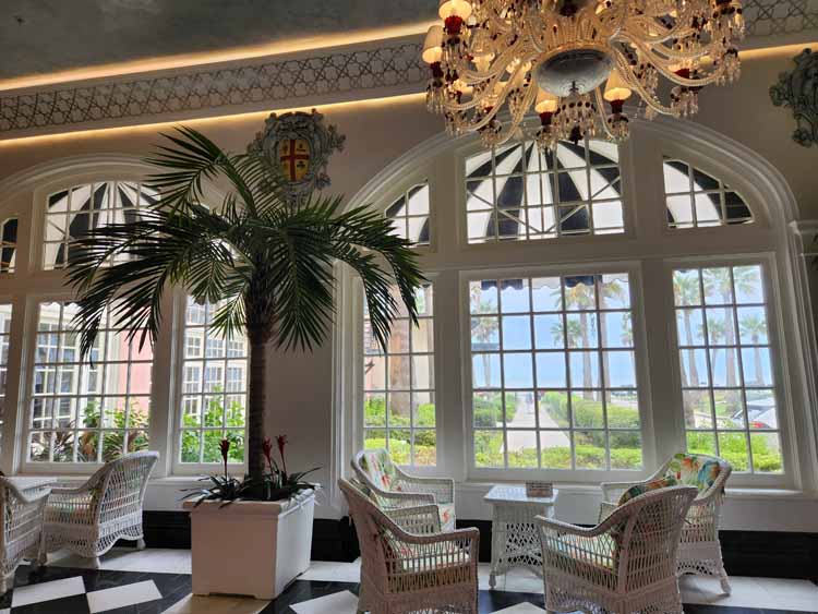
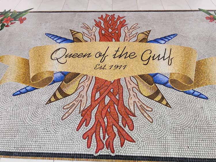
The Galvez Hotel is Galveston's only historic beachfront hotel. Known as the Queen of the Gulf, it was established in 1911 and by 1918 it had registered 40,000 guests at $2 per night. It became the Summer White House for President Franklin Roosevelt during his presidency, and in World War II it was military headquarters for the U.S. Coast Guard. Various owners over the years have made changes to the interior as well as its name, and in more recent years its exterior was renovated to its original color. Its most recent name: Grand Galvez.
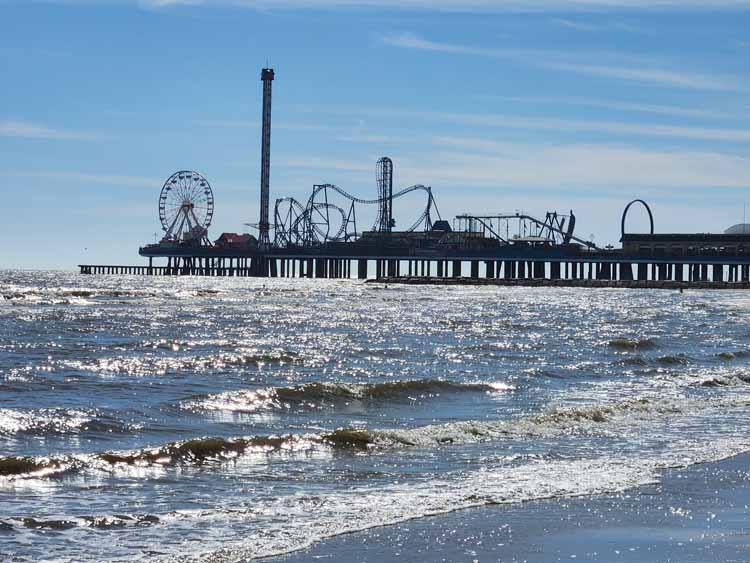
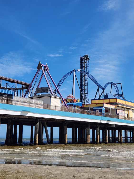
Electric Park, as it was called upon its establishment in 1906, came about as pleasure piers around the country gained popularity.
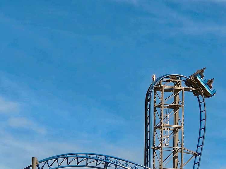
In the 1940s it was one of the best amusement parks in the country. Then, in 1961 it was severely damaged by Hurricane Carla. After four years, it was rebuilt into the Flagship Hotel, offering a one-of-a-kind hotel over the water. It remained in operation for 40 years until its demise by Hurricane Ike in 2008. Today it's back to its original purpose, a fun-filled pleasure pier, featuring various rides including a roller coaster that makes my stomach flop every time I watch it hit its peak and make a severe vertical drop.
Along the Port Bolivar shoreline
On Galveston Bay


.jpg)
.jpg)
.jpg)
.jpg)
.jpg)
.jpg)
.jpg)
.jpg)
.jpg)
.jpg)
.jpg)
.jpg)
.jpg)
.jpg)
.jpg)
.jpg)
.jpg)
.jpg)
.jpg)
.jpg)
.jpg)
.jpg)
.jpg)
 (640x416).jpg)
.jpg)
.jpg)
.jpg)
.jpg)
.jpg)
.jpg)
.jpg)
.jpg)
.jpg)
.jpg)
.jpg)
.jpg)
.jpg)
.jpg)
.jpg)
.jpg)
.jpg)
.jpg)
.jpg)
.jpg)
.jpg)
.jpg)
.jpg)
.jpg)
.jpg)
.jpg)
.jpg)
.jpg)
.jpg)
.jpg)
.jpg)
.jpg)
.jpg)
.jpg)
.jpg)
.jpg)
.jpg)
.jpg)
.jpg)
.jpg)
.jpg)
.jpg)
.jpg)
.jpg)
.jpg)
.jpg)
.jpg)
.jpg)
 (750x354).jpg)
.jpg)
.jpg)
.jpg)
.jpg)
.jpg)
.jpg)
.jpg)
.jpg)
.jpg)
.jpg)
.jpg)
.jpg)
.jpg)
.jpg)
.jpg)
.jpg)
.jpg)
.jpg)
.jpg)
.jpg)
.jpg)
.jpg)
.jpg)
.jpg)
.jpg)
.jpg)
.jpg)
.jpg)
.jpg)
.jpg)
.jpg)
.jpg)
.jpg)
.jpg)
.jpg)
.jpg)
.jpg)
.jpg)
.jpg)
.jpg)
.jpg)
.jpg)
.jpg)
.jpg)
.jpg)
.jpg)
.jpg)
.jpg)
.jpg)
galveston ferry.jpg)
-tx-galv bay-ferry to bolivar.jpg)
-tx-galv bay-ferry to bolivar.jpg)