the wandering chick
...Big Bend National Park
a dramatic mingling of mountains, river and desert
TX-BBNP-The Window Trail.JPG)
It's a location I've been wanting to see for years. Finally, I made the trek with a travel partner, leaving Houston and taking our time getting to the big bend. The park is named for the bend in the Rio Grande that acts as the natural border between the U.S. and Mexico.
Spectacular hardly describes this remote area of total beauty, a wild yet easy overlapping of river, desert and mountain.
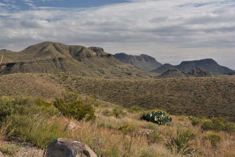
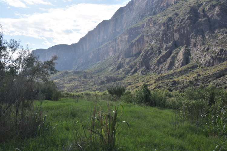
Big Bend is vast. There are, for example, roughly 30 miles between Rio Grande Village in the southeast corner of the park and the Chisos Basin, the heart of the park. The Santa Elena Canyon, another popular destination, is located in the southwest corner of the park, roughly 50 miles from the Chisos Basin in the opposite direction.
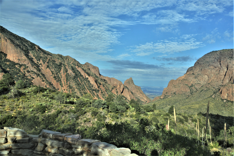
Entering the Chisos Basin is a true awe-inspiring experience. The Chisos Basin Road is six miles of spectacular curves and hills, as you roller coaster the narrow road lined with lush greenery as well as steep cliffs from the desert floor to the basin. The elevation difference can easily be recognized in the temperature even on the hottest of days.
If one had only a day or two in the park, the basin and perhaps the Ross Maxwell Scenic Drive would be favorable visits. The basin has several hiking trails from easy to strenuous, and the Ross Maxwell drive highlights 20 miles of the desert floor and mountain terrain with scenic vistas, canyons, hiking trails and historic markers along the way. The road ends at the popular Santa Elena Canyon.
Big Bend is becoming increasingly popular despite the time and miles it takes to get there. Reservations for camping as well as the lodge are necessary.
.JPG)
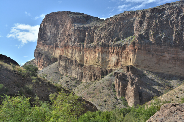
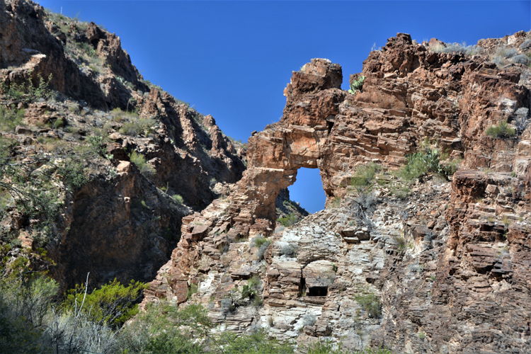
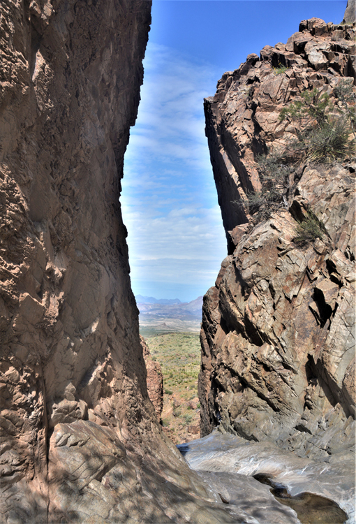
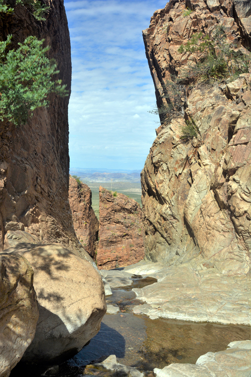
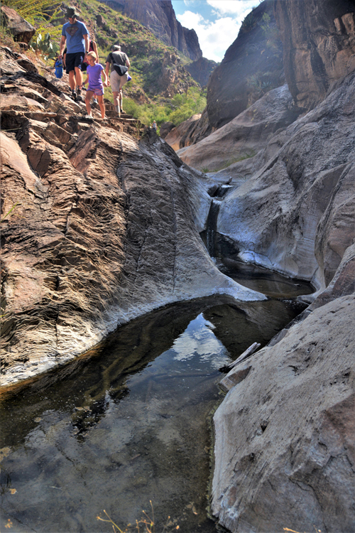
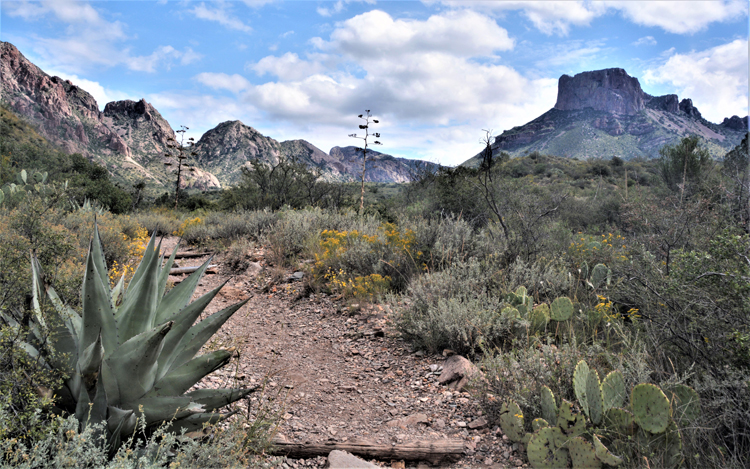
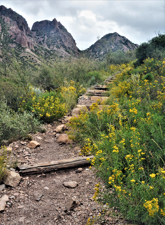
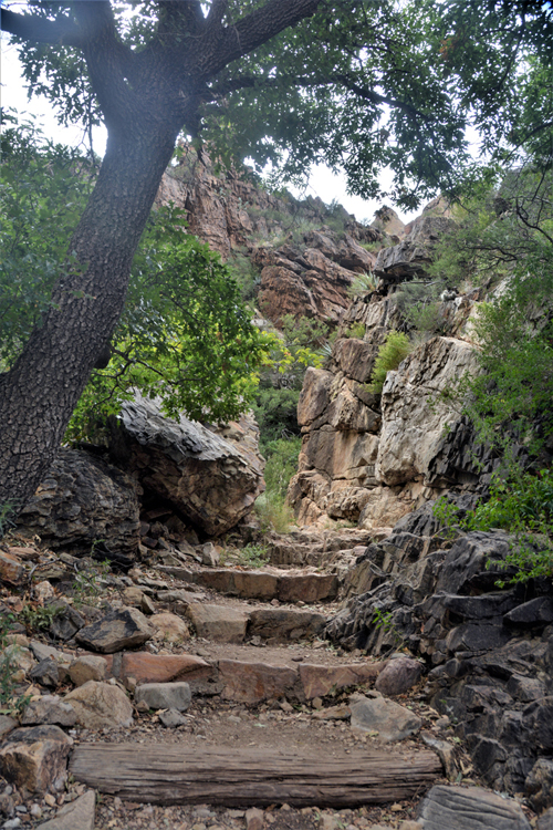
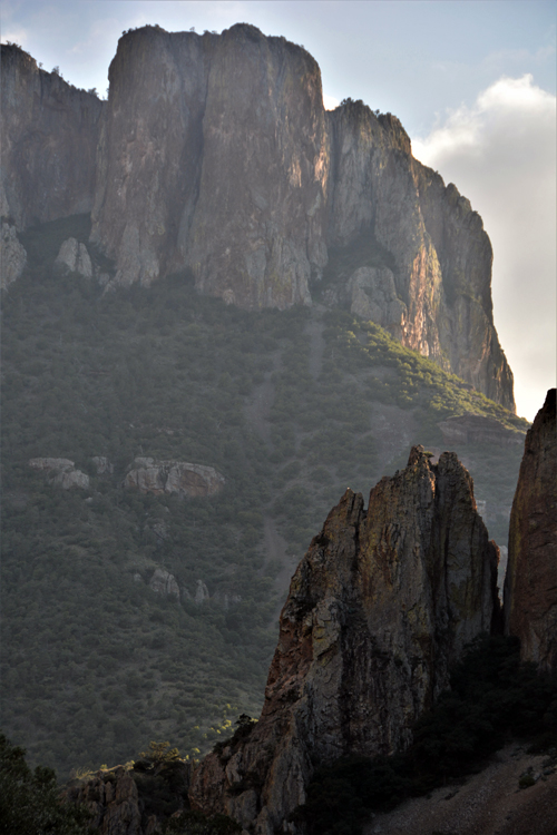
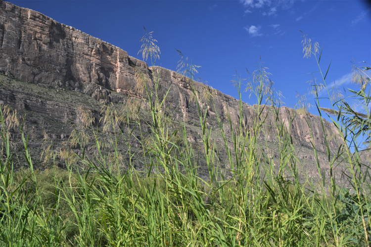
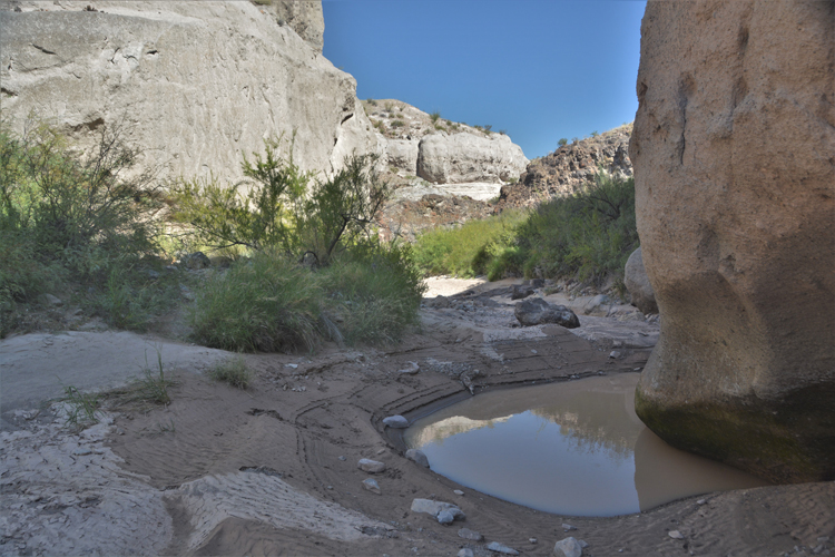
The masterpiece of Big Bend is "The Window." There are two hikes, both within the basin, that give access to it. One, the short one, is the Window View Trail. This is a photo of what one sees from the end of the point three paved walk. The other, the moderate hike, is called the Window Trail. It's a near four and a half mile (roundtrip) hike that takes you to the window itself. Not paved, not flat, the hardest part is within the last quarter mile when some rock climbing is necessary. Everyone who did it said the view was worth the hike. Everyone, I suppose, but me. In my opinion, the above view is much more picturesque than the limited view seen at the window. There is not much manuevering room there, and to see out past the window, one has to get dangerously close to the edge. A couple of pictures of the view from The Window are below. The longer hike does offer beautiful views of the landscape and terrain.
It's also from the short Window View trail that some awesome sunsets can be seen as the view is facing almost directly west.
These are three shots (left, right and below left) are of the views that one gets after arriving The Window. The next few shots after them are along the path that leads to it.
It may be difficult to imagine this is a trail, but note the steps on the right side of the photo.
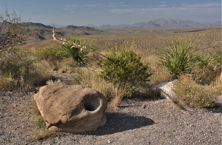
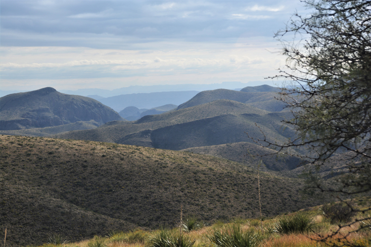
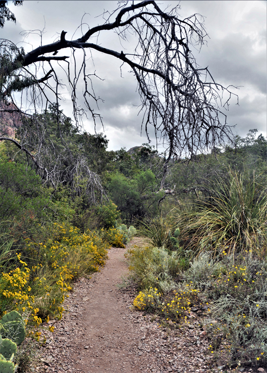
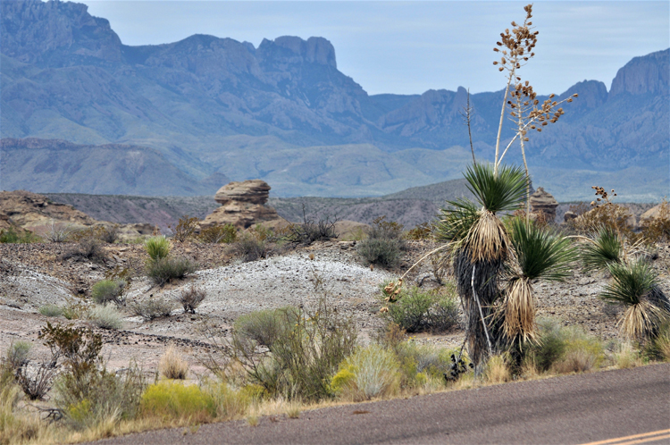
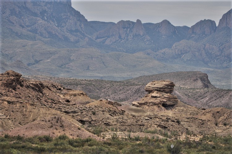
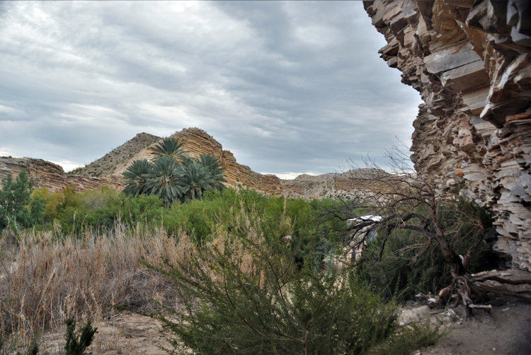
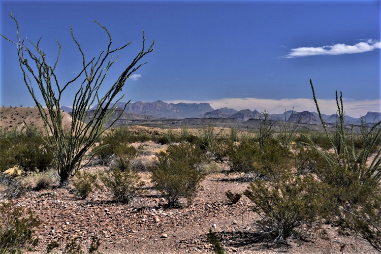
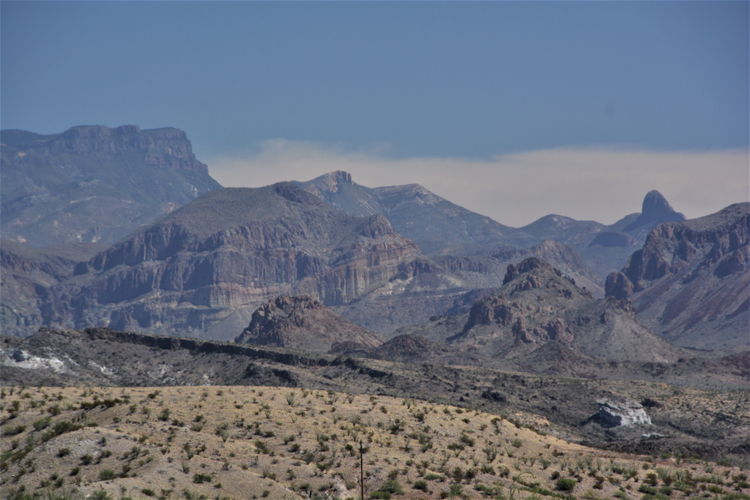
The beautiful landscape seen off Highway 385 upon entering the park from Marathon
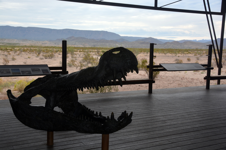
Big Bend is one of the best places in North America to find fossils spanning 130 million years. The outstanding Fossil Discovery Exhibit that both chldren and adults will enjoy is on the park's main road (Highway 385) coming from Marathon. Not only is the exhibit informative, but the surrounding terrain, seen in two pictures above, is stunning.
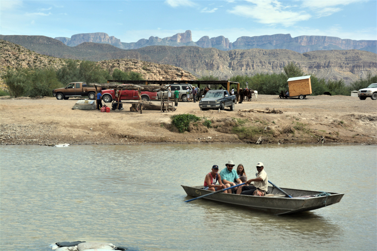
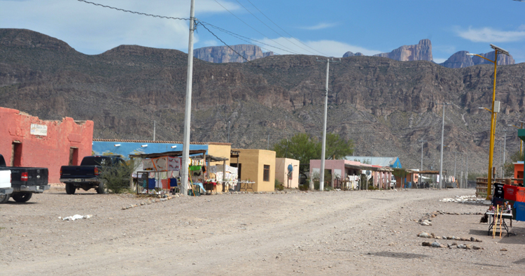
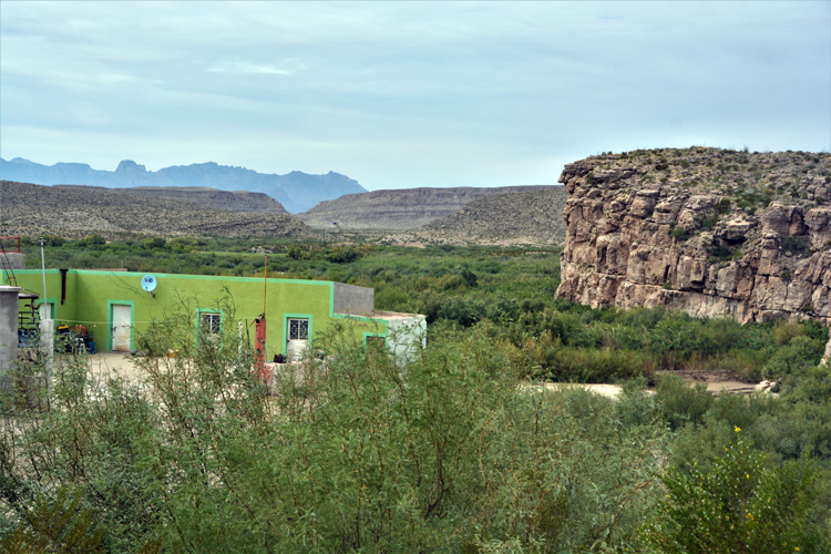
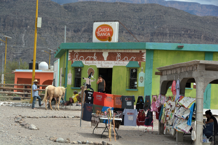
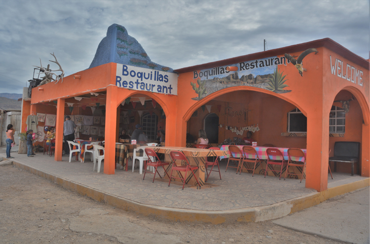
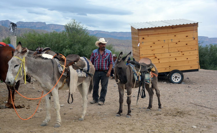
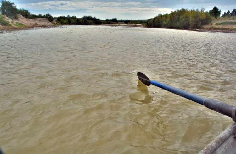
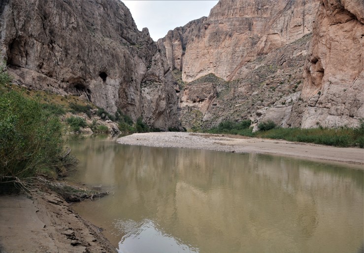
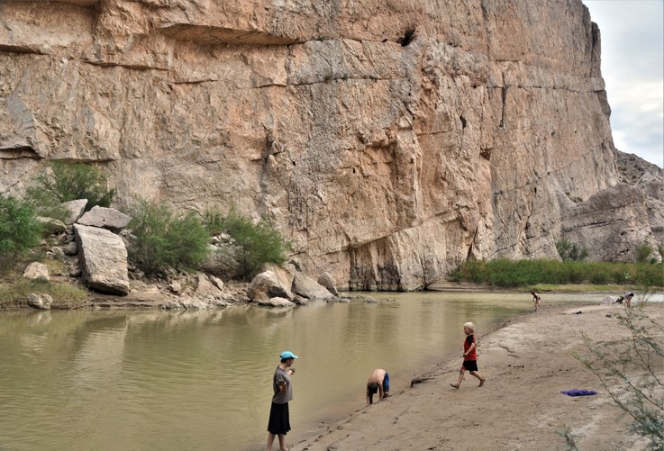
Deep in the southeast corner of the park is the area where the Rio Grande separates the U.S. from Mexico. It's the one area in the park that allows entry into Mexico, to the dusty and declining town of Boquillas. But it's a process. First, one must enter only through the Port of Entry with passport. Then walk a quarter mile to the river, where Mexicans, for a small fee, will rowboat you across the river. The next part of the journey is by choice: walking, horse, truck or burro. There's also a small fee for that, but it's a three-quarter miles on a bumpy dirt road, so worth the fee. The one-dirt-road town is lined with soft-colored stucco homes, most with women and many small children offering their handmade crafts. Tourism is their main industry. There is also a restaurant and a bar. One returns by the same method, as the price paid is for a round trip.
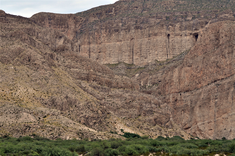
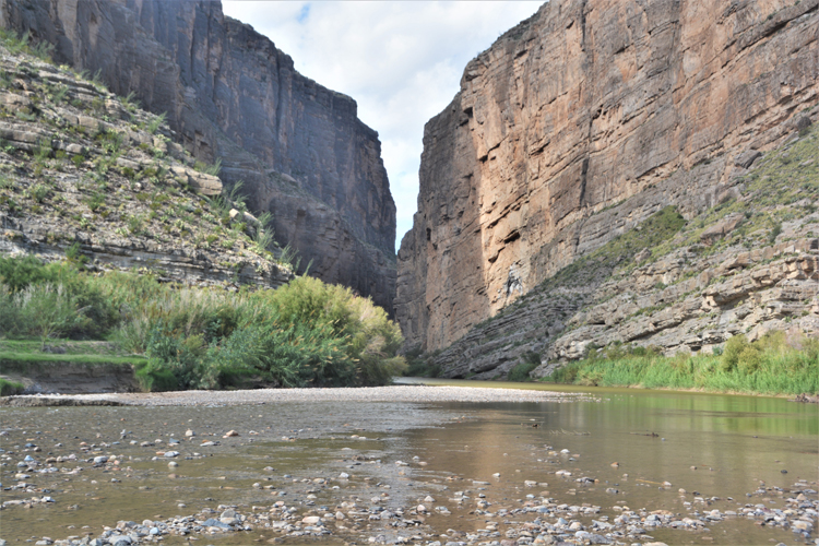
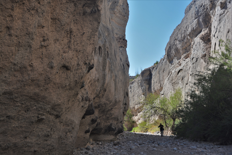
Not to be missed in this same area is the Boquillas Canyon. A short easy hike leads down to the river which has carved a gorge through the massive cliff walls of the Sierra del Carmen.
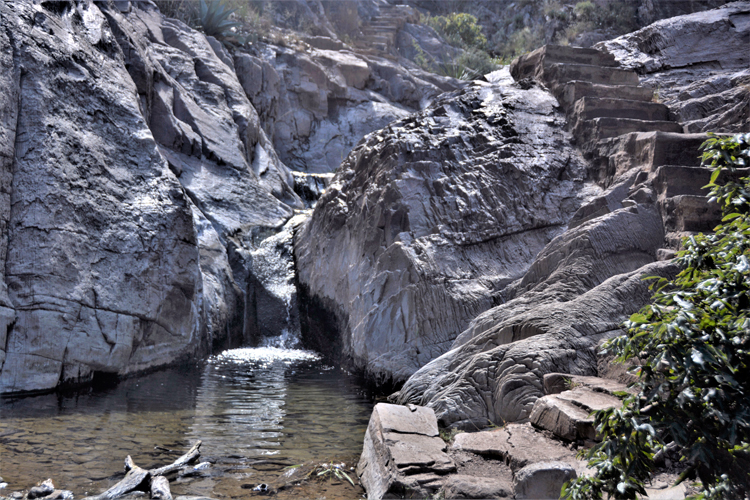
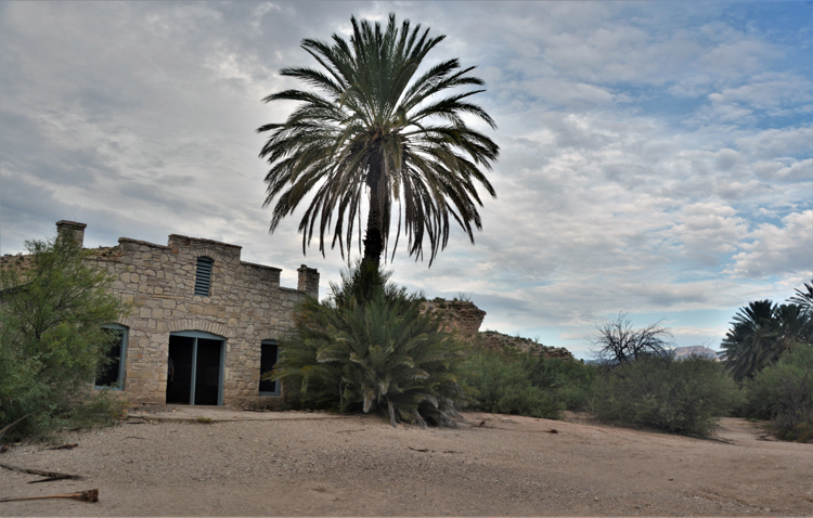
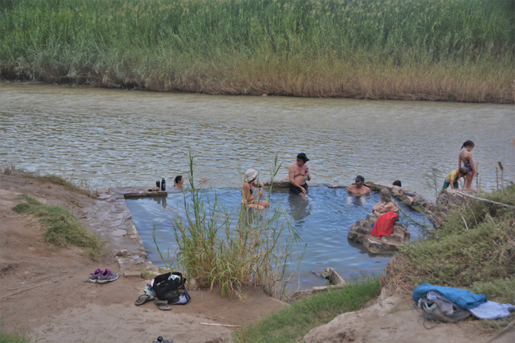
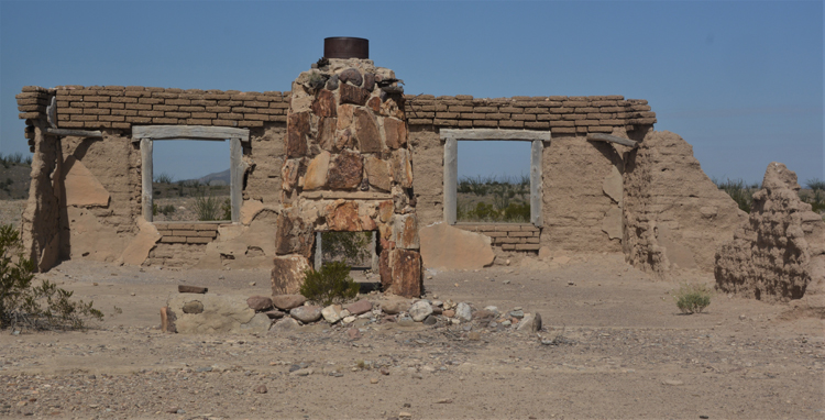
Another nearby feature is the Hot Springs, which up until the 1950s had been built up as a popular resort community. J.O. Langford had malaria. He was in Alpine ini 1909 when he overheard talk of the healing qualities of the mineral water. He purchased the land sight unseen and traveled 10 days with his wife and child before reaching the Rio Grande. For the next 21 days, he bathed in and drank the water, and soon felt healthier and stronger than he ever had. In time, he had succecssfully built a growing resort that included a post office, store, bathhouse and motel. In 1942, the Langford sold the property to the state of Texas. Though the buildings remain, abandoned, visitors still hit the warm water of the hot springs.
So narrow is the entrance to the canyon it can hardly be distinguished.
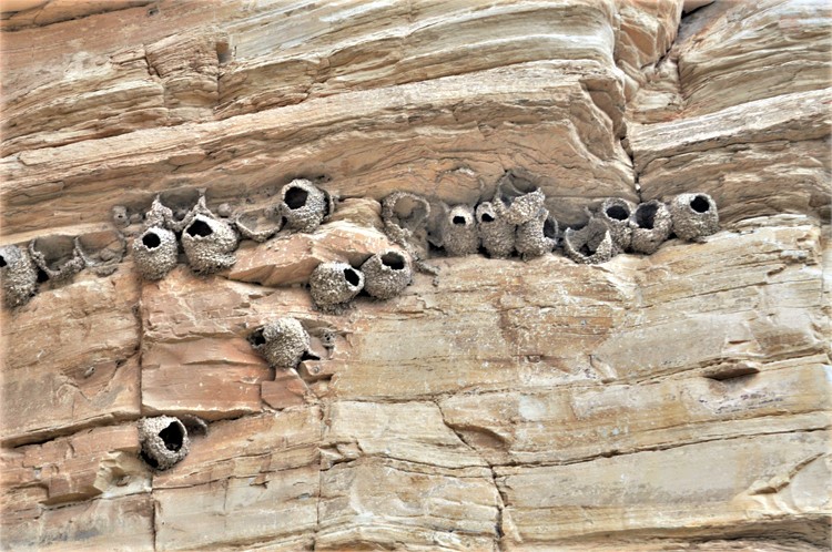
Swallow nests monopolize the cliff walls along the quarter-mile hike to the hot springs.
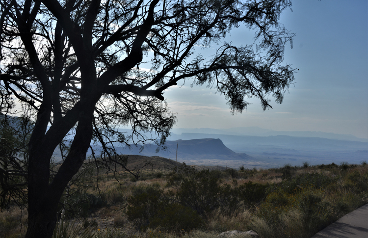
The sun sets on the Sierra del Carmens.
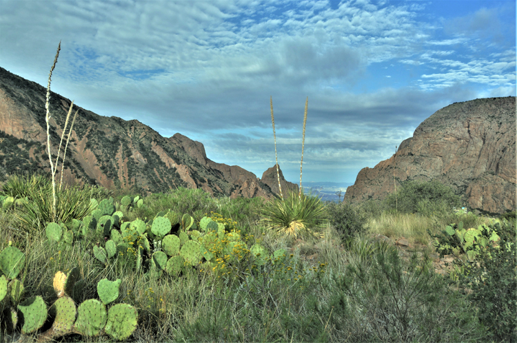
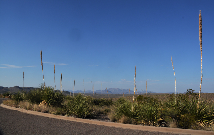
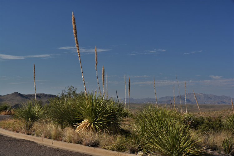
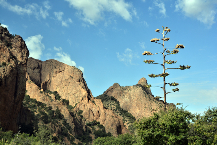
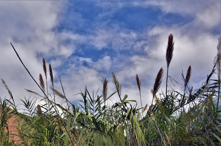
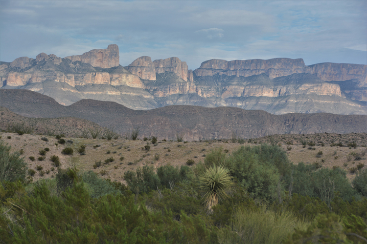
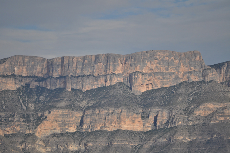
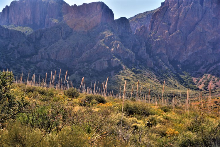
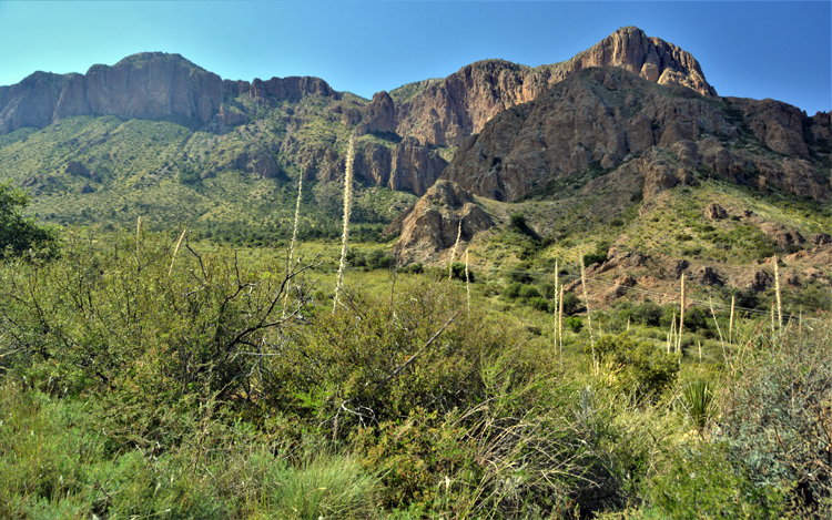
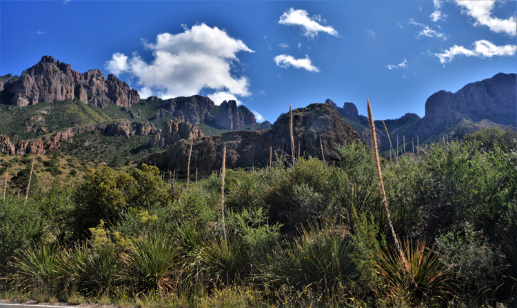
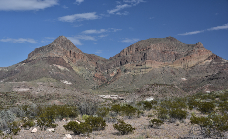
The next few shots are of Chisos Mountains. This is the only mountain range in the U.S. that is completely withinn the boundaries of a national park. It's highest peak is Emory Peak at 7,825 feet. The plant stems seen here, already past bloom, is the Sotol, seen throughout the park.
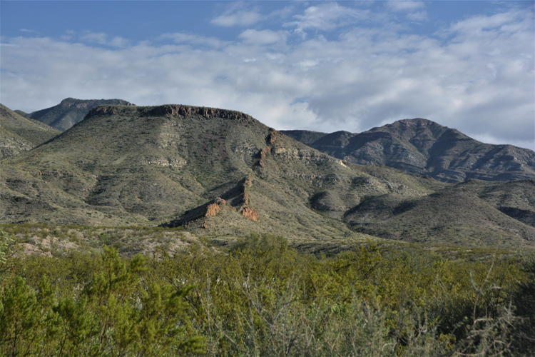
The most prominent of the Chisos peaks is Casa Grande. It towers 7,325 feet over the Chisos Basin like a sentinel. Stately, rugged and breath-taking.
Casa Grande
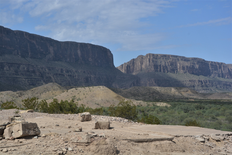
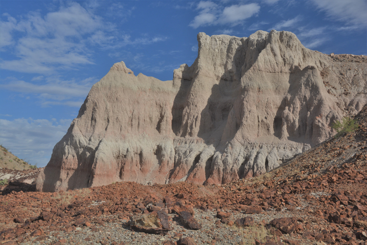
The remaining photos were taken along the Ross Maxwell Scenic Drive, a 30-mile paved north to south road that meanders through spectacular terrain, over canyons and to the top of high desert vistas. It ends at the Santa Elena Canyon, in itself a park feature not to be missed. Pullouts and overlooks along the road as well as short hikes to interesting and historical features make the trek an easy day-long highlight. Ross Maxwell was the first superintendent of Big Bend National Park and it was he who laid out the route of the road named in his honor. He died in 1933.
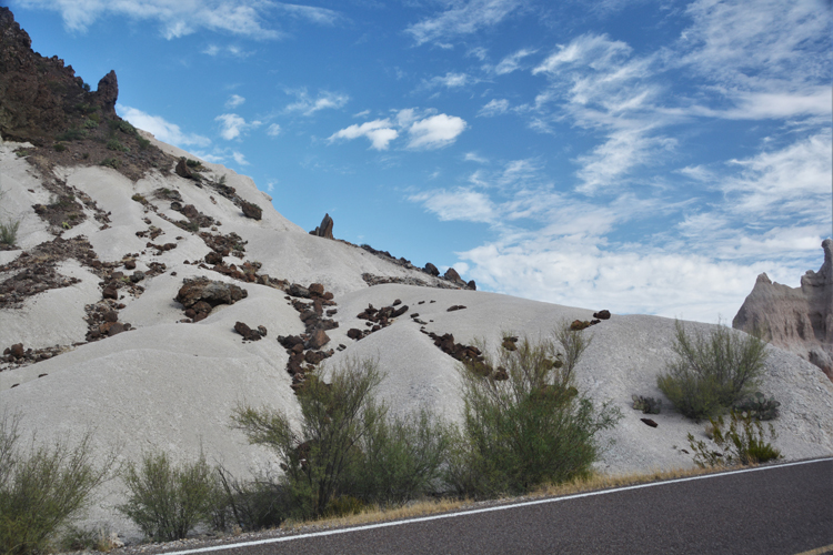
This area of the park is the Tuff Canyon area, covered in white volcanic ash known as tuff. A trail as well as overlooks give insight into the natural feature.
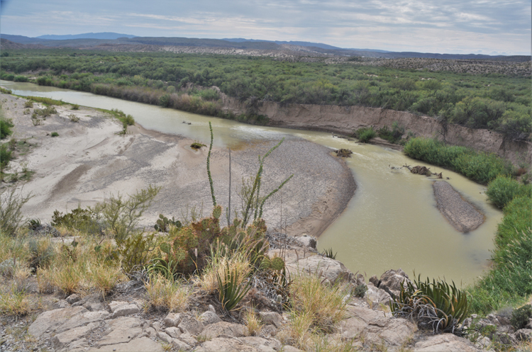
The Rio Grande lazily makes its way south to the Gulf of Mexico.
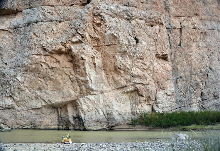
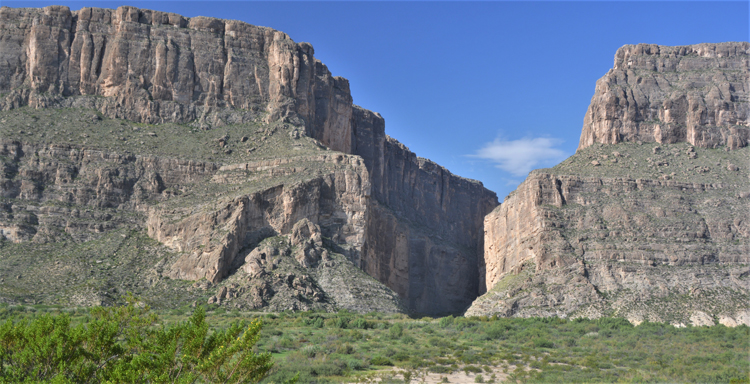
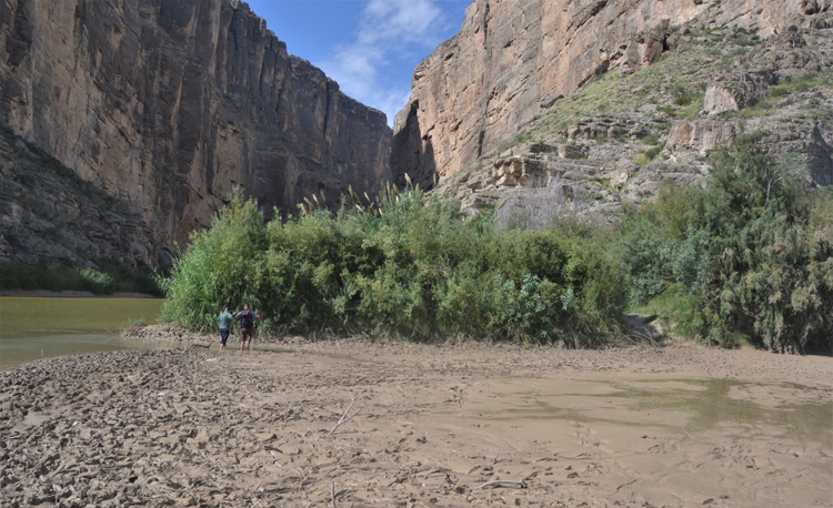
Almost from the very beginning of the Ross Maxwell Scenic Drive, one sees in the far distance the high cliffs of the Santa Elena Canyon. Anticipation rises the closer one gets, as does the appreciation of its enormity.
Here, the walls seemingly collide save the narrow passage of the Rio Grande. The left wall is in Mexico; the right wall in the U.S.
There's a story here, but first view the photo below. Then, you'll understand.
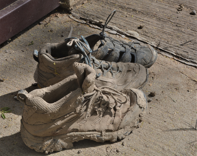
There are times, not often, when the trail into the Santa Elena Canyon is cut off by rain. Because the trail is one of the highlights of the whole big bend park, some die-hards decide to take the challenge and make their way across the 100 feet or so of what some call quagmire, others quicksand. It's thick, deep mud. And it steals shoes. Note the picture is of right-footed shoes only. One hiker described the experience as losing his shoe when he'd put pressure on one foot in an effort to raise the other. The foot would sink deeper and upon trying to raise it out, his shoe would come off, sometimes never to be found. We watched one hiker search for several minutes for his wife's shoe, which he was eventually able to dig up.
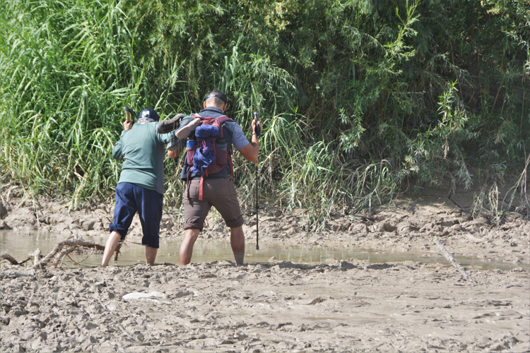
Some hikers, I guess the smart ones, took their shoes off before starting across, as did this guy and his not-so-young co-hiker. We bystanders applauded, hooted and hollered when they reached dry land. Walking sticks help somewhat because it's easy to lose one's balance in the mud. Once across the wet part, hikers take a few minutes to somehow get their legs and feet mud-free, get their shoes on, then continue the trail up the side of the cliff for a short distance before it levels off to the canyon floor. It's considered an easy walk and only one point six miles roundtrip.
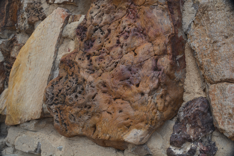
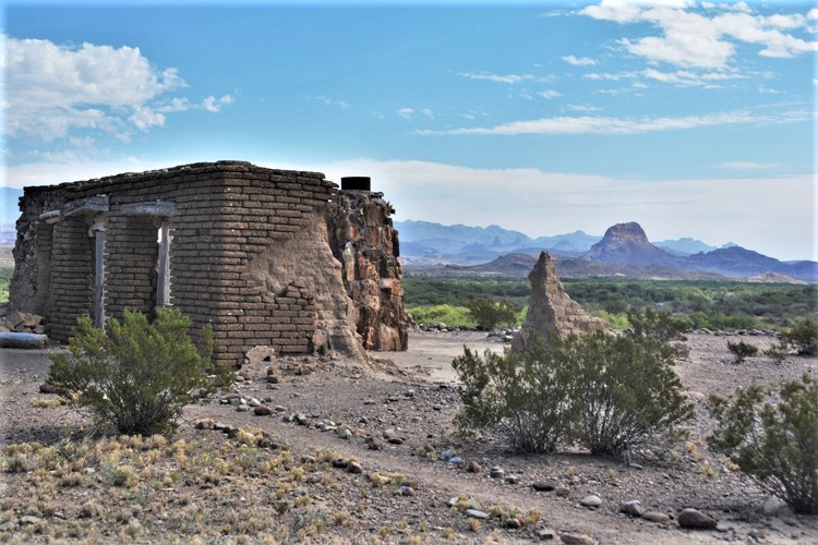
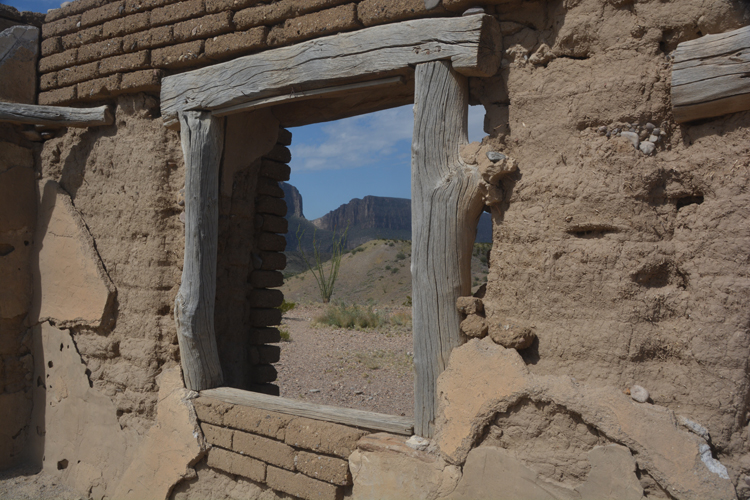
The Dorgan-Sublett Trail leads to what was once the homes of Albert Dorgan and James Sublett and their families. The two were farmers who established an irrigation system on the desert land below and lived atop these small hills until the 1950s when the land was sold to the park. All that remains of the Sublett home is the foundation and the stunning panorama for which he built his home. More remains of the Dorgan house, as shown here. The hike up the gentle slope to the two homes is less than a mile roundtrip.
This beautiful chunk of wood impressed me. It was built into the fireplace of the Dorgan house.
The foundation is all that remains of the Sublett home.
Somehow I saw art in these two burnt cottonwood trees at the entrance to the Cottonwood Campground. Sad but graceful.
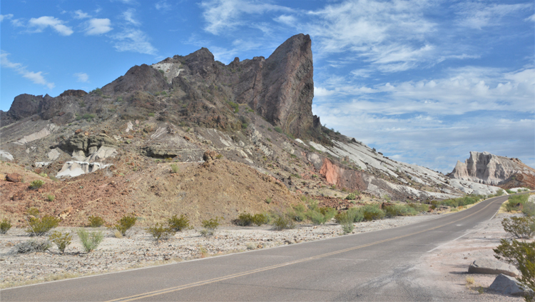
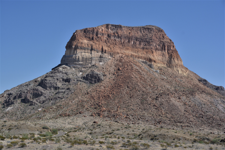
Castolon Peak, like all the mountains of the world, is a history lesson....a lesson in geological formations. One can clearly see layers of different rock. Some are from volcanic eruptions and others are from dry periods of erosion that occurred between the eruptions. Castolon stands 3293 feet.
We ruled out mountain goats. We've seen those up close and personal in Glacier National Park, But are these sheep or goats? We walked away not sure. Nor were other passers-by who saw them. Upon some research, I learned that the park has a band of barbary sheep, distinguished by the hairy chest of the males. So, that's what I'm going with: Barbary sheep
The Big Bend park service is actively working to reduce the growing number of barbary sheep in the park. Firstly, it's because they're not native to the park. And secondly, they're jeopardizing the smaller number of Desert Bighorn sheep which ARE native.
Tuff Canyon
Small, appropriately named peaks called Mule Ears
Goat Mountain
The Lower Burro Mesa Pouroff Trail is an easy one-mile round trip trek to this view. Looking upward, it's fascinating to see how the water has smoothed the surface of the rock at the pouroff.
This and the next couple of shots are of the Lower Burro Mesa Pouroff Trail....a truly scenic collection of rock formations.
Aaaaaaaah. Sotol Vista. How magnificent. Just get out of your car at the overlook and take it all in. Stunning terrain in all directions. Sotol is the Spanish name for the Dasylirion wheeleri also called the Desert Spoon. Its flowering stem can grow to 16 feet. Unfortunately, the blooming season had passed when I was there, but it wasn't hard to imagine how beautiful they must be, and so abundant.
 BBNP -R.Maxwell ScDr Scene from Sotol Vista.JPG)
There is also an UPPER Burro Mesa Pouroff Trail, not to be confused with the Lower. Frankly, I didn't get many pictures of this trail. I was too busy pouting. There were warnings, I must admit, of the difficulty level. The most obvious being at the trailhead that said, "Don't climb into anything that you can't climb out of." RED FLAG!!! RED FLAG!!! In other brochures it was rated moderate, which I'd been handling okay. So, yes, there were a few rocks/boulders to climb over, but the real clincher was to walk the walk only to get to the very end and not be able to complete it...too difficult. Since I didn't even see it, I can't explain it. But, based on the words of others, the final few feet of the trail is something like a three-story drop. That in itself should have rated the trail more than a moderate.
 BBNP-R.Maxwell Sc.Dr. The Window viewed from the west.JPG)
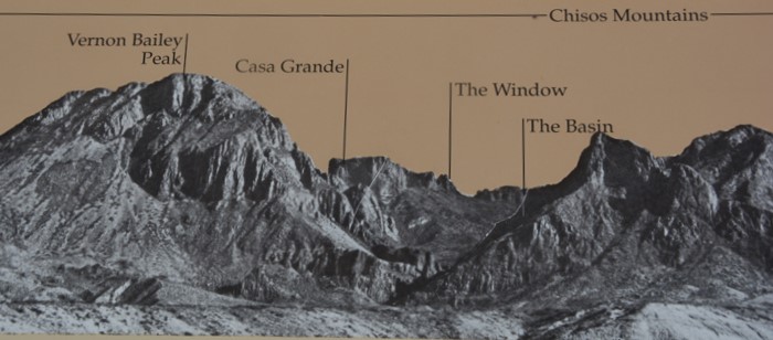
From the west looking east, one can see inside The Window. Not easily identfiable, the photo to the left may help. Most prominent in this photo is Casa Grand, the squared mountain in the center of the picture.
A continuation of the trip can be seen by viewing photos of the River Road within the Big Bend Ranch State Park.
To view other Texas locations, please return to the Texas home page.
Thank you for visiting these photo pages.
If you're interested in seeing more, please return to my Main Menu at the bottom of my home page and make your selection.
All images within thewanderingchick.com Web site are copyright protected. They may not be downloaded or otherwise copied.
Please contact me if you think a particular photo or set of photos can be used in your publication.
TX-BBNP-The Window Trail.jpg)
TX-BBNP-The Window Trail.JPG)


 BBNP -R.Maxwell ScDr,Tuff Canyn area.JPG)
 BBNP -R.Maxwell ScDr,Tuff Canyn area.JPG)
 BBNP R.Maxwell ScDr. Rio Grande River.JPG)
BBNP R.Maxwell ScDr. Landscape scene.JPG)


 BBNP R.Maxwell ScDr - Barbary sheep.JPG)
 BBNP R.Maxwell ScDr - Barbary sheep.JPG)
 BBNP R.Maxwell ScDr - Barbary sheep.JPG)
 BBNP R.Maxwell ScDr - Barbary sheep.JPG)
 BBNP R.Maxwell ScDr - Barbary sheep.JPG)

 BBNP R. Maxwell ScDr. Mule Ears Overlook.JPG)
 BBNP R. Maxwell Sc.Dr. Goat Mtn.JPG)
 BBNP R.Maxwell ScDr. Landscape scene.JPG)

 BBNP-R,Maxwell ScDr. Lower Burro Mesa Pouroff Trail.JPG)