the wandering chick
Leg 1 - Santa Fe to Seattle
...A summer (back!)road trip
I had traveled to Santa Fe for a reunion with friends I worked with in Germany in the 1970s. After the reunion, a friend from Houston flew in to Santa Fe, and
we began our nine-day backroads trip to Seattle.
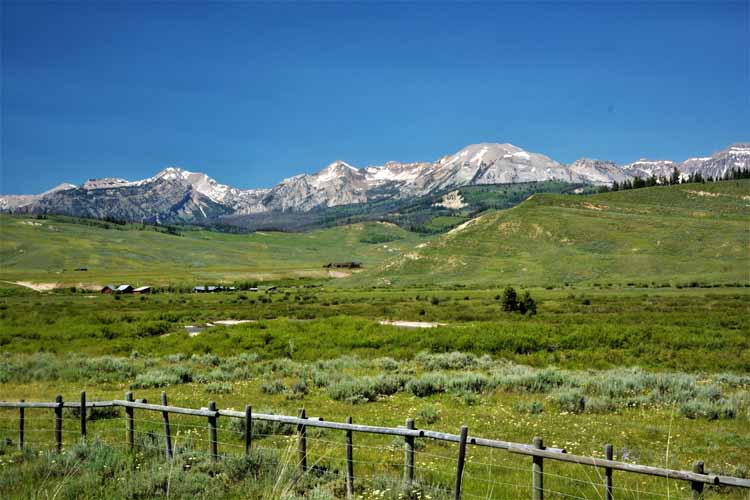
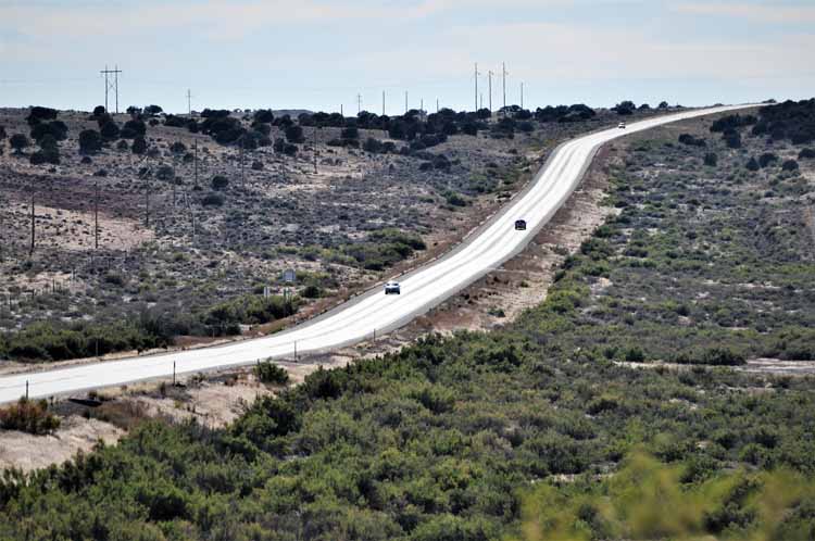
Our first jaunt was on the Highway 17, a scenic byway that crosses from New Mexico into Colorado.
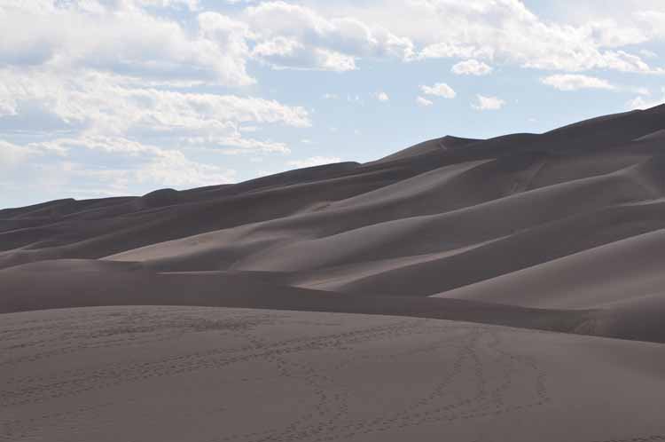
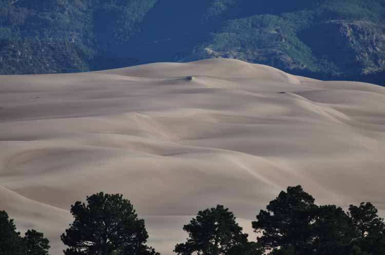
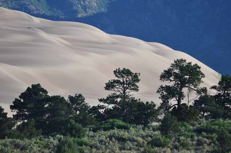
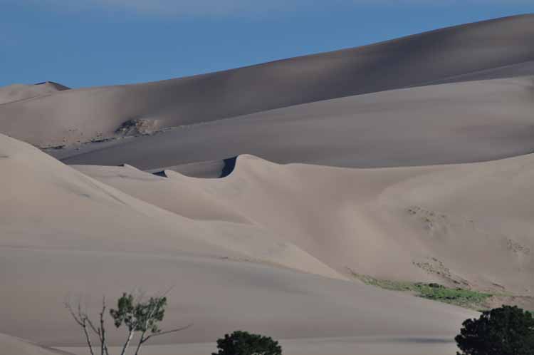
Nearby was the Great Sand Dunes National Park, so we took our chances on finding a camping spot there and lo and behold - we had our choice of two - only two. We grabbed one, set up our site, then went to climb the dunes. (Hmmm...may be climbed the dunes, THEN set up camp...don' t remember!) The next morning we made one last viewing of the dunes, then continued north and westward to take in Colorado's
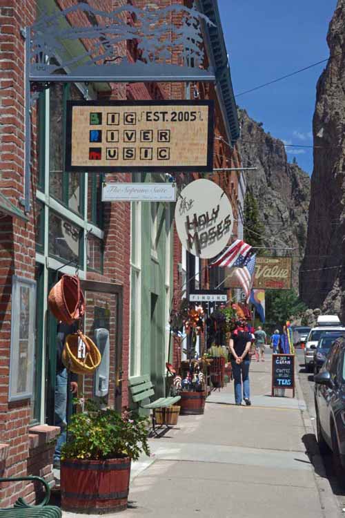
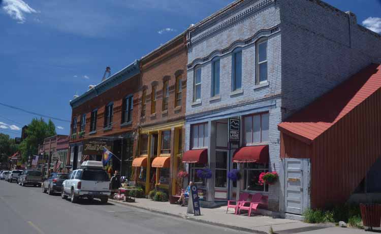
Silver Thread Scenic Byway It is a lovely drive, super scenic and includes the towns of Lake City and Creede . We checked both of them out and spent our second night near Lake City.
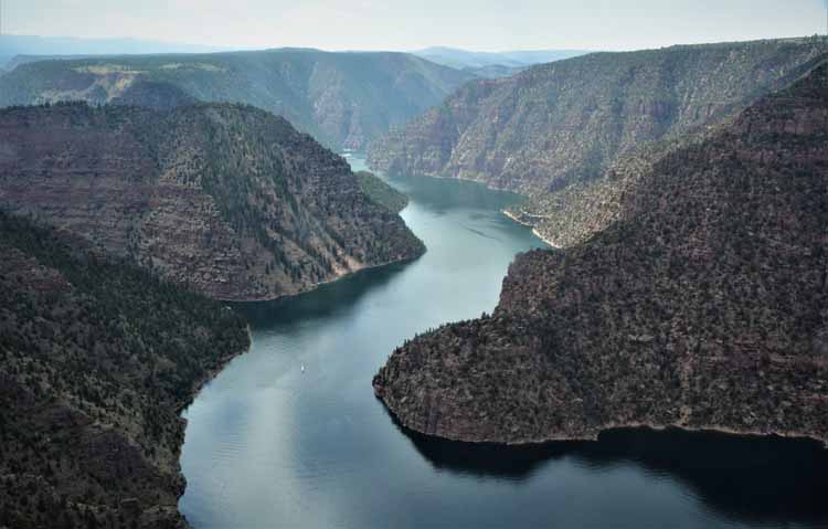
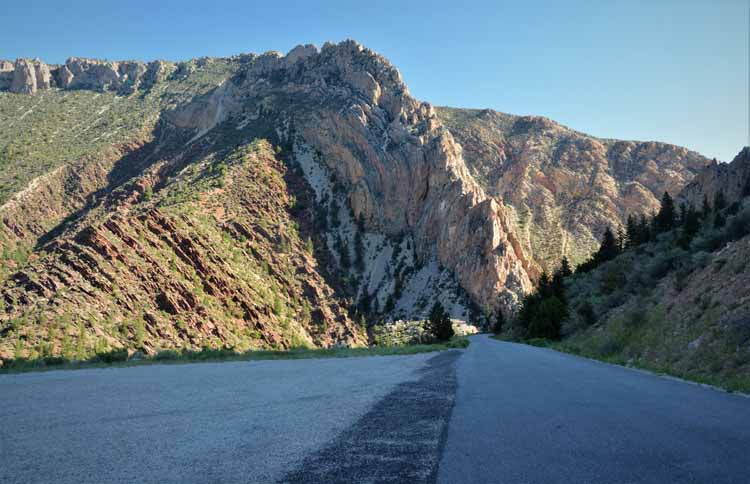
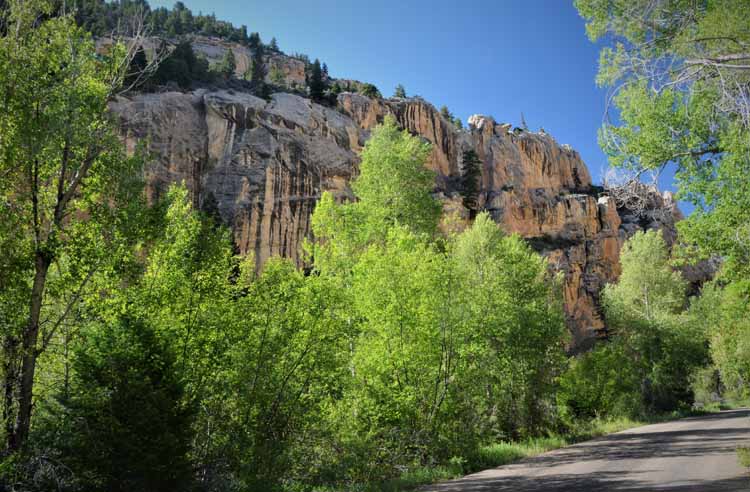
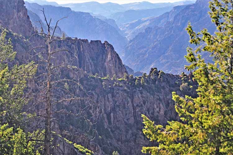
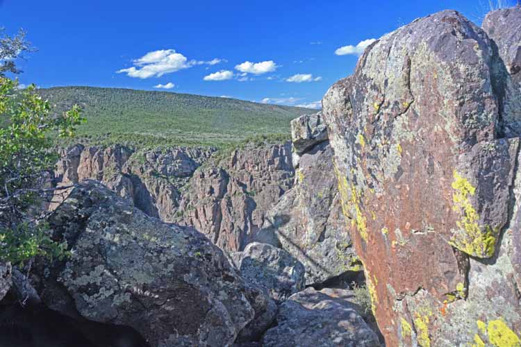
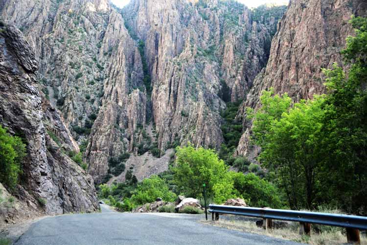
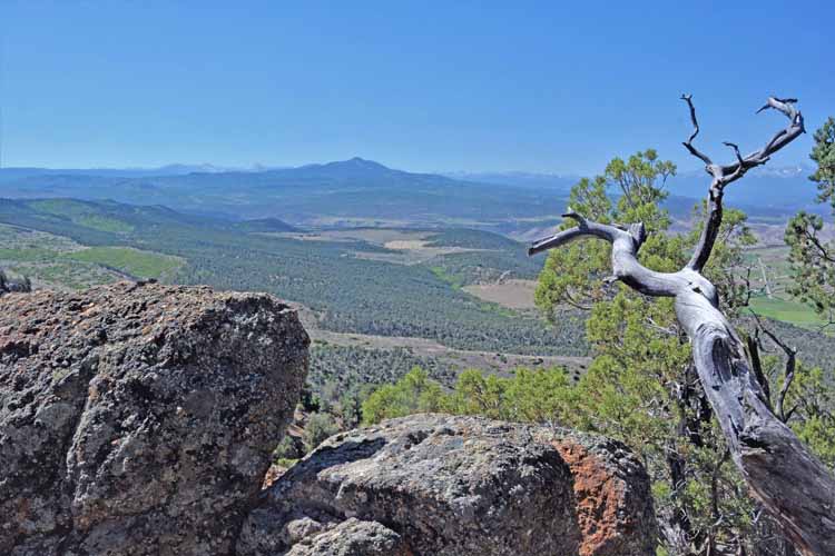
At the north end of the Silver Thread Highway is the Black Canyon of the Gunnison National Park,
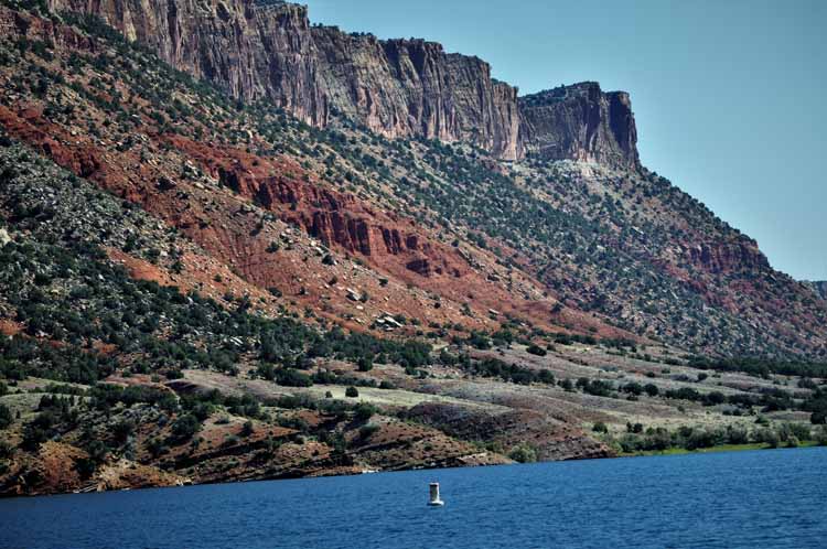
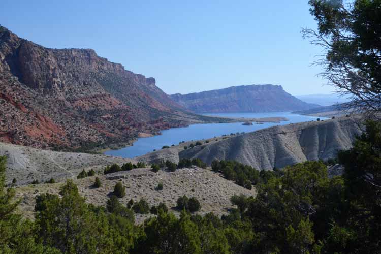
a must-see for anyone in the area. We spent the night there, then left the next morning for the Flaming Gorge National Recreation Area, on the Utah-Wyoming border, a breath-taking part of the U.S. not
seen by many.
On our 7th day, we continued on through the Tetons and Yellowstone, spent the night in Yellowstone, then reluctantly entered the Interstate 90 to make a mad dash through Montana, Idaho and Washington, up to Ferndale, Washington, where I left my dependable , but tired, little car with friends. By the 9th day we were in Seattle - right on schedule - to pick up a friend who would travel with us into B.C. We took the next day to take in a few sights in Seattle, then the three of us began our long-awaited adventure into Canada's British Columbia.
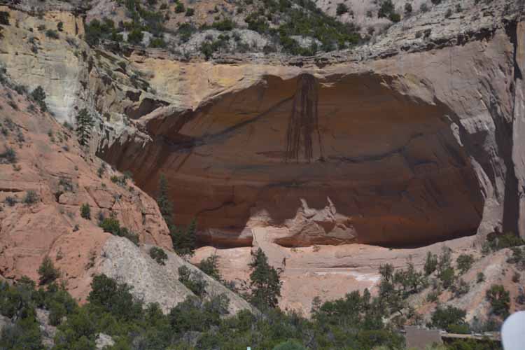
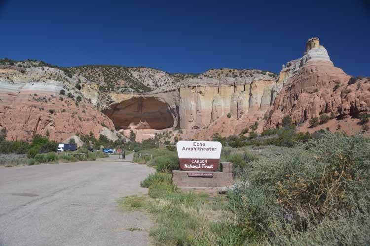
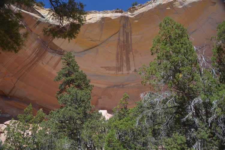
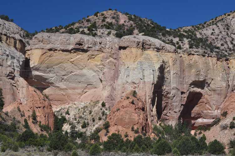
Echo Amphitheater, New Mexico We happened upon this amazing and picturesque jewel while driving New Mexico's Highway 84 about 4 miles west of Ghost Ranch. Kids AND
adults will enjoy listening to their echo made by the huge upright bowl-like main attraction, naturally carved from the smooth near-white Entrada sandstone and its 200-foot thick walls.
This small US Forest Service campground/picnic area, part of the Carson National Forest, is a quick stop, easy to find and well-worth one's time.
The Highway 17 from Chama to San Antonito is a scenic byway straddling the New Mexico-Colorado border. Starting in Chama, New Mexico,
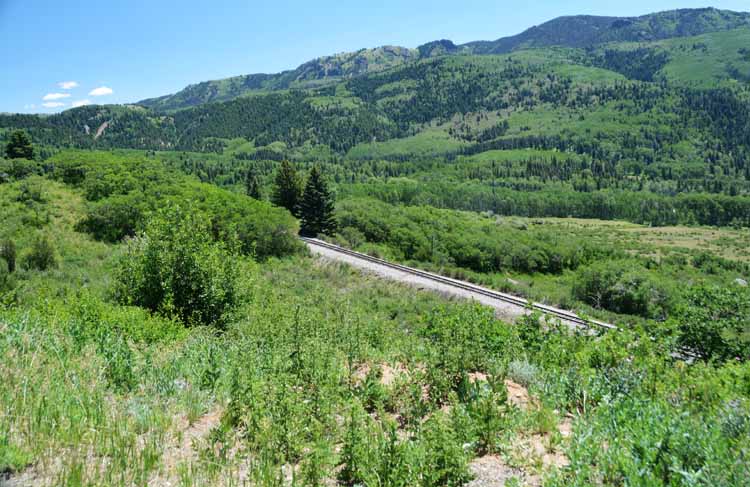
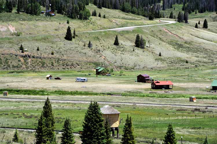
it travels 50 miles generally in a northeasterly direction through the San Juan Mountains and over the Cumbres Pass. If you're lucky, you may see the Cumbres-Toltec Railroad as it makes its way from San Antonito, Colorado to Chama, New Mexico.
The Cumbres-Toltec Railroad offers a tour out of both Chama and San Antonito, its route meandering through the San Juan Mountains, crossing back and forth often through New Mexico and Colorado.
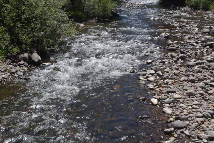
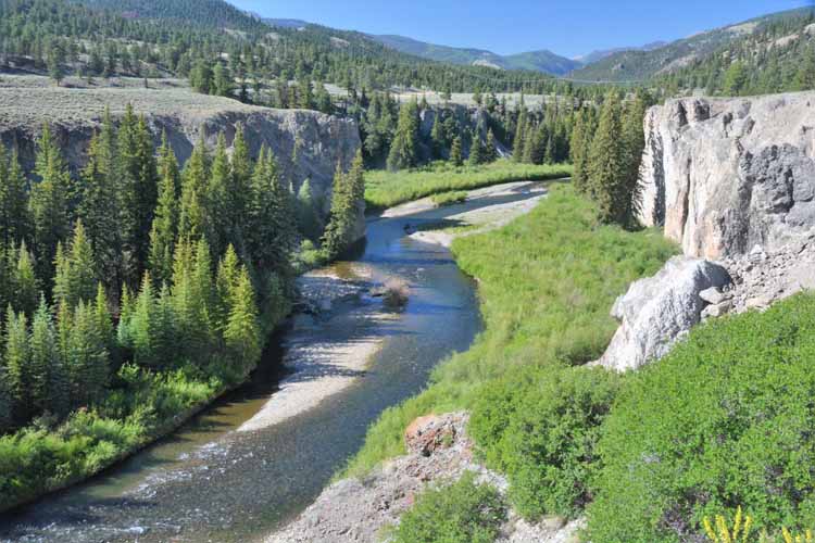
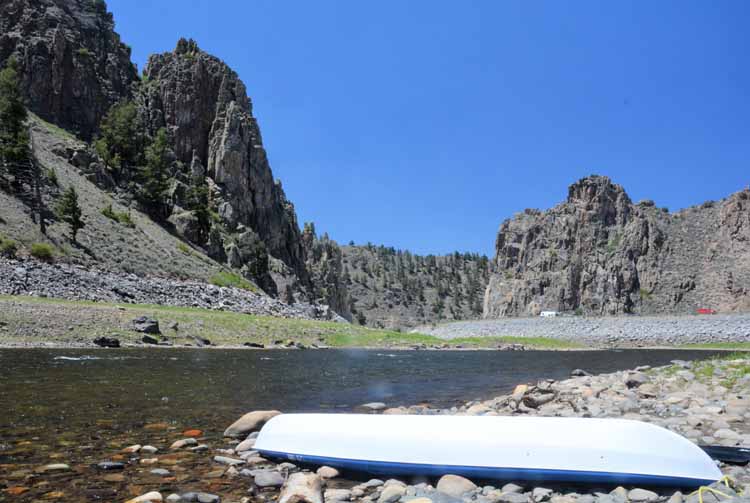
The Elk Creek Campground offers picnic tables close to the cool water's edge.
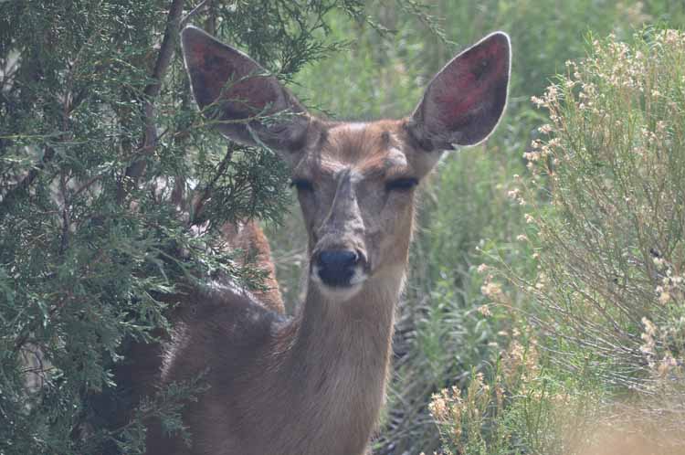
A mule deer was a first greeter at the Great Sand Dunes. She didn't seem too concerned at how close we were. Being right on the edge of the campground, I suspect she was pretty accustomed to people.
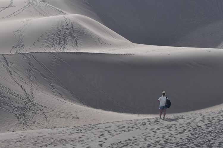
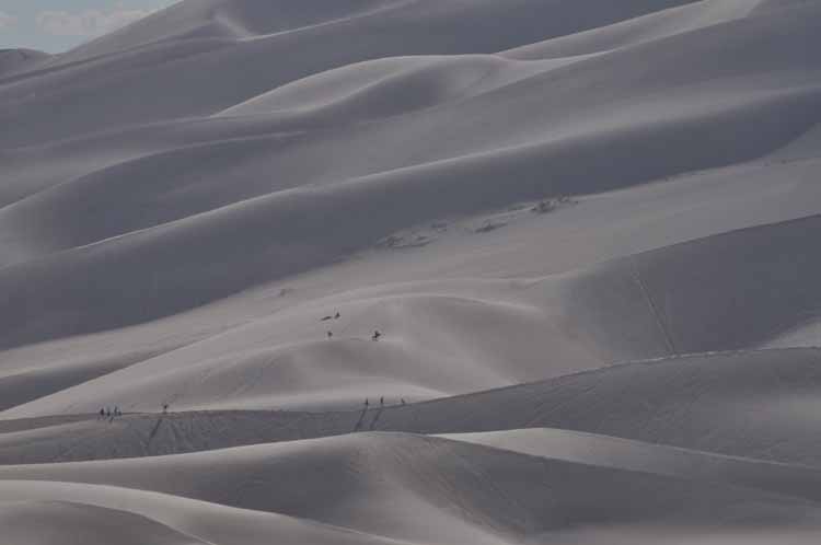
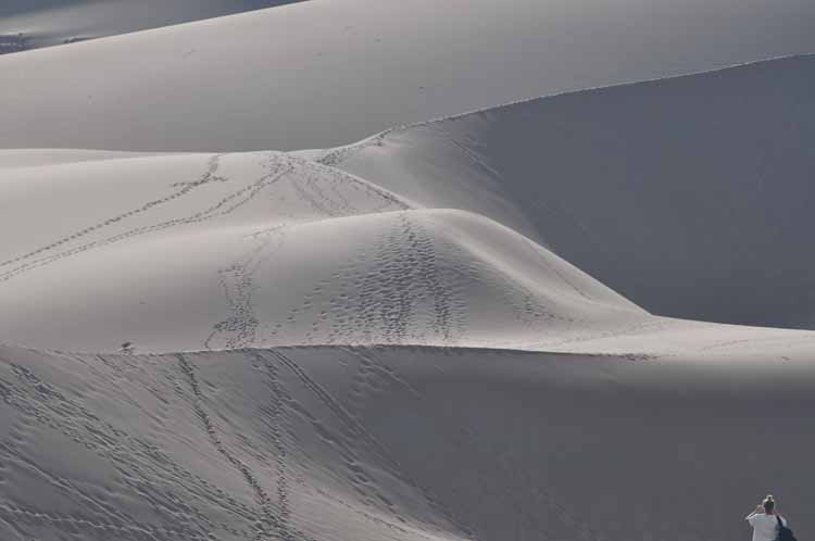
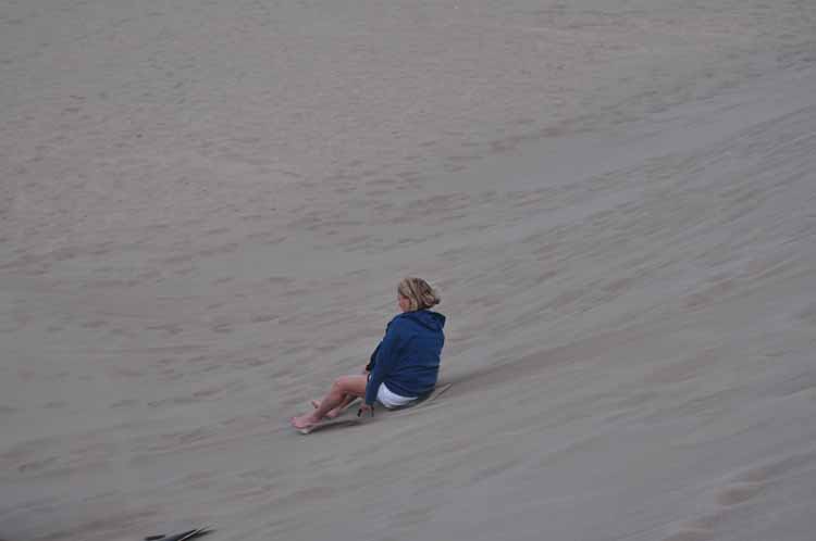
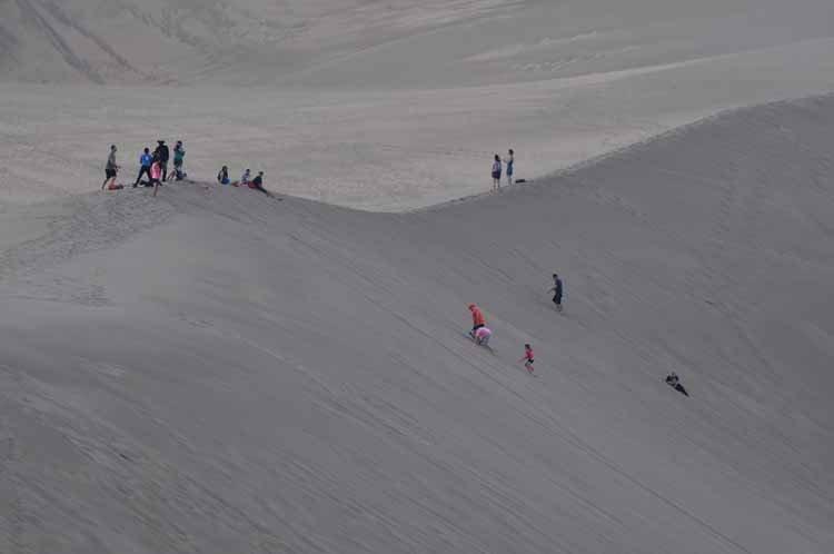
It's here among the great dunes that the inner child in us comes out. Kids of all ages use whatever they have to take the big slide.
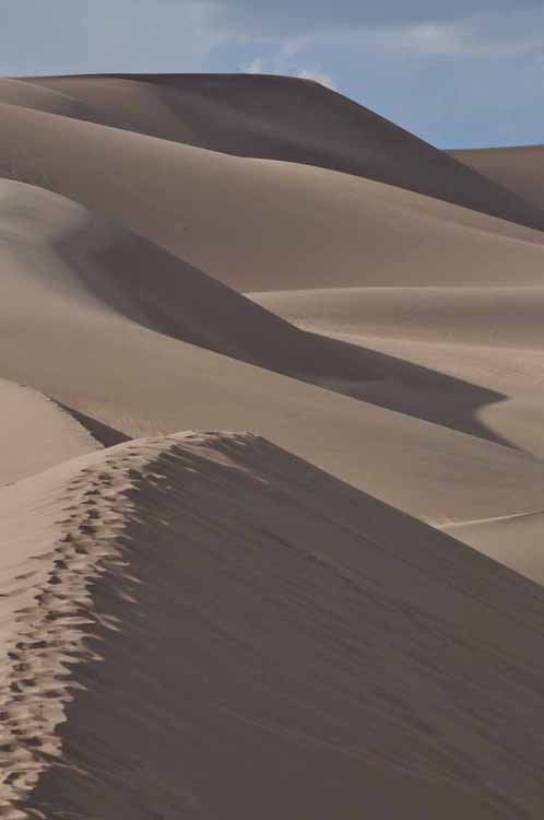
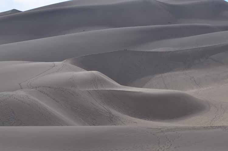
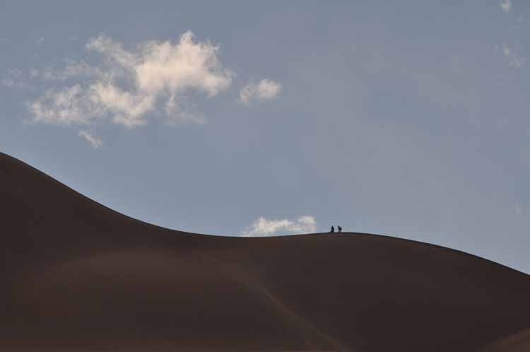
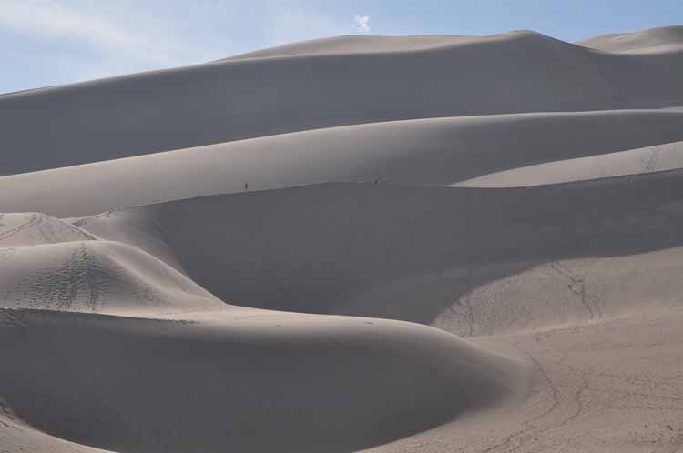
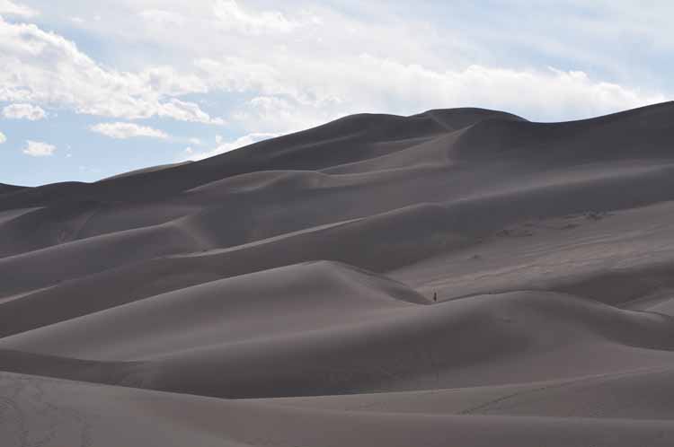
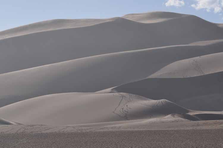
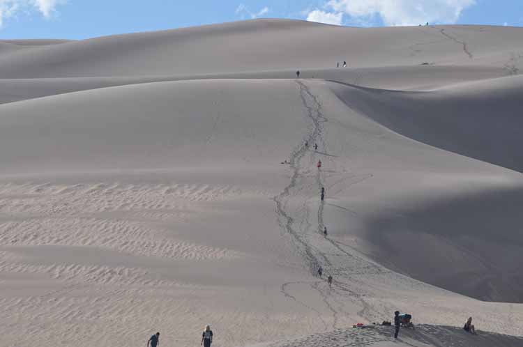
With dunes rising 750 feet, the Great Sand Dunes National Park and Preserve comprises the tallest dunes in North America. The park, which before 2004 was a national monument, is our newest national park. It sits at the foot of the Sangre de Cristo Mountains, on the west side, in southern Colorado's San Luis Valley. It is, in fact, the Sangre de Cristos that indirectly formed the dunes. As the sand blows across the vast valley floor, it's blocked by the mountain range, having nowhere to go .... but up.
The morning cast a glorious pure light on the vast field of dunes.
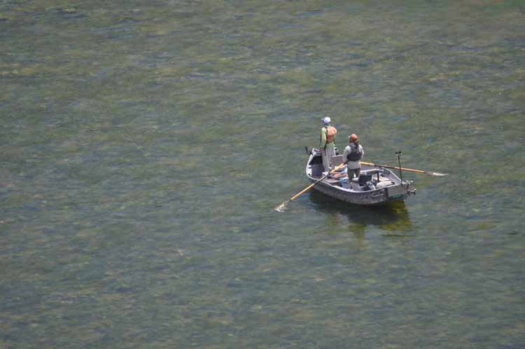
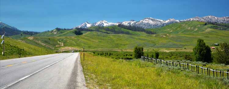
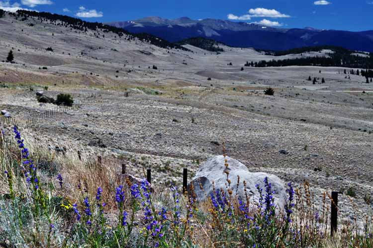
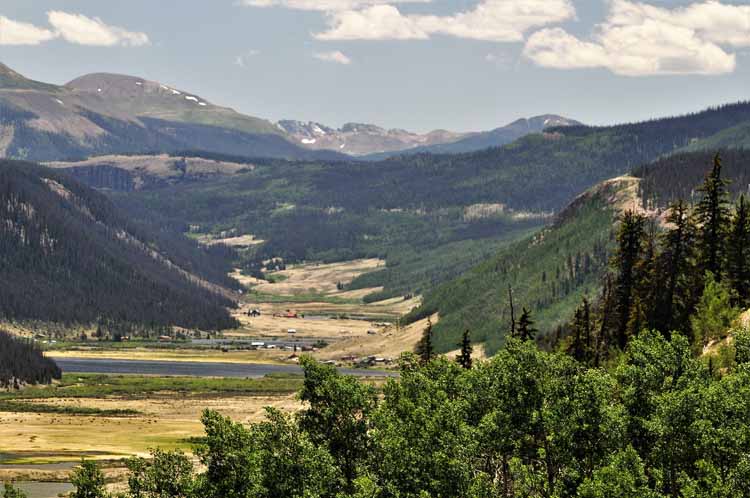
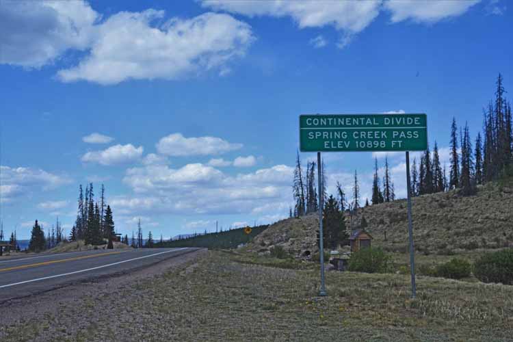
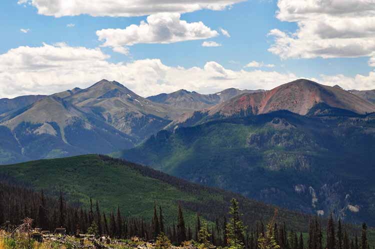
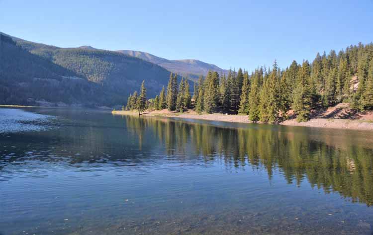
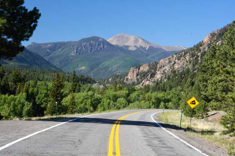
Colorado's Silver Thread Scenic Byway, a.k.a. Highway 149, is a 120-mile stretch of stunning scenery between South Fork on the south end and just west of Gunnison on
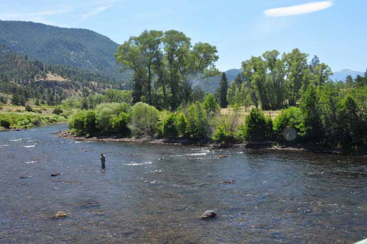
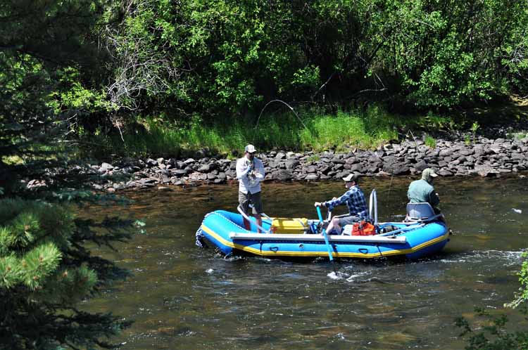
the north end. "Don't miss-ems" along the route include North Clear Creek Falls, the historic towns of Lake City and Creede and Lake San Crystobal. Above and left: fishing the Rio Grande.
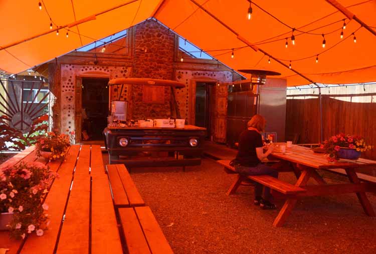
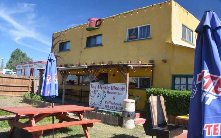
The Mystic Biscuit in Del Norte, Colorado...starting the day with a hearty breakfast. I couldn't pass up their Hawaiian Toast French Bread!
The town of Creede is one of two on the Silver Thread Highway. A western-style town, it's known for its rich mining history. The underground mining museum is a hit with many folks.
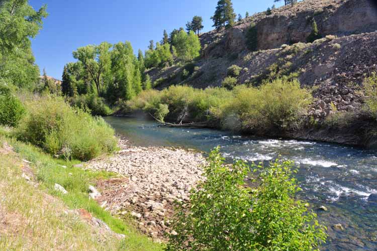
Here begins the Rio Grande! The headwater of this mighty river is in Colorado's San Juan Mountains, seen here. It travels some 1900 miles before it empties into the Gulf of Mexico near Brownsville, Texas.
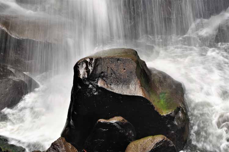
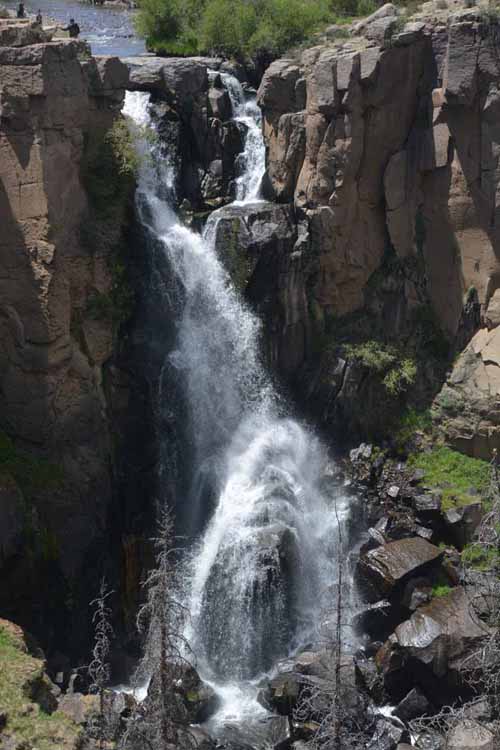
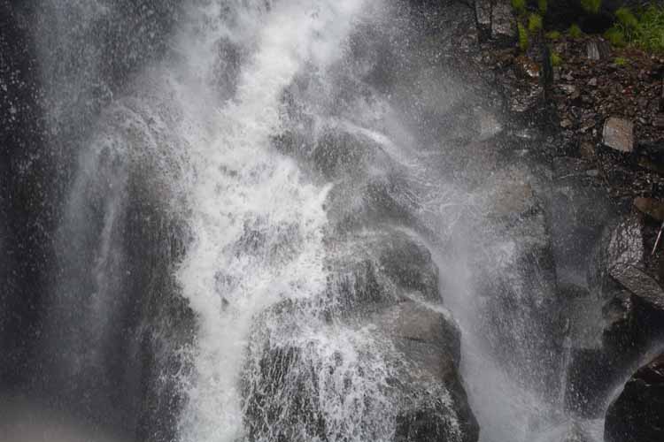
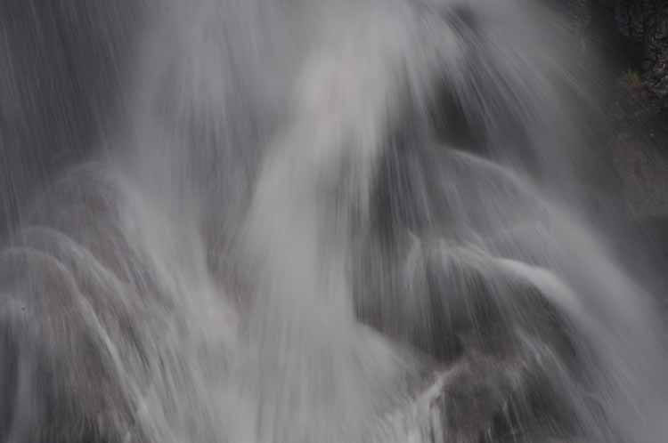
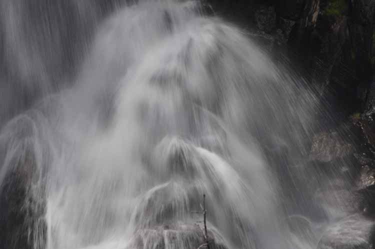
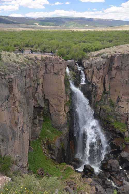
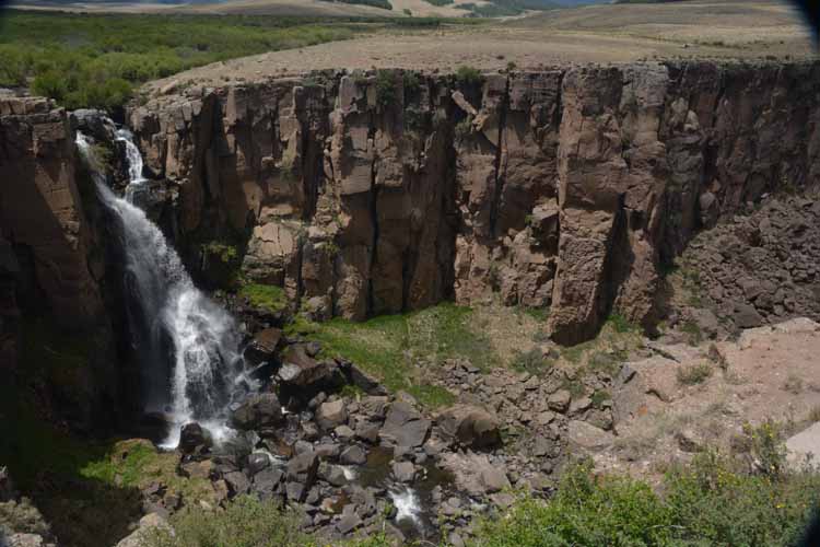
North Clear Creek Falls is located north of Creede. The falls is easily accessible and requires a minimal walk
to see the impressive 100-foot cascade of water.
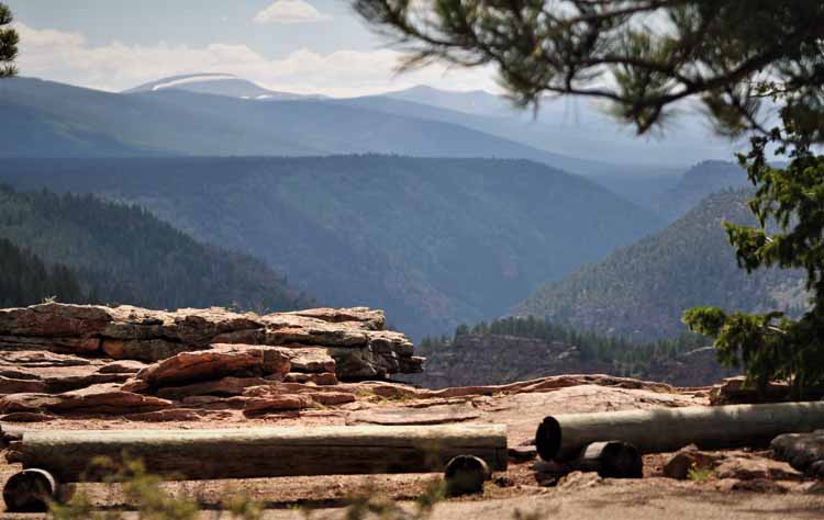
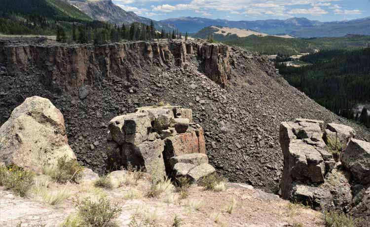
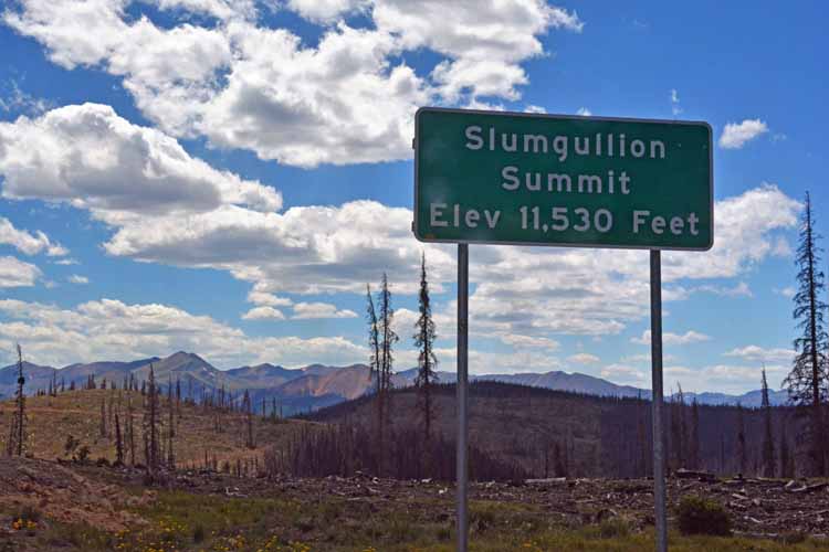
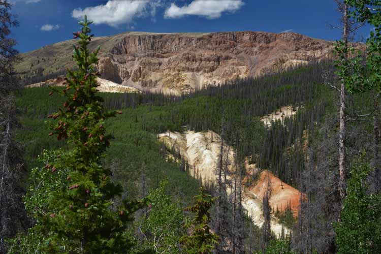
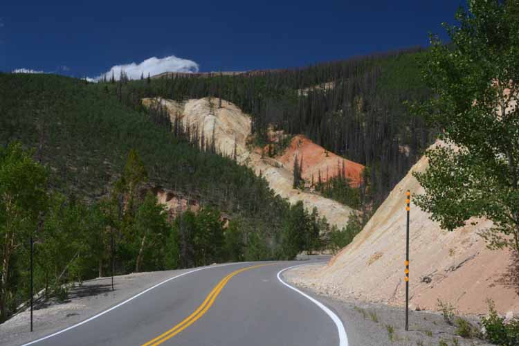
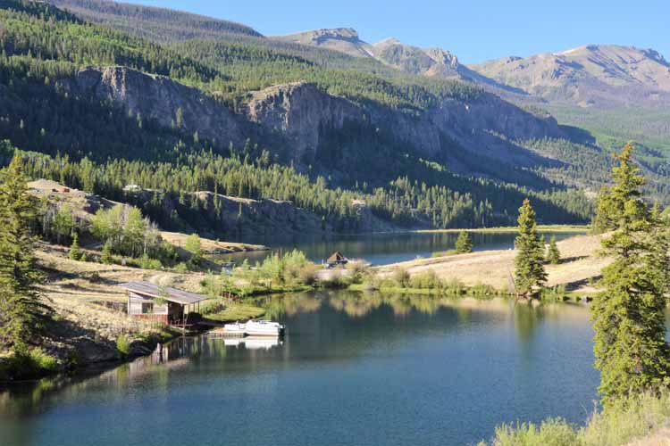
The scenic beauty around Slumgullion Pass is breath-taking. The pass is Colorado's 10th highest.
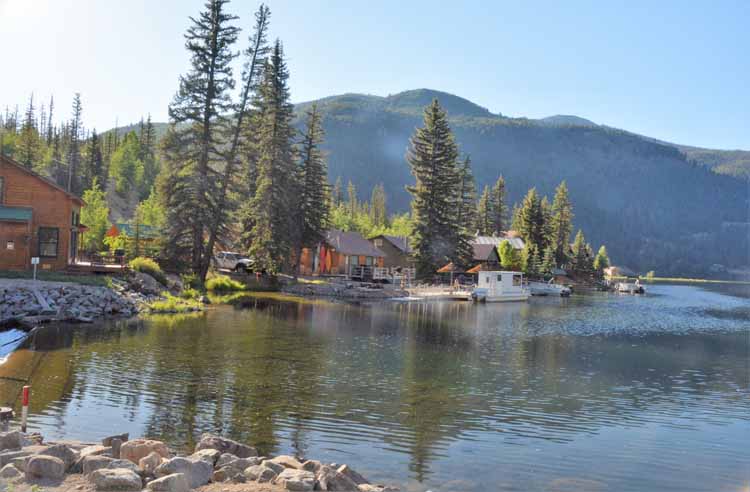
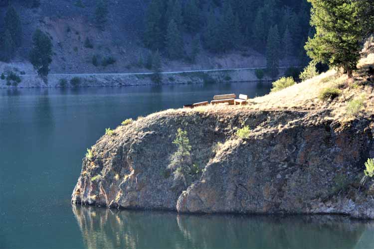
Lake San Cristobal has an interesting birth, created only between 700 and 800 years ago by an earth flow that continues today. It's a freshwater lake, stocked with rainbow trout and contnues for some 2 miles high in the San Juan Mountains. Seeing the morning sun on this beautiful lake was both soothing and refreshing.
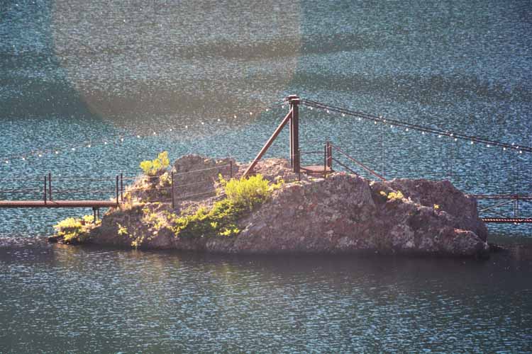
A bridge connects a small island at the north end of San Cristobal to the shore.
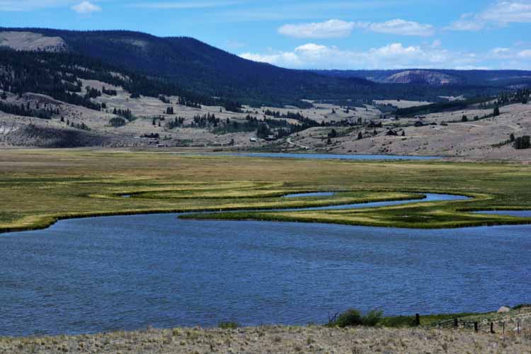
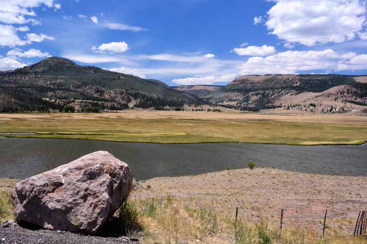
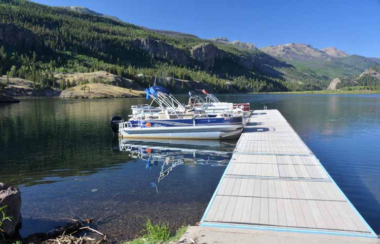
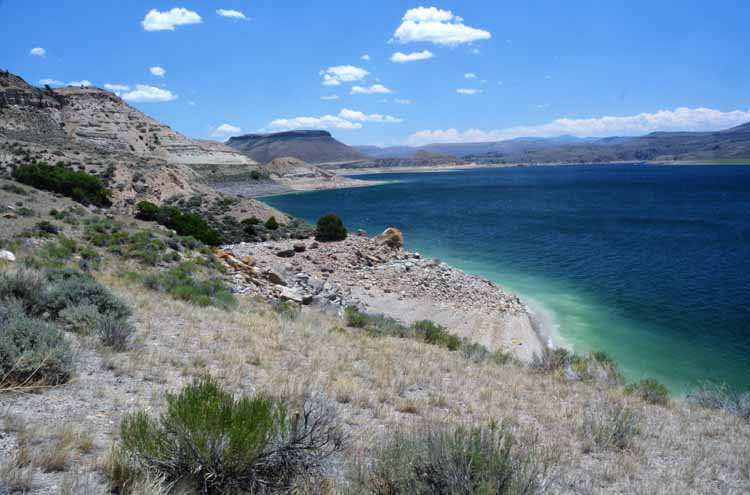
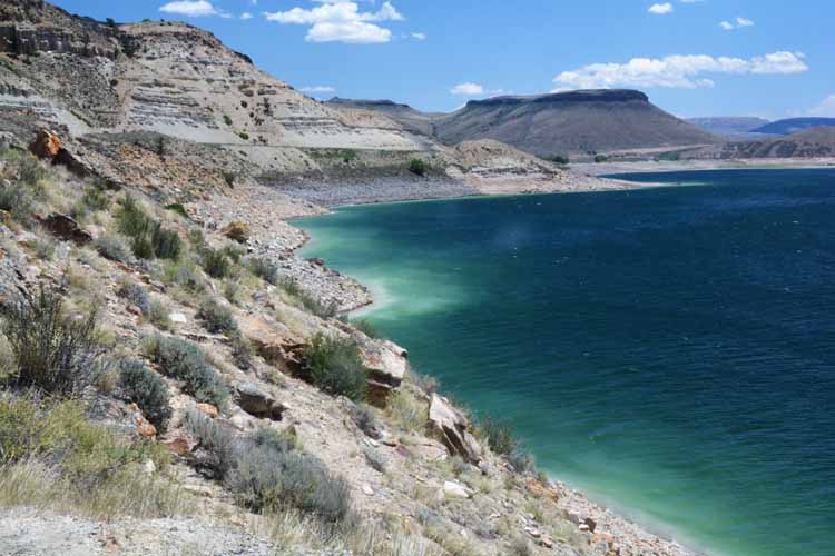
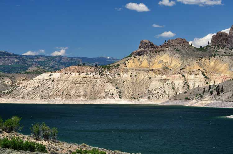
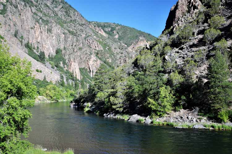
The Gunnison River
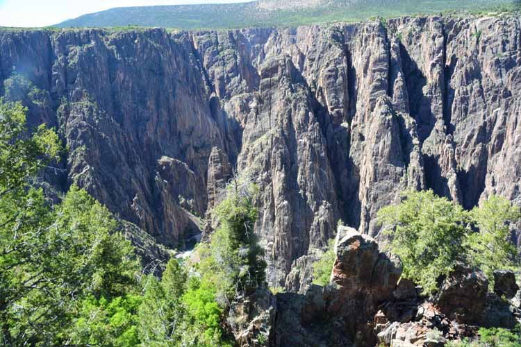
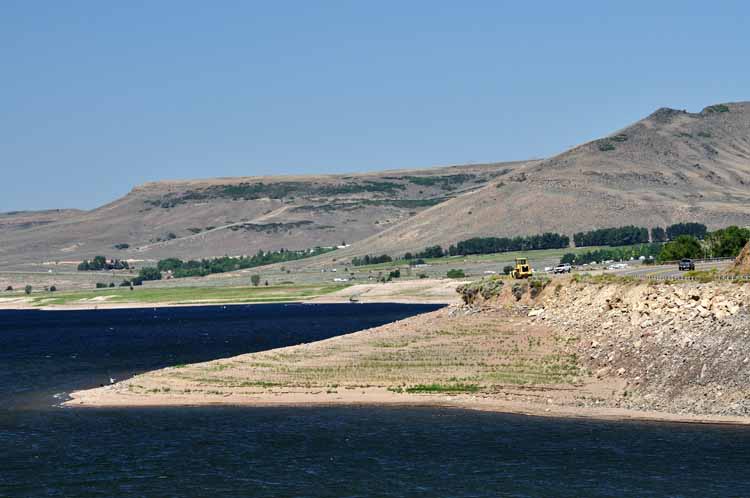
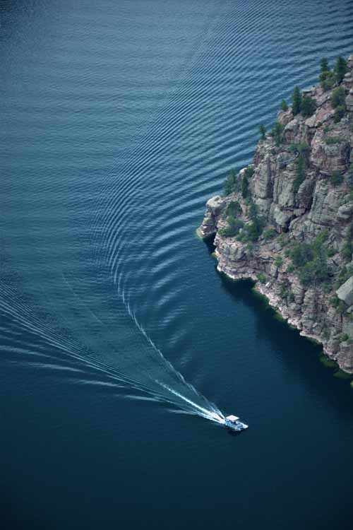
We're treated to one last series of spectacular views as we finish the Silver Thread Highway at its north end near Gunnison: the Blue Mesa Reservoir in the Curecanti National Recreation Area. The next few pictures were taken there.
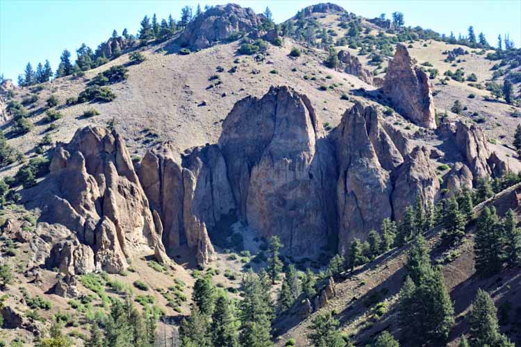
The Dillon Pinnacles tower over the blue waters of the reservoir.
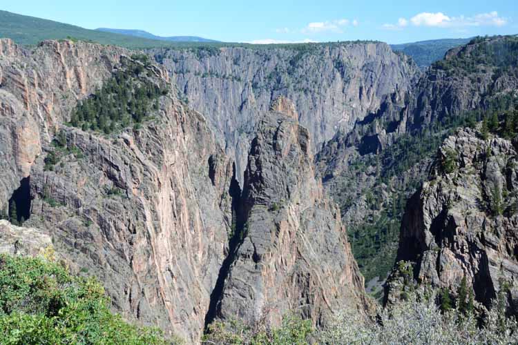
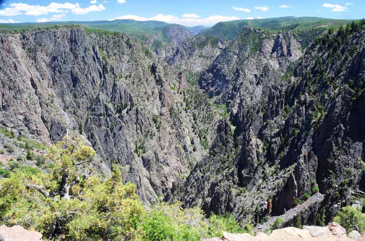
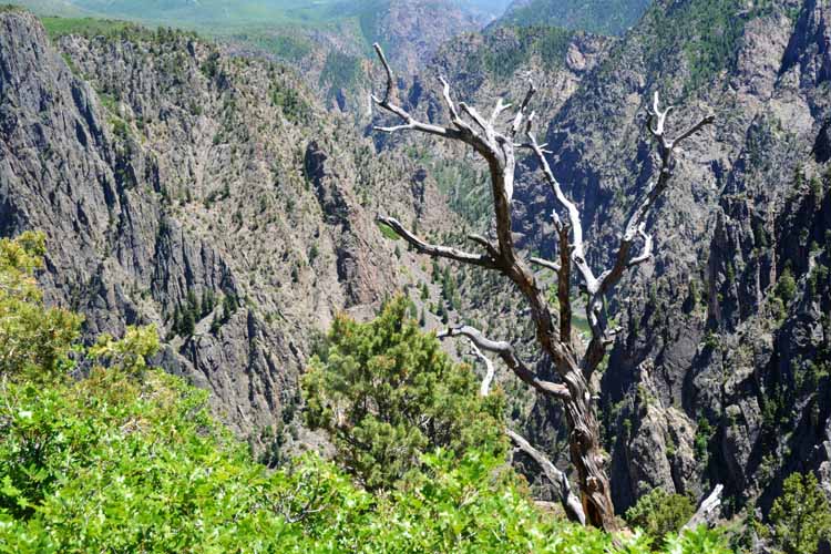
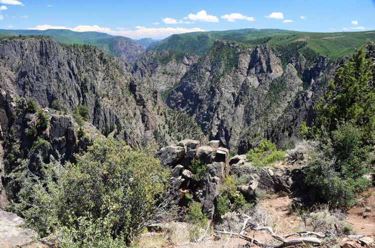
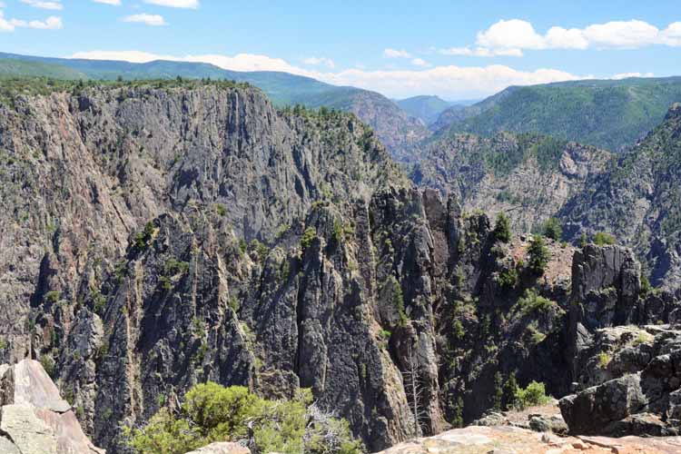
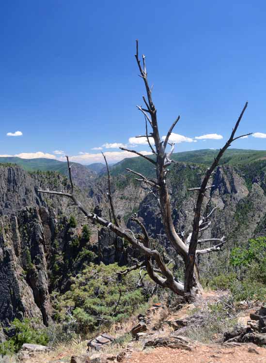
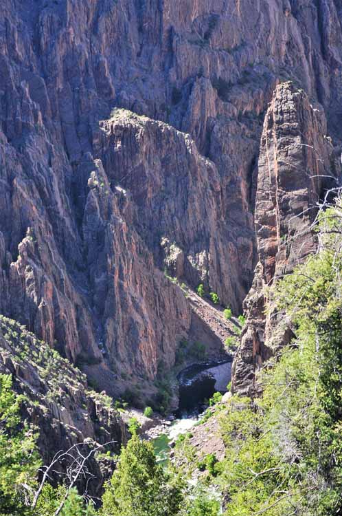
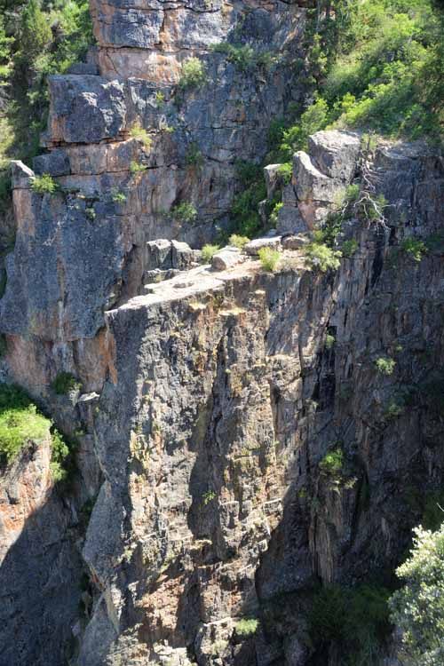
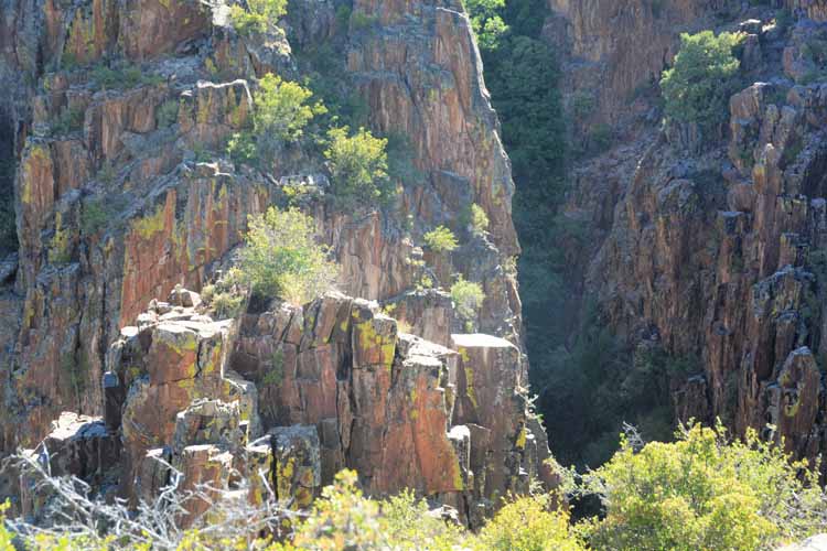
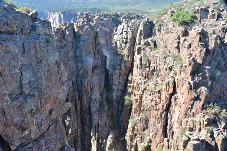
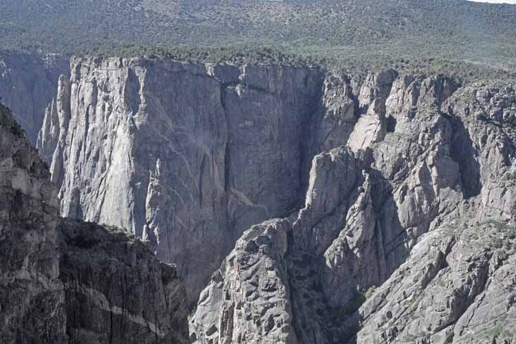
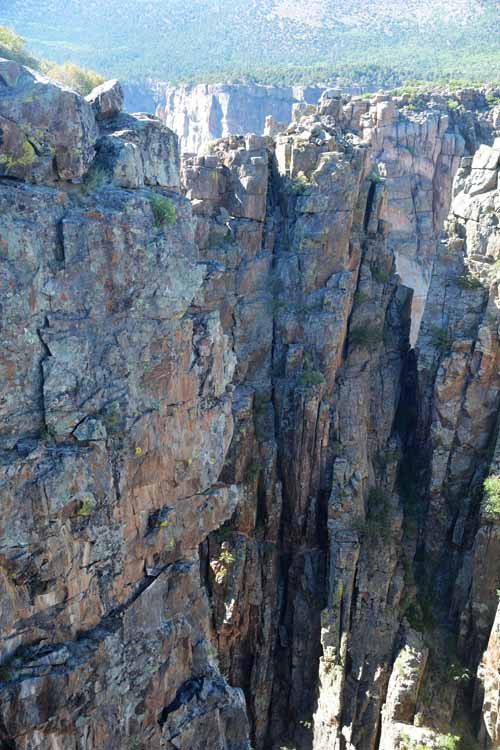
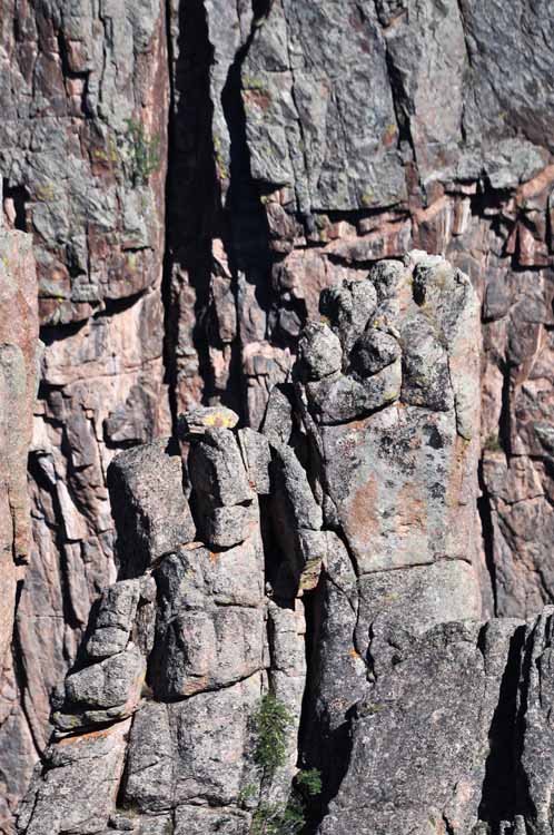
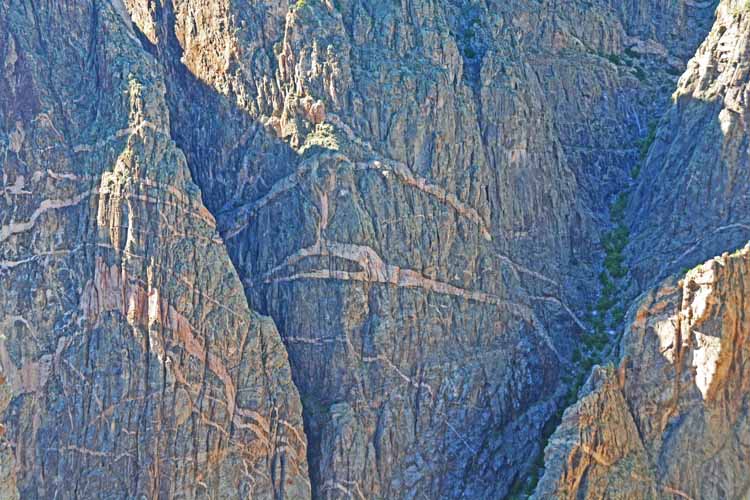
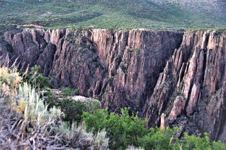
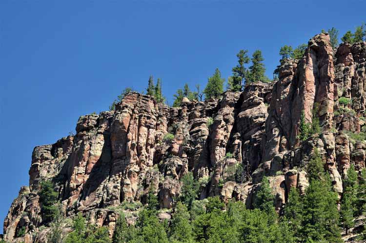
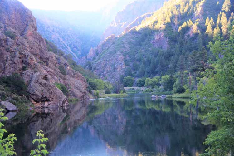
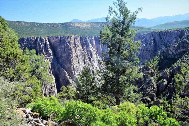
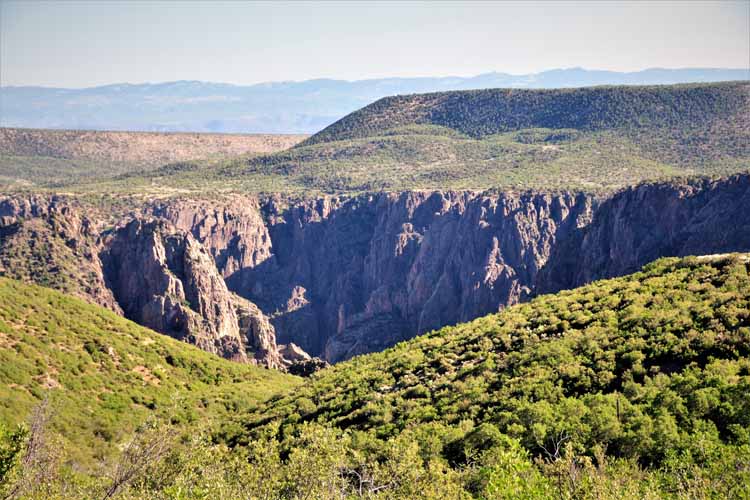
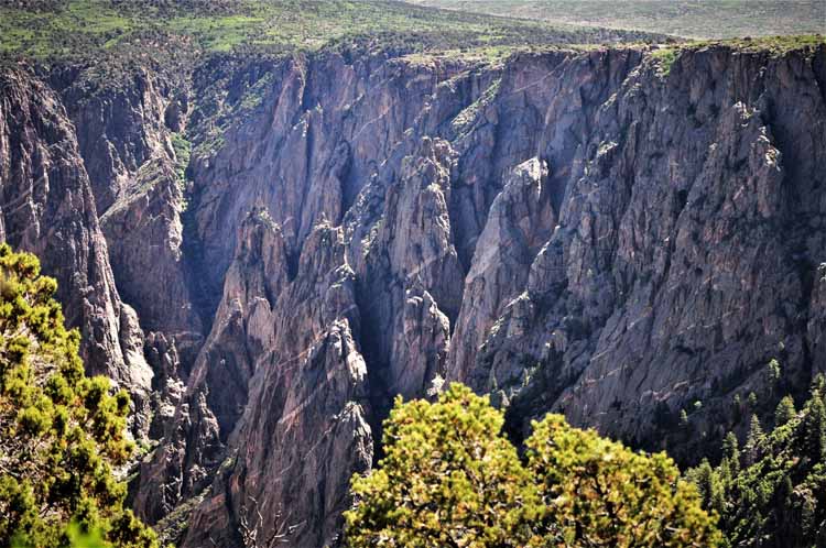
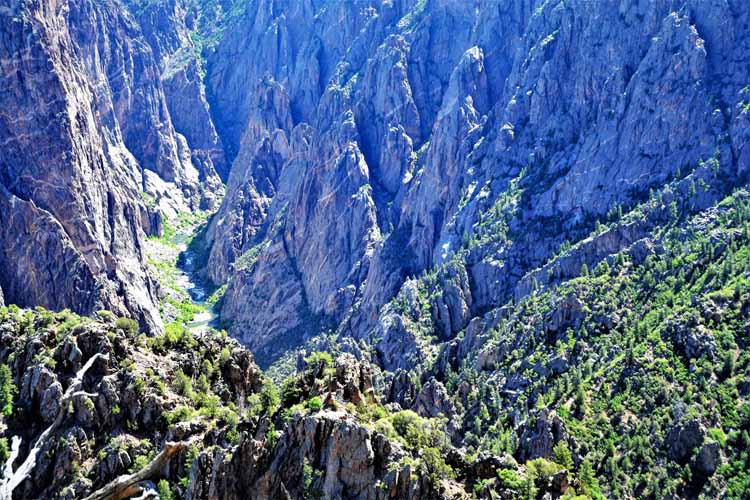
There's more than one reason the Black Canyon of the Gunnison is named Black: it's so deep, so narrow and the walls so sheer that little sunlight finds the Gunnison River at the bottom. It's the shadow that gives the canyon such a dramatic - and dark - appearance.
The Black Canyon has a south rim and a north rim. There are overviews on both sides, many of them with short hikes to the overview platform. A visitor center at the south rim has an interesting video showing the exploration of the canyon in the early 1900s.
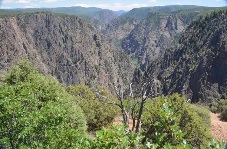
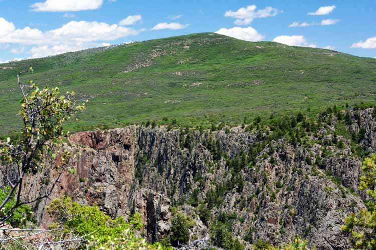
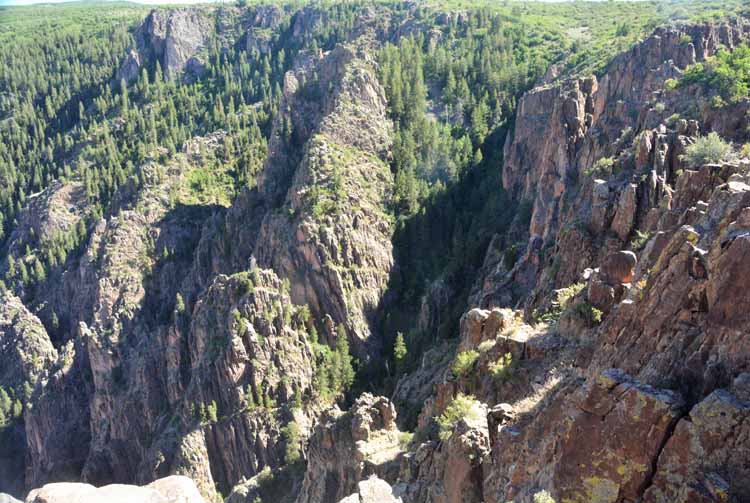
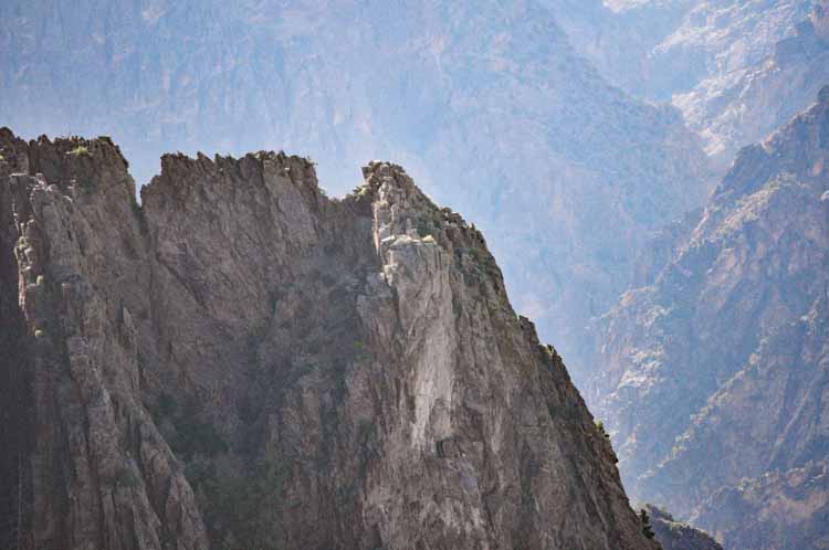
The Black Canyon of the Gunnison is located 15 miles east of Montrose, Colorado. The south rim has paved roads and some 12 overlooks. The north rim, less developed, has about five overlooks, and the roads there are well-packed unpaved. The north rim can be reached by way of Crawford, on the Highway 92.
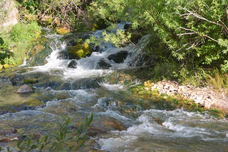
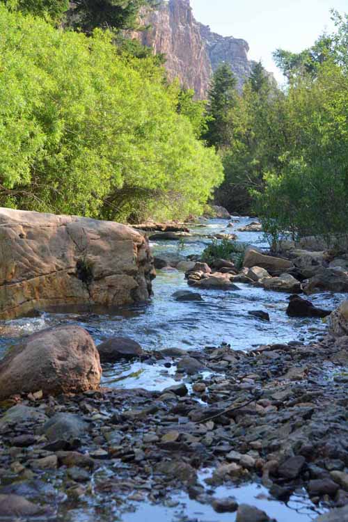
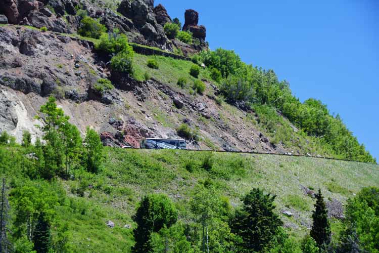
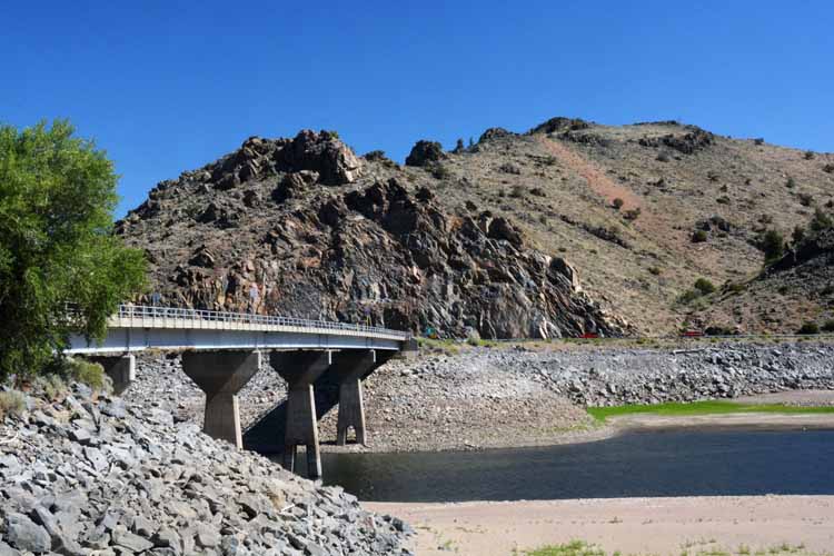
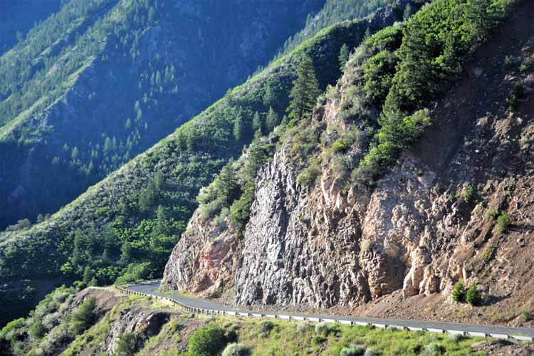
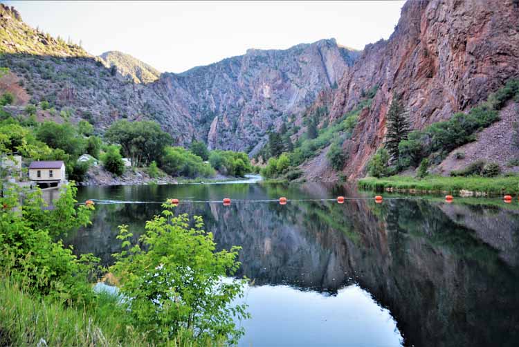
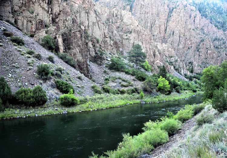
One can actually drive down to the Gunnison River from the south rim. The road is called the East Portal Road and shoots off to the right as soon as you pass through the entrance/ticket booth to the park. It's a beautiful drive of just two or three miles of curves and hairpins, and the grade is a 16% descent. (Nope! Not a misprint!!) The views at river level are definitely worth the drive down.
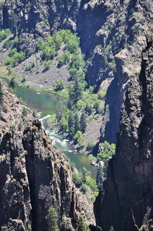
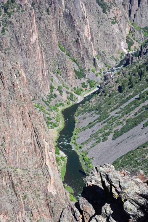
It took a few extra minutes getting down to the East Portal because of a few obstacles in the road.
The East Portal Road leads to the Gunnison River below.
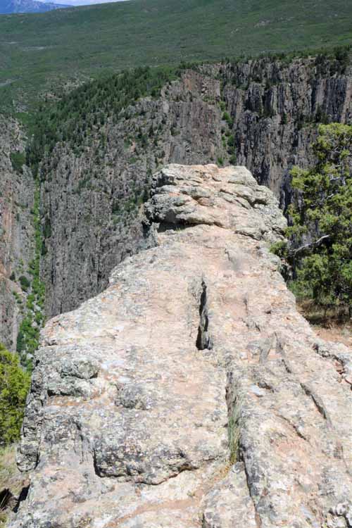
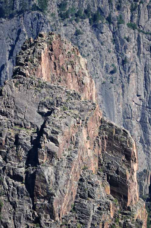
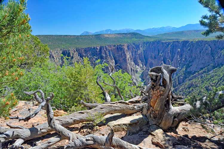
One of the Black Canyon's more popular hikes is Warner Point. It's at the far end of the South Rim road. It's approximately three-quarters of a mile one-way and offers spectacular views.
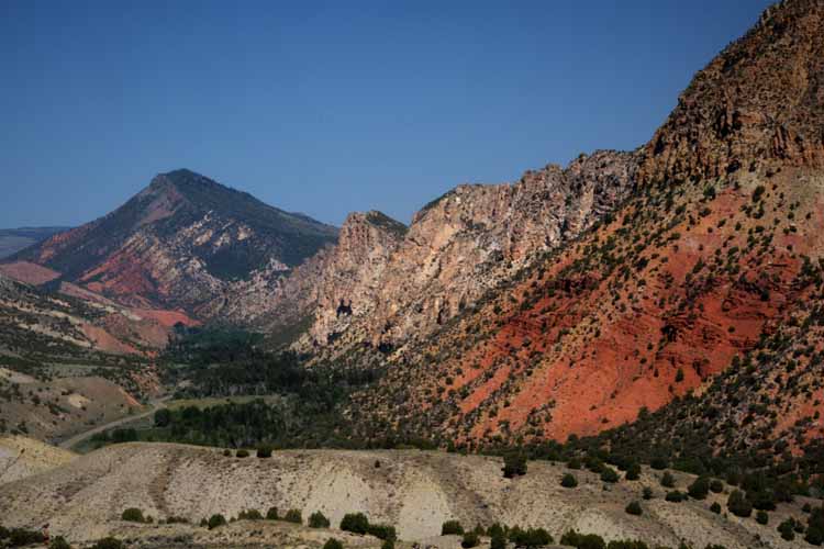
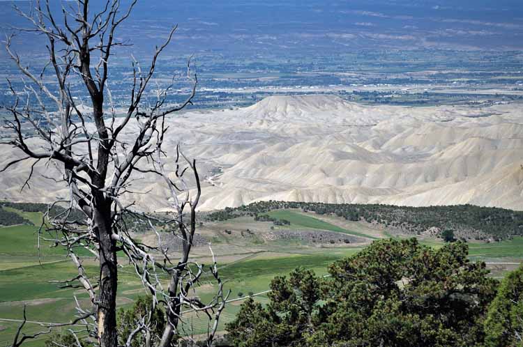
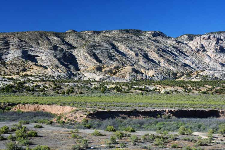
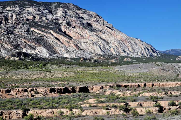
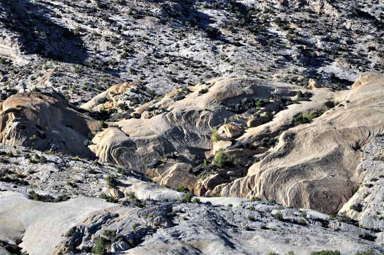
Traveling on Utah's Highway 40 toward Vernal, and headed for The Flaming Gorge Recreation Area, we happened upon what is called the Blue Mountain Plateau. Since there was a pullover and overlook to it, I figured it must have some significance. It is a single mountain, not a range, and is considered an anticline, that is ridge-shaped with the rock flowing downward. That pretty much describes what I saw. Some might consider it a two-faced mountain. The south side, the side that's visible from Highway 40, is desert-like and rugged, formed with layers of upturned rock. The north side, however, according to informaton I read later, is less rugged and covered with aspen and ponderosa pines.
Utah's State Highway 40 as it parallels Blue Mountain
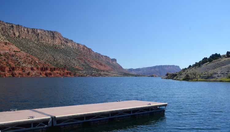
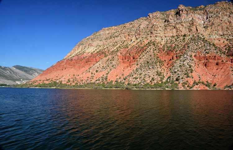
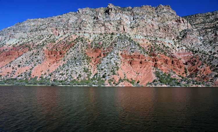
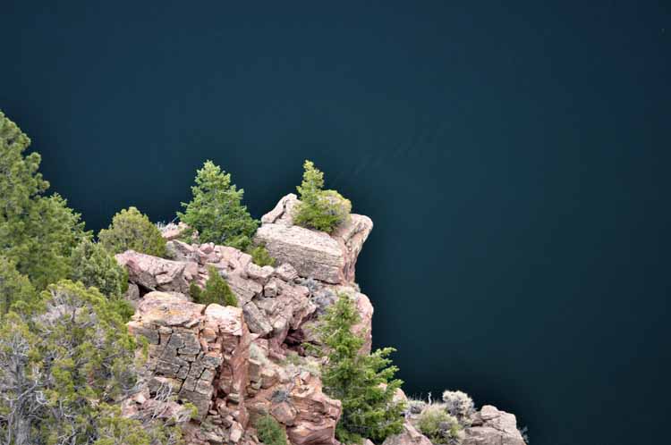
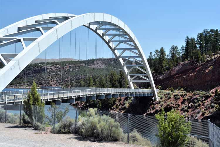
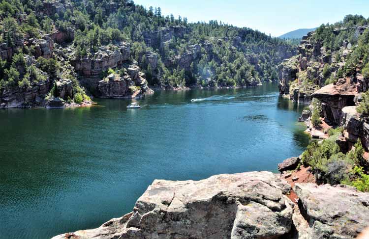
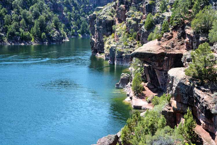
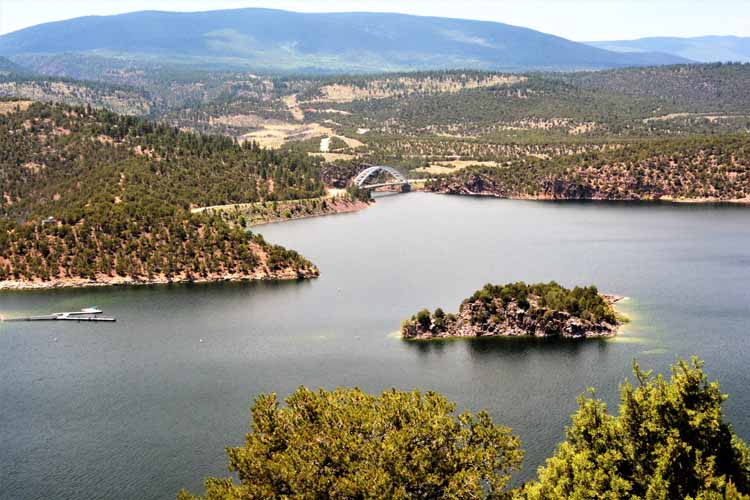
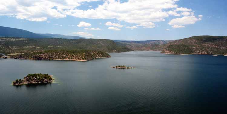
The Flaming Gorge National Recreation Area straddles the Utah/Wyoming border. Its dramatic and colorful canyon walls and its lush forested hillside,
combined with the
stunning clear waters of the Green River, make it an absolute must-see. Quiet campgrounds, numerous hiking trails and opportunity for every imaginable
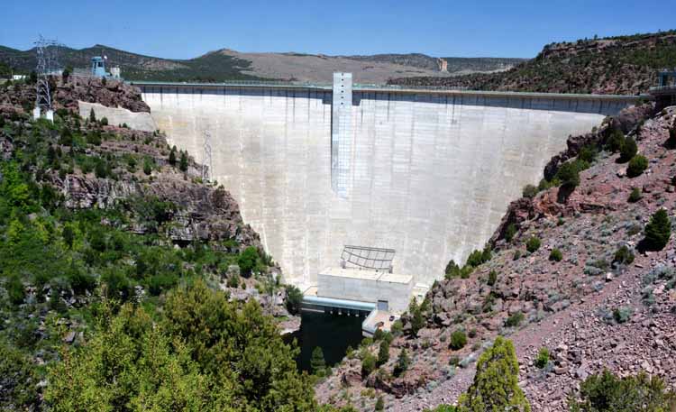
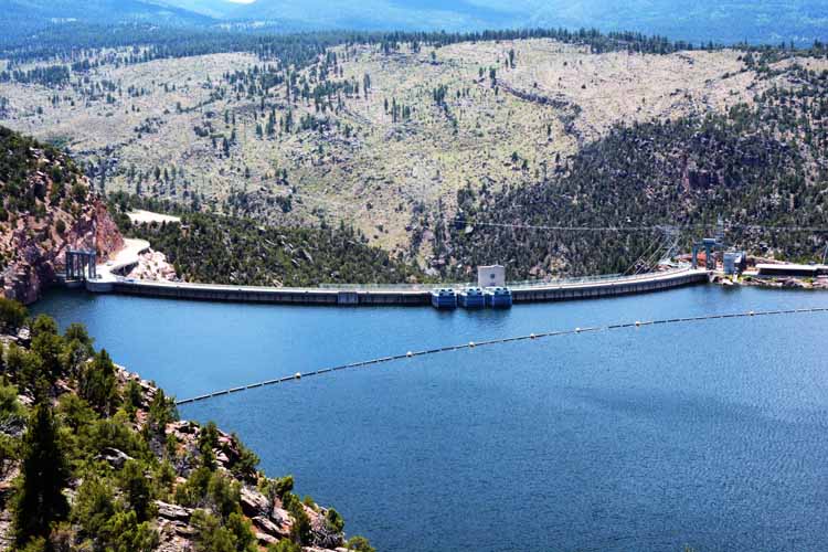
water sport can be enjoyed. The 500-foot Flaming Gorge Dam impounds the water of the Green River which makes up the Flaming Gorge Reservoir.
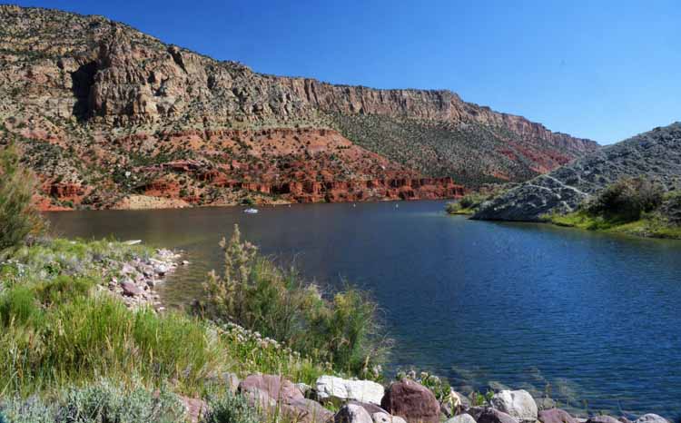
Flaming Gorge
was so named by John Wesley Powell on May 26, 1869, just as the sun was being reflected off the red rocks of the gorge.
An additional sight to the gorge is the Sheep Creek Loop, a 13-mile scenic geological byway with sheer rugged cliffs that
line the narrow winding paved road.
The drive features The Uinta Fault which can be seen in the twisted rock formations that make up Sheep Canyon.
View of the Flaming Gorge from the Sheep Creek Bay Overlook
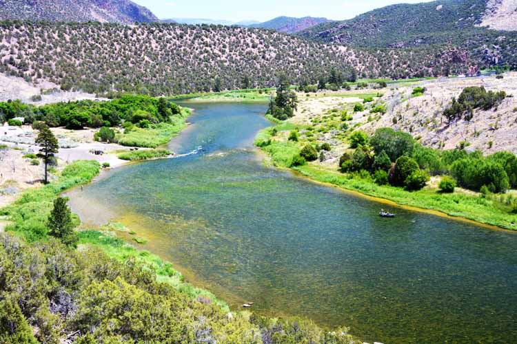
The Green River from the Little Hole Overlook
Construction of the Flaming Gorge Dam was completed in 1962. At 502 feet tall, the dam holds the waters of Flaming Gorge Reservoir.
Views of Flaming Gorge from the Sheep Creek Bay Overlook
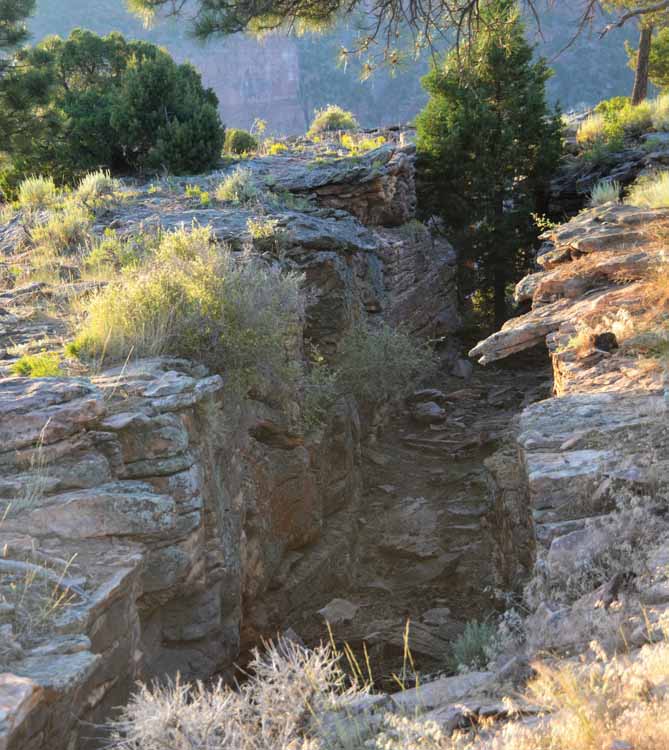
Behind the Red Canyon Visitor's Center at Flaming Gorge NRA is the Glendale Overlook which follows the rim of the canyon. Its views of the 1400-foot high canyon walls and the water below are spectacular. Warning signs abound, however, of crevices such as this one (above) that are random throughout the walk. A safe paved path to various directions to and along the rim are provided. For this reason, as well as many others, visitors should always stay on the designated trails.
An excellent side trip out from The Flaming Gorge is the Sheep Creek Geological Area, a 13-mile scenic loop with sheer rugged cliffs that
line the narrow winding paved road. The drive features The Uinta Fault which can be seen in the twisted rock formations that make up Sheep Canyon. The next few shots were taken in this fascinating area.
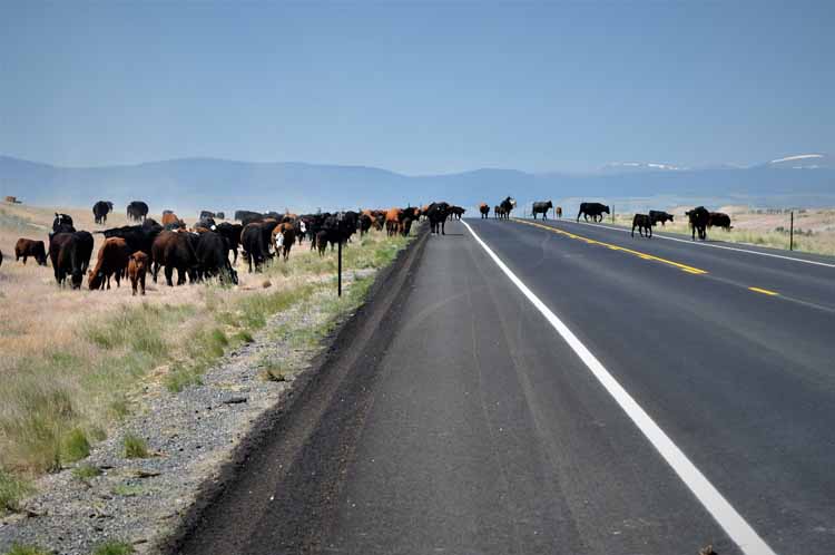
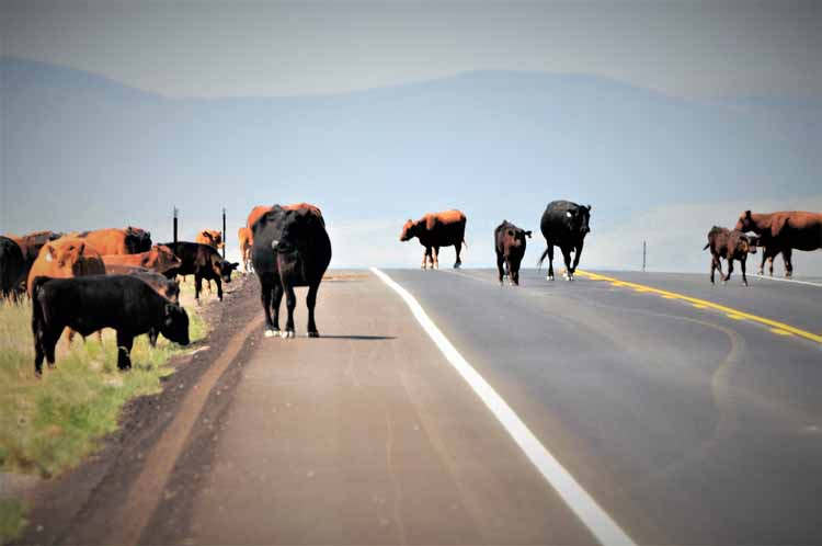
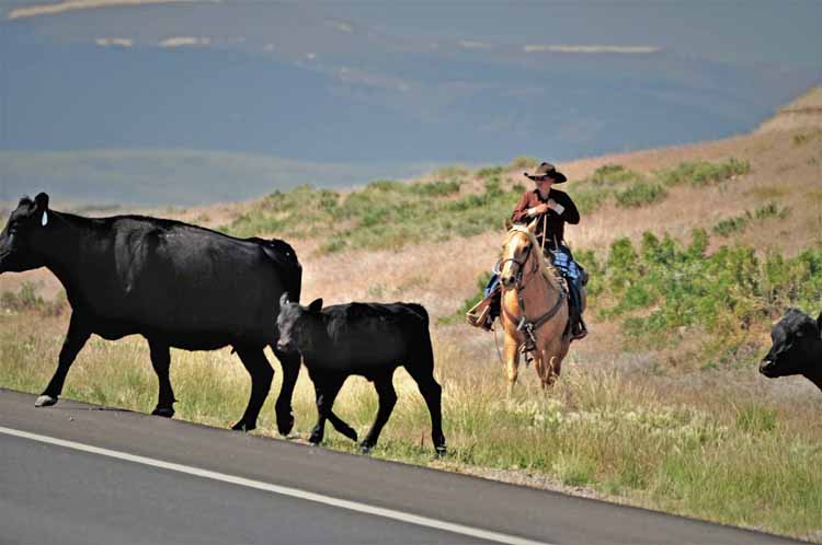
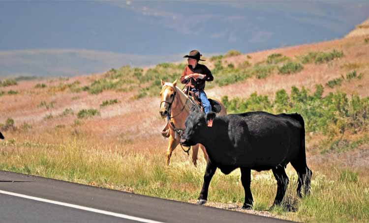
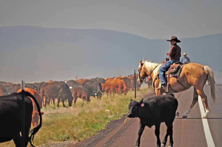
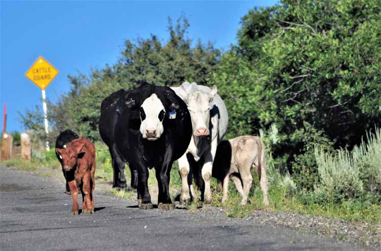
We weren't long in Wyoming before we saw our first cattle drive. This one was a traffic-stopper.
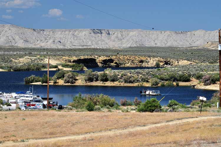
Even though we left the Flaming Gorge back several miles, the Green River continues its journey well into Wyoming.
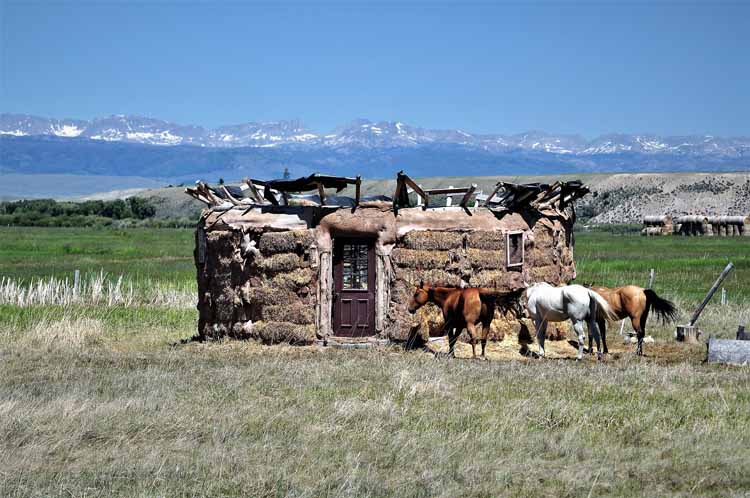
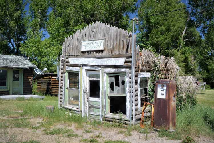
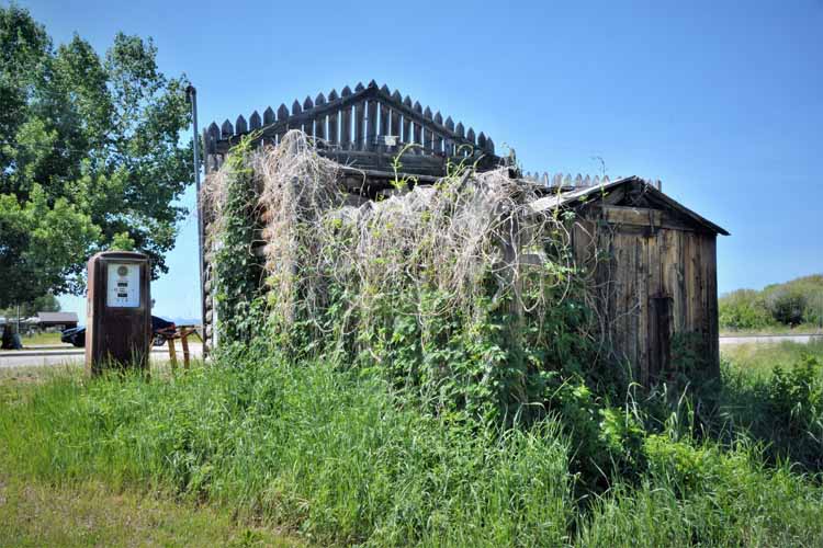
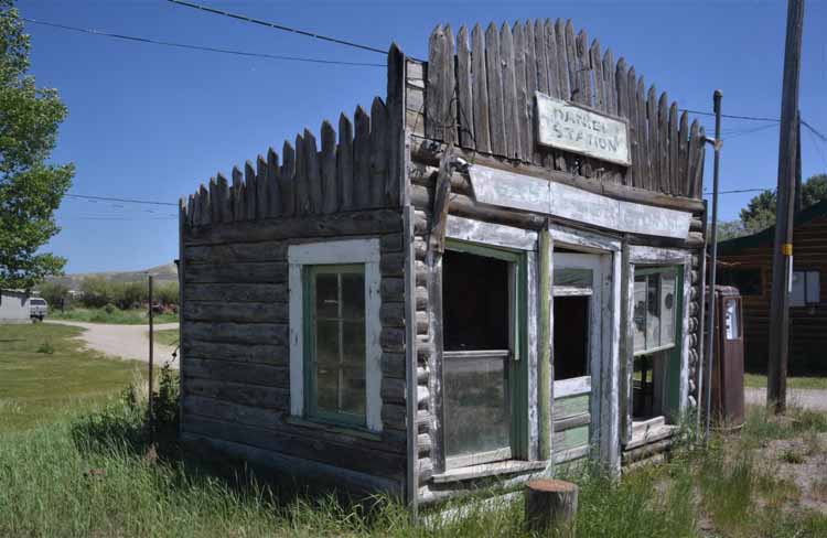
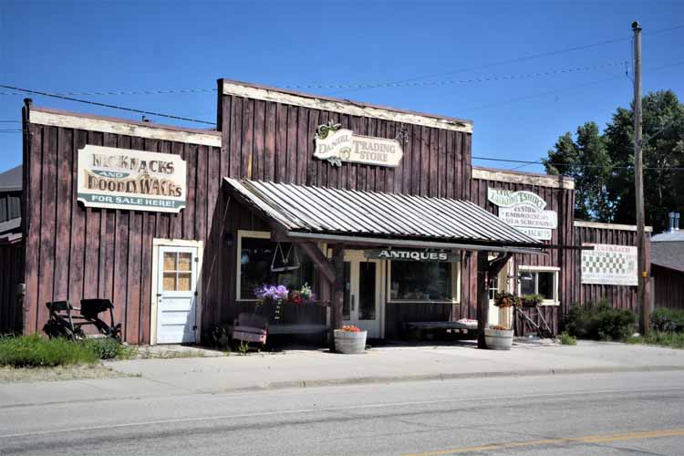
At the junction of Wyoming state's highways 191 and 89 lies the town of Daniel. Daniel is a tiny don't-blink town of less than 200 residents. It was established by Thomas Daniel in 1900 when he was named its first postmaster. Today, a strong sense of community keeps the town alive. Ranching is its biggest industry. It was the old buildings of years long past that caught my eye and are pictured here.
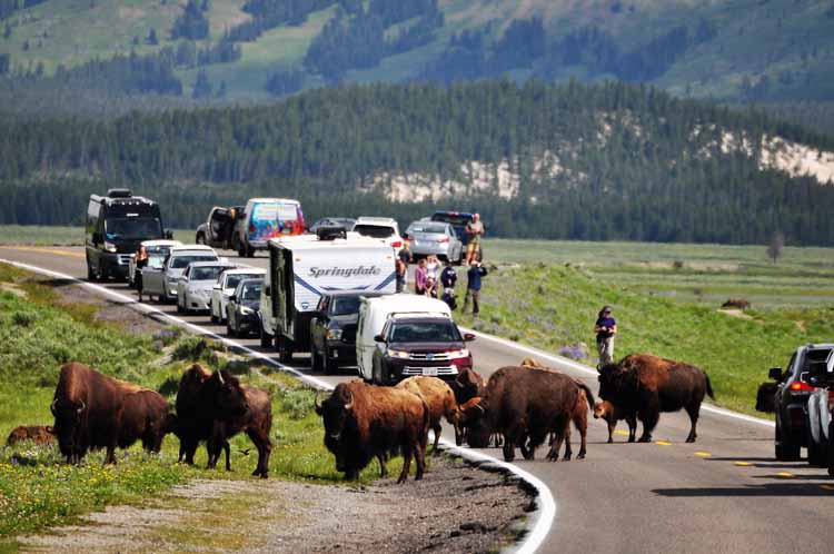
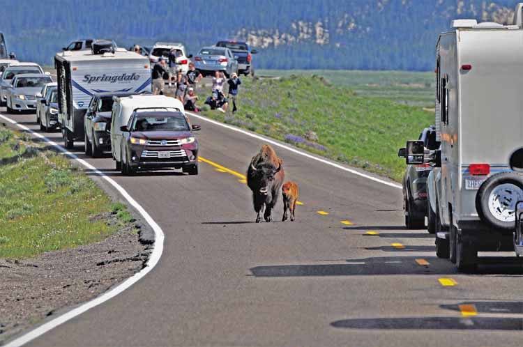
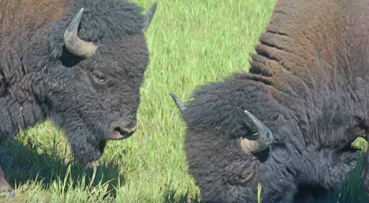
It's not unusual to see buffalo while driving the main road, Highway 191, through Grand Teton National Park. Yep, another traffic stopper.
Through thick and thin, mamas protect their young.
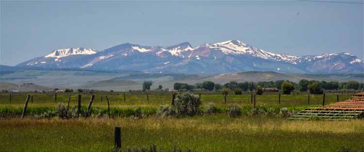
The Highway 191 travels through western Wyoming offering majestic views of the mountainous skyline on display in the distance.
Yellowstone National Park has its share of buffalo, too, and we saw these two young guys butting heads along side the road.
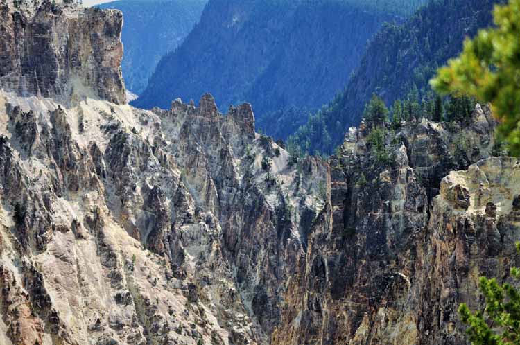
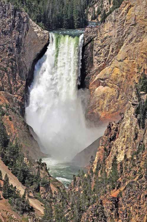
Pictured here are the Lower Falls, taken from the south rim at Artist's Point. This fall drops 308 feet into the Yellowstone River and is the largest waterfall within the park. The river itself travels some 600 miles beginning at a peak south of the park and ends in the Missouri River in North Dakota. It is the longest river in the continental U.S. that is not dammed.
Yellowstone's Grand Canyon has seen a lot of change in its 600,000 years, so how it looks today is much different than how it looked when it was first formed. Geologists believe that the canyon as it is today is no more than 10,000 to 14,000 years old. It ranges from 800 to 1200 feet deep and, at its widest point, is 4,000 feet across.
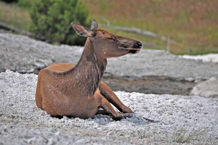
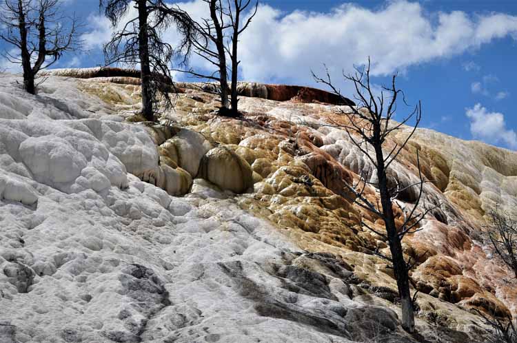
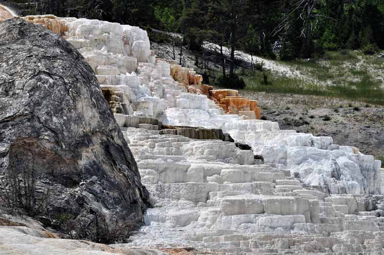
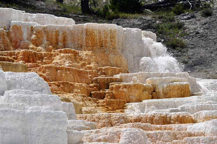
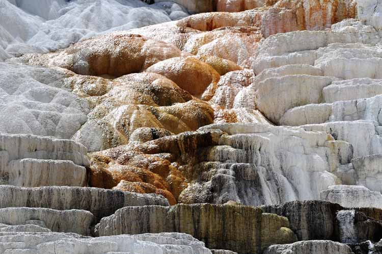
One of my favorite areas of Yellowstone is the Mammoth Hot Springs in the northwest corner of the park. The remaining shots were taken at the lower terraces, where this female elk was one of three that lounged on the turf, quite content and unconcerned of the people milling about.
Thank you for visiting these photo pages.
If you're interested in seeing more, please return to my Main Menu at the bottom of my home page and make your selection.
All images within thewanderingchick.com Web site are copyright protected. They may not be downloaded or otherwise copied.
Please contact me if you think a particular photo or set of photos can be used in your publication.
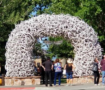
Anyone who has been through Jackson, Wyoming, surely knows of the antler arch. Who can resist a picture of it?

.JPG)